
| Memorials | : | 0 |
| Location | : | Lancaster County, USA |
| Coordinate | : | 34.7300000, -80.7047000 |
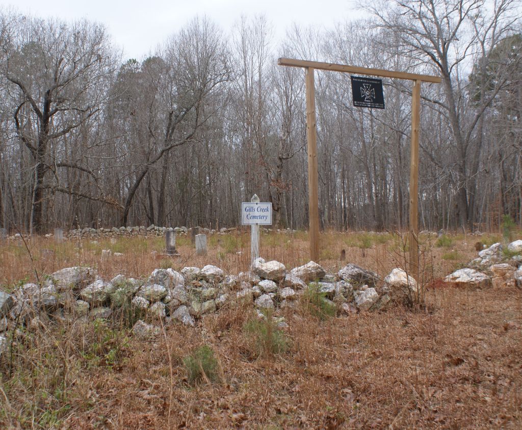
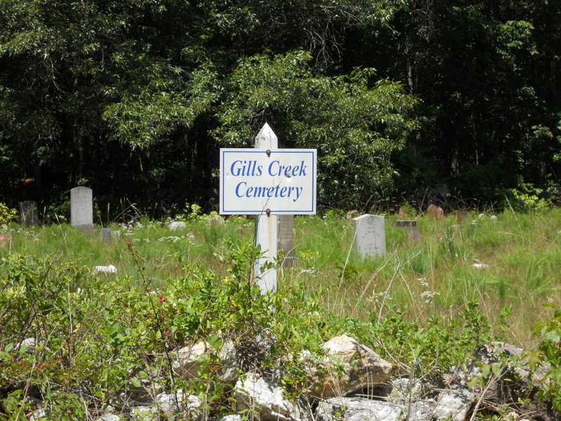
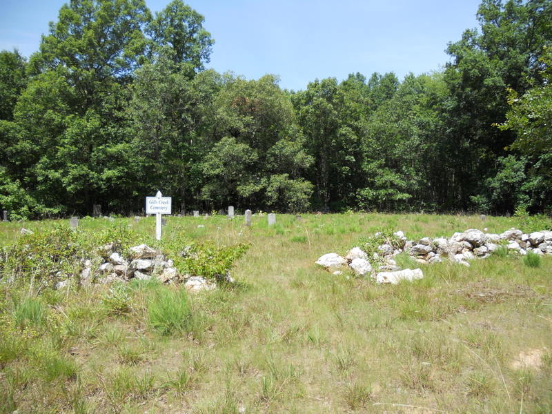
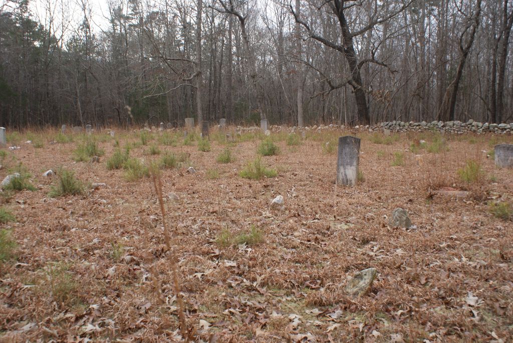
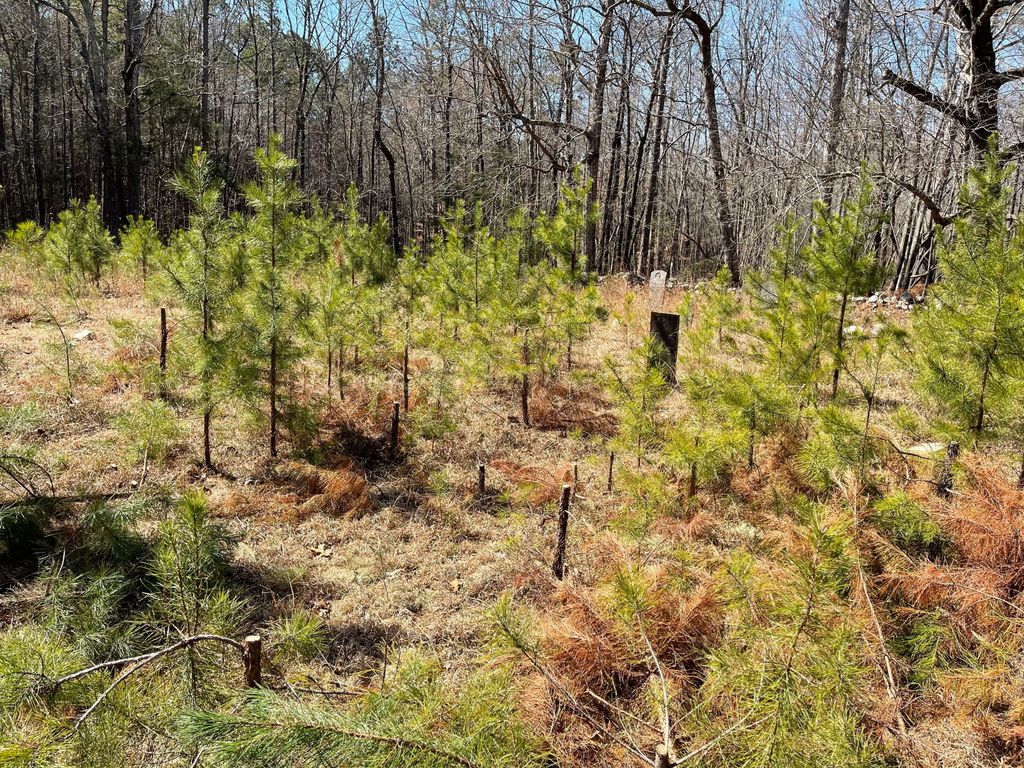
| Description | : | This cemetery is in the woods off of Highway 9, Pageland Highway, in Lancaster, SC. Go in the driveway for 2505 Pageland Highway--the driveway is between 2505 and 2483 Pageland Highway. Keep going straight--it will appear as though you are going into the woods. The old cemetery is enclosed in a flintstone wall. Be careful--there is poison oak everywhere! The site of the cemetery is the former location of the Old Gills Creek Associate Reformed Presbyterian Church. The church is no longer active. In the fall of 1950 vandals destroyed some of the stones with sledge hammers. There... Read More |
frequently asked questions (FAQ):
-
Where is Gills Creek Cemetery?
Gills Creek Cemetery is located at Lancaster County ,South Carolina ,USA.
-
Gills Creek Cemetery cemetery's updated grave count on graveviews.com?
0 memorials
-
Where are the coordinates of the Gills Creek Cemetery?
Latitude: 34.7300000
Longitude: -80.7047000
Nearby Cemetories:
1. Pleasant Dale Baptist Church Cemetery
Pleasant Dale, Lancaster County, USA
Coordinate: 34.7319740, -80.6920230
2. County Home Cemetery
Lancaster, Lancaster County, USA
Coordinate: 34.7232400, -80.7258500
3. Centenniel A.M.E. Zion Church Cemetery
Lancaster, Lancaster County, USA
Coordinate: 34.7082970, -80.7257430
4. Camp Creek Baptist Church Cemetery
Lancaster, Lancaster County, USA
Coordinate: 34.7592720, -80.6943690
5. Antioch Baptist Church Cemetery
Antioch, Lancaster County, USA
Coordinate: 34.7053185, -80.6746674
6. Hopewell United Methodist Church Cemetery
Lancaster, Lancaster County, USA
Coordinate: 34.7385150, -80.6498510
7. New Hope AME Zion Church Cemetery
Lancaster, Lancaster County, USA
Coordinate: 34.7569220, -80.6586460
8. Fellowship Bible Church
Lancaster, Lancaster County, USA
Coordinate: 34.6914920, -80.7422720
9. Saint Paul Methodist Cemetery
Lancaster, Lancaster County, USA
Coordinate: 34.7231800, -80.7654770
10. Zion United Methodist Church Cemetery
Lancaster, Lancaster County, USA
Coordinate: 34.7734060, -80.7377770
11. Clinton Memorial Cemetery
Lancaster, Lancaster County, USA
Coordinate: 34.7268982, -80.7671967
12. Shaver Family Cemetery
Elgin, Lancaster County, USA
Coordinate: 34.6794680, -80.7173810
13. New Cut Memorial Cemetery
Lancaster, Lancaster County, USA
Coordinate: 34.7803640, -80.6744440
14. Olde Presbyterian Church Cemetery
Lancaster, Lancaster County, USA
Coordinate: 34.7168999, -80.7735977
15. First Presbyterian Church of Lancaster Columbarium
Lancaster, Lancaster County, USA
Coordinate: 34.7278800, -80.7756800
16. Saint Luke UMC Cemetery
Lancaster, Lancaster County, USA
Coordinate: 34.6728310, -80.7204780
17. Witherspoon Cemetery
Lancaster, Lancaster County, USA
Coordinate: 34.7229170, -80.7768560
18. West Side Cemetery
Lancaster, Lancaster County, USA
Coordinate: 34.7216988, -80.7774963
19. Mount Nebo AME Zion Church
Lancaster, Lancaster County, USA
Coordinate: 34.7905820, -80.7134230
20. Buford Battleground Memorial
Buford, Lancaster County, USA
Coordinate: 34.7427410, -80.6274600
21. Bethlehem Baptist Church Cemetery
Lancaster County, USA
Coordinate: 34.7592350, -80.6315860
22. Deliverance Church of God in Jesus Christ
Lancaster County, USA
Coordinate: 34.7754480, -80.7677200
23. New Zion Missionary Baptist Church Cemetery
Lancaster County, USA
Coordinate: 34.7207100, -80.6185490
24. Mount Calvary AME Zion Church Cemetery
Lancaster County, USA
Coordinate: 34.6586740, -80.7130700