
| Memorials | : | 291 |
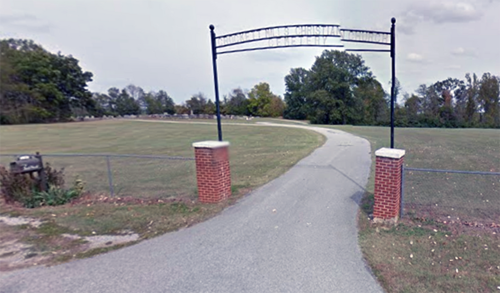
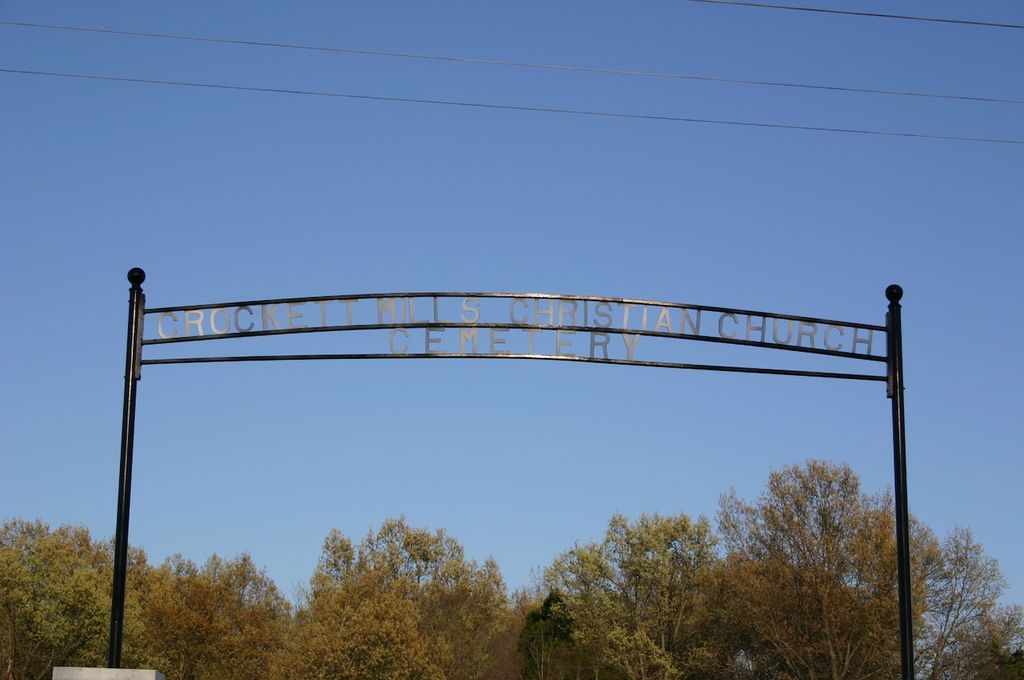
| Location | : | Crockett Mills, Crockett County, USA |
| Coordinate | : | 35.8690090, -89.1593320 |
| Description | : | From the intersection of TN-152 E & US-412/TN-20, south of Friendship, travel east on TN-152 E for 0.9 mi.; turning north onto TN-188 N, going 2.3 mi.; turning east into the entrance driveway to this large 'deeded' cemetery at the end of the driveway, as notated on USGS topo maps. It is next to the large water tank (facing the tank, the cemetery would be on your left [north]). The entrance is designated with a large sign and is easily visible. |
frequently asked questions (FAQ):
-
Where is Crockett Mills Christian Church Cemetery?
Crockett Mills Christian Church Cemetery is located at 4832 TN-188 Crockett Mills, Crockett County ,Tennessee ,USA.
-
Crockett Mills Christian Church Cemetery cemetery's updated grave count on graveviews.com?
0 memorials
-
Where are the coordinates of the Crockett Mills Christian Church Cemetery?
Latitude: 35.8690090
Longitude: -89.1593320
Nearby Cemetories:
1. Stamps Cemetery
Crockett Mills, Crockett County, USA
Coordinate: 35.8678400, -89.1495400
2. Providence Baptist Church Cemetery
Crockett Mills, Crockett County, USA
Coordinate: 35.8839830, -89.1595080
3. Asprey Cemetery
Crockett Mills, Crockett County, USA
Coordinate: 35.8844990, -89.1532570
4. Lanier Cemetery
Crockett Mills, Crockett County, USA
Coordinate: 35.8852830, -89.1465090
5. Hudson Grove Church Cemetery
Crockett Mills, Crockett County, USA
Coordinate: 35.8713410, -89.1956910
6. Avery Cemetery
Crockett Mills, Crockett County, USA
Coordinate: 35.8533000, -89.1226400
7. Perry Cemetery
Maury Junction, Crockett County, USA
Coordinate: 35.8675600, -89.2051410
8. Warren Cemetery
Crockett Mills, Crockett County, USA
Coordinate: 35.9074790, -89.1521770
9. Sanders Cemetery
Crockett Mills, Crockett County, USA
Coordinate: 35.9096750, -89.1609030
10. Cairo Cemetery
Alamo, Crockett County, USA
Coordinate: 35.8254210, -89.1636750
11. Old Dyer Church Cemetery
Friendship, Crockett County, USA
Coordinate: 35.8844600, -89.2101900
12. Nance Cemetery
Nance, Crockett County, USA
Coordinate: 35.8332040, -89.1220730
13. New Cemetery
Maury City, Crockett County, USA
Coordinate: 35.8329850, -89.2048090
14. Koonce Cemetery
Cairo, Crockett County, USA
Coordinate: 35.8176300, -89.1849750
15. Nunn Cemetery
Maury City, Crockett County, USA
Coordinate: 35.8282660, -89.2062360
16. Mount Zion Cemetery
Friendship, Crockett County, USA
Coordinate: 35.9131950, -89.2032590
17. Tempy Walker Tombstone
Alamo, Crockett County, USA
Coordinate: 35.8130500, -89.1716900
18. Nunn Cemetery
Maury City, Crockett County, USA
Coordinate: 35.8257020, -89.2068300
19. Pond Creek Church Cemetery
Alamo, Crockett County, USA
Coordinate: 35.8111000, -89.1669006
20. Williams Chapel Baptist Church Cemetery
Friendship, Crockett County, USA
Coordinate: 35.9258940, -89.1916320
21. Smith Cemetery
Cairo, Crockett County, USA
Coordinate: 35.8072720, -89.1737770
22. Quincy Cemetery
Quincy, Crockett County, USA
Coordinate: 35.8378310, -89.0903850
23. Bethesda Cemetery
Wilcox, Crockett County, USA
Coordinate: 35.9361230, -89.1557970
24. Robertson-Warren Cemetery
Friendship, Crockett County, USA
Coordinate: 35.8830700, -89.2427200