
| Memorials | : | 1 |
| Location | : | Ohatchee, Calhoun County, USA |
| Coordinate | : | 33.7835999, -85.9332962 |
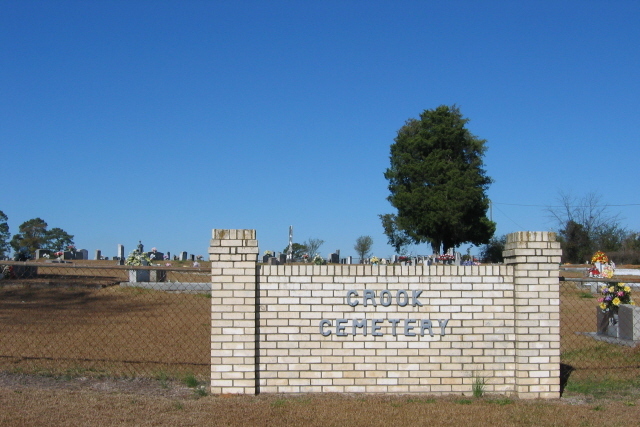
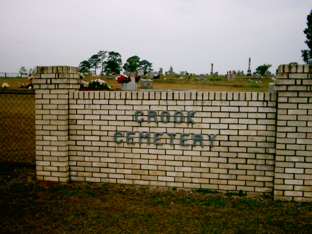
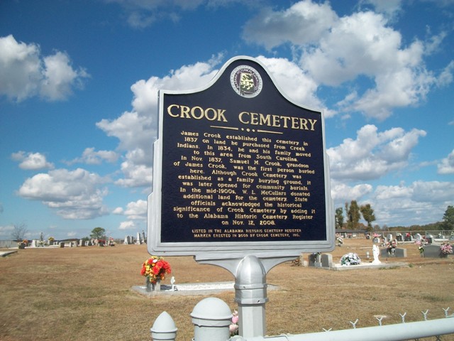
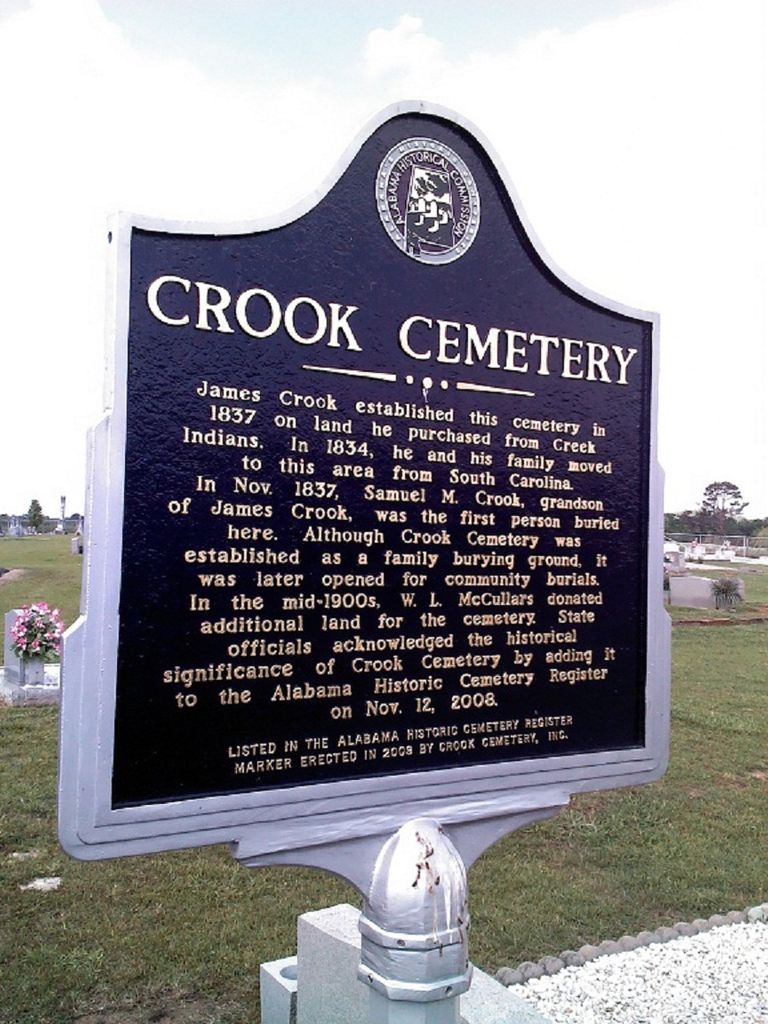
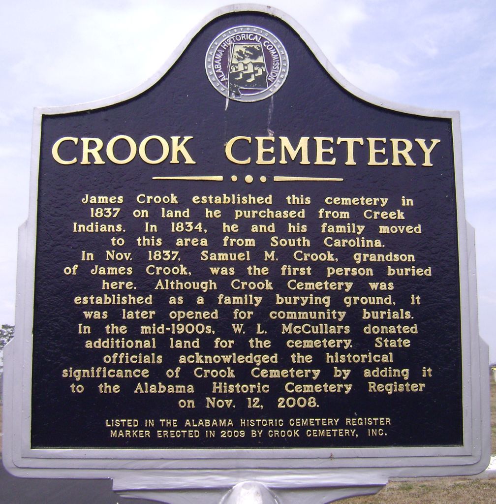
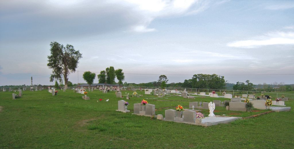
| Description | : | James Crook established the cemetery in 1837 on land he purchased from the Creek Indians. The cemetery incorporated August 1, 2007. The Crook Cemetery in Ohatchee was added to the Alabama Historical Cemetery Registry on November 12, 2008. Crooks Cemetery is actually in Calhoun County between Ohatchee and Alexandria near the old Antebellum mansion near the quarry on the south side of Highway 149 which was part of the old Crooks Plantation. The old house was built in 1860 and somehow survived the Yankees. |
frequently asked questions (FAQ):
-
Where is Crook Cemetery?
Crook Cemetery is located at 319 McCullars Lane Ohatchee, Calhoun County ,Alabama , 36271USA.
-
Crook Cemetery cemetery's updated grave count on graveviews.com?
1 memorials
-
Where are the coordinates of the Crook Cemetery?
Latitude: 33.7835999
Longitude: -85.9332962
Nearby Cemetories:
1. Gladden Cemetery
Lowrimores Crossroads, Calhoun County, USA
Coordinate: 33.7668991, -85.9122009
2. United Fellowship Baptist Church Cemetery
Alexandria, Calhoun County, USA
Coordinate: 33.7865982, -85.8946991
3. Hampton Cemetery
Lowrimores Crossroads, Calhoun County, USA
Coordinate: 33.7482986, -85.9289017
4. New Mount Sellers Cemetery
Anniston, Calhoun County, USA
Coordinate: 33.7432289, -85.9170837
5. Mount Zion Baptist Church Cemetery
Alexandria, Calhoun County, USA
Coordinate: 33.7578011, -85.8925018
6. Ten Island Church Cemetery
Ohatchee, Calhoun County, USA
Coordinate: 33.7642083, -85.9794997
7. Alexandria United Methodist Church Cemetery
Alexandria, Calhoun County, USA
Coordinate: 33.7728004, -85.8824997
8. Middleton Cumberland Presbyterian Church Cemetery
Middleton, Calhoun County, USA
Coordinate: 33.7700005, -85.9835968
9. Oak Bowery Baptist Church Cemetery
Ohatchee, Calhoun County, USA
Coordinate: 33.7694016, -85.9839020
10. Union United Methodist Church Cemetery
Wellington, Calhoun County, USA
Coordinate: 33.8151310, -85.8925510
11. Wellington First Baptist Church Cemetery
Wellington, Calhoun County, USA
Coordinate: 33.8267030, -85.8976870
12. Maple Grove Cemetery
Alexandria, Calhoun County, USA
Coordinate: 33.7420200, -85.8927300
13. First Missionary Baptist Church of Ohatchee Cemete
Ohatchee, Calhoun County, USA
Coordinate: 33.7983600, -85.9967100
14. Morrisville Cemetery
Morrisville, Calhoun County, USA
Coordinate: 33.7313220, -85.9543000
15. Hebron Cemetery
Duke, Calhoun County, USA
Coordinate: 33.8389015, -85.9413986
16. Pace Cemetery
Anniston, Calhoun County, USA
Coordinate: 33.7306290, -85.9087830
17. Mount Ararat C. M. E. Church Cemetery
Jacksonville, Calhoun County, USA
Coordinate: 33.7877965, -85.8638639
18. Bethel Baptist Church Cemetery
Alexandria, Calhoun County, USA
Coordinate: 33.7825012, -85.8630981
19. Cane Creek Cemetery
Cane Creek, Calhoun County, USA
Coordinate: 33.7239250, -85.9380140
20. Post Oak Springs Baptist Church Cemetery
Jacksonville, Calhoun County, USA
Coordinate: 33.7956009, -85.8628006
21. Ohatchee Cemetery
Ohatchee, Calhoun County, USA
Coordinate: 33.8005981, -86.0038986
22. Ohatchee First Baptist Church Cemetery
Ohatchee, Calhoun County, USA
Coordinate: 33.7840030, -86.0082080
23. Anniston Memorial Gardens
Anniston, Calhoun County, USA
Coordinate: 33.7324982, -85.8806000
24. McClelen Family Cemetery
Alexandria, Calhoun County, USA
Coordinate: 33.7627094, -85.8560829