
| Memorials | : | 0 |
| Location | : | Barbourville, Knox County, USA |
| Coordinate | : | 36.8394508, -83.9185486 |
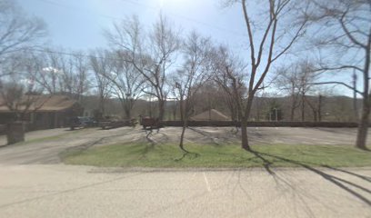
| Description | : | Please Do Not Request Photographs of Headstone/Markers The First Baptist Church, Barbourville, originally named Cumberland River Baptist Church, was constituted on May 12, 1804. The site is believed to of been "in the narrows" on the north side of the Cumberland River, close to where Walker State Park is now located, it no longer exists By BluMoKitty |
frequently asked questions (FAQ):
-
Where is Cumberland River Baptist Church Cemetery?
Cumberland River Baptist Church Cemetery is located at Barbourville, Knox County ,Kentucky ,USA.
-
Cumberland River Baptist Church Cemetery cemetery's updated grave count on graveviews.com?
0 memorials
-
Where are the coordinates of the Cumberland River Baptist Church Cemetery?
Latitude: 36.8394508
Longitude: -83.9185486
Nearby Cemetories:
1. Abner Wells Cemetery
Knox County, USA
Coordinate: 36.8364060, -83.9215730
2. Fuson Cemetery
Knox County, USA
Coordinate: 36.8493996, -83.9163971
3. Miles Cemetery
Knox County, USA
Coordinate: 36.8324640, -83.8996650
4. Adams and Eve Cemetery
Barbourville, Knox County, USA
Coordinate: 36.8500000, -83.9000000
5. Hurst Cemetery
Barbourville, Knox County, USA
Coordinate: 36.8500000, -83.9000000
6. Goins Cemetery
Barbourville, Knox County, USA
Coordinate: 36.8511870, -83.8995920
7. Hampton Cemetery
Swanpond, Knox County, USA
Coordinate: 36.8231010, -83.8964005
8. Glasscock Cemetery
Barbourville, Knox County, USA
Coordinate: 36.8471985, -83.8899994
9. Hawn Graveyard
Barbourville, Knox County, USA
Coordinate: 36.8642006, -83.9238968
10. Apple Grove Cemetery
Knox County, USA
Coordinate: 36.8592480, -83.8944010
11. Mayhew Cemetery
Barbourville, Knox County, USA
Coordinate: 36.8678017, -83.9094009
12. Wilson Graveyard
Barbourville, Knox County, USA
Coordinate: 36.8112250, -83.9291490
13. Adams Cemetery
Knox County, USA
Coordinate: 36.8163986, -83.9417038
14. Powell Cemetery
Barbourville, Knox County, USA
Coordinate: 36.8692017, -83.9207993
15. Mealer Cemetery
Barbourville, Knox County, USA
Coordinate: 36.8586370, -83.8850640
16. Mealer Cemetery
Barbourville, Knox County, USA
Coordinate: 36.8596818, -83.8846452
17. Mealer Cemetery
Barbourville, Knox County, USA
Coordinate: 36.8599319, -83.8847580
18. Charlie Smith Cemetery
Barbourville, Knox County, USA
Coordinate: 36.8604720, -83.9531280
19. Grindstaff Cemetery #2
Barbourville, Knox County, USA
Coordinate: 36.8663902, -83.8888931
20. Prichard Cemetery
Mackey Bend, Knox County, USA
Coordinate: 36.8153000, -83.9569016
21. Barbourville Cemetery
Barbourville, Knox County, USA
Coordinate: 36.8560982, -83.8739014
22. Elliott Cemetery
Barbourville, Knox County, USA
Coordinate: 36.8803062, -83.9297104
23. Gross Cemetery
Gray, Knox County, USA
Coordinate: 36.8739640, -83.9510920
24. Foley Cemetery
Dishman Springs, Knox County, USA
Coordinate: 36.8704200, -83.9576560