
| Memorials | : | 0 |
| Location | : | Root Center, Montgomery County, USA |
| Coordinate | : | 42.8351900, -74.4723000 |
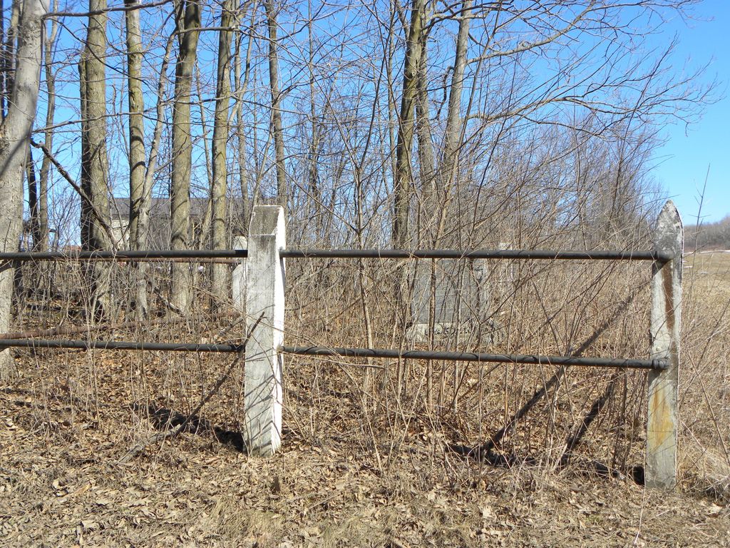
| Description | : | Dated October 1, 1961, prepared for the Caughnawaga DAR chapter, no reader given. "On the former Darrow farm on Darrow Road from Currytown to Root Center there is quite a large monument near the road with this inscription": ??? Per Bill Maring: the Darrow Rd. Burial Ground has another 8-10 graves out side the fence, but all they are, are field stones stood on edge, no names or anything. |
frequently asked questions (FAQ):
-
Where is Darrow Road Burial Ground?
Darrow Road Burial Ground is located at Darrow Road Root Center, Montgomery County ,New York ,USA.
-
Darrow Road Burial Ground cemetery's updated grave count on graveviews.com?
0 memorials
-
Where are the coordinates of the Darrow Road Burial Ground?
Latitude: 42.8351900
Longitude: -74.4723000
Nearby Cemetories:
1. Dievendorf Burial Lot
Root Center, Montgomery County, USA
Coordinate: 42.8573100, -74.4680100
2. Dievendorf Family Burial Grounds
Currytown, Montgomery County, USA
Coordinate: 42.8579700, -74.4622300
3. Antis Family Burial Ground
Currytown, Montgomery County, USA
Coordinate: 42.8579880, -74.4602470
4. Currytown Reformed Church Cemetery
Currytown, Montgomery County, USA
Coordinate: 42.8597900, -74.4692200
5. Haight Family Burial Ground
Root Center, Montgomery County, USA
Coordinate: 42.8322000, -74.4386000
6. Gove Cemetery
Rural Grove, Montgomery County, USA
Coordinate: 42.8486000, -74.4402400
7. Rural Grove Cemetery
Rural Grove, Montgomery County, USA
Coordinate: 42.8479210, -74.4369770
8. Lykers Cemetery
Montgomery County, USA
Coordinate: 42.8086014, -74.4899979
9. Olmstead Cemetery
Montgomery County, USA
Coordinate: 42.8584800, -74.5098800
10. Flanders and Lasher Cemetery
Flat Creek, Montgomery County, USA
Coordinate: 42.8625150, -74.5077540
11. Wessell Hill Cemetery
Root Center, Montgomery County, USA
Coordinate: 42.8321600, -74.5267300
12. Flanders Cemetery
Montgomery County, USA
Coordinate: 42.8664017, -74.5231018
13. Argusville Wives Cemetery
Sharon, Schoharie County, USA
Coordinate: 42.7977215, -74.5225235
14. Lathers Family Cemetery
Randall, Montgomery County, USA
Coordinate: 42.8848700, -74.4419100
15. Argusville Lutheran Church Cemetery
Argusville, Schoharie County, USA
Coordinate: 42.7886111, -74.5147222
16. Friends Cemetery
Charleston Four Corners, Montgomery County, USA
Coordinate: 42.8073900, -74.4045700
17. Argusville Cemetery
Argusville, Schoharie County, USA
Coordinate: 42.7885960, -74.5198450
18. Christian Church Cemetery
Charleston Four Corners, Montgomery County, USA
Coordinate: 42.8036590, -74.4037700
19. Spraker Hill Cemetery
Sprakers, Montgomery County, USA
Coordinate: 42.8893900, -74.5090200
20. Mapletown Cemetery
Mapletown, Montgomery County, USA
Coordinate: 42.8389500, -74.5594900
21. Dockstader Family Plot
Yosts, Montgomery County, USA
Coordinate: 42.9007600, -74.4718300
22. Montgomery County Home Cemetery
Palatine, Montgomery County, USA
Coordinate: 42.8987600, -74.4979900
23. Kimbal Cemetery
Charleston, Montgomery County, USA
Coordinate: 42.8167620, -74.3808070
24. Yates Family Burial Ground
Randall, Montgomery County, USA
Coordinate: 42.9050481, -74.4515560