
| Memorials | : | 0 |
| Location | : | Henry County, USA |
| Coordinate | : | 33.5508842, -84.2703018 |
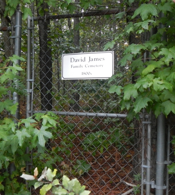
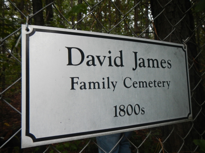
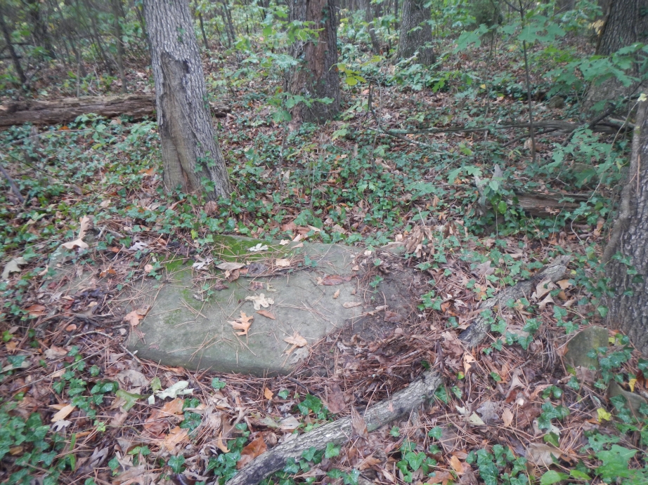
| Description | : | This cemetery is located in Land Lot 72 of the 12th District of Henry County, Georgia. Take I75 South to Exit 228. Left on GA Hwy. 138. Right on Hanover Parkway South (it is a large shopping area). The cemetery is located behind the last office building on the left enclosed by chain link fencing. There are no inscribed headstones; however, there is a plaque on the fence showing the name of this cemetery. Burial info gleaned from various sources. Information by Linda S Sanders. |
frequently asked questions (FAQ):
-
Where is David James Family Cemetery?
David James Family Cemetery is located at Henry County ,Georgia ,USA.
-
David James Family Cemetery cemetery's updated grave count on graveviews.com?
0 memorials
-
Where are the coordinates of the David James Family Cemetery?
Latitude: 33.5508842
Longitude: -84.2703018
Nearby Cemetories:
1. Old Spivey Cemetery
Stockbridge, Henry County, USA
Coordinate: 33.5425859, -84.2889050
2. Burks Cemetery
Stockbridge, Henry County, USA
Coordinate: 33.5454025, -84.2427368
3. Rocky Mount Baptist Church Cemetery
Rex, Clayton County, USA
Coordinate: 33.5754776, -84.2629013
4. Red Oak UMC Cemetery
Stockbridge, Henry County, USA
Coordinate: 33.5254200, -84.2648850
5. Stockbridge First United Methodist Church Cemetery
Stockbridge, Henry County, USA
Coordinate: 33.5437813, -84.2389297
6. Adamson Family Cemetery
Rex, Clayton County, USA
Coordinate: 33.5738340, -84.2902720
7. Branan Family Cemetery
Henry County, USA
Coordinate: 33.5572014, -84.2358017
8. Allen Family Cemetery #1
Clayton County, USA
Coordinate: 33.5465000, -84.3103900
9. Concord Cemetery
Stockbridge, Henry County, USA
Coordinate: 33.5744019, -84.2378006
10. Cemetery Street
Stockbridge, Henry County, USA
Coordinate: 33.5373535, -84.2302017
11. Rock Baptist Church Cemetery
Rex, Clayton County, USA
Coordinate: 33.5856018, -84.2910995
12. Stockbridge City Cemetery
Stockbridge, Henry County, USA
Coordinate: 33.5441200, -84.2230200
13. Mount Zion Cemetery
Morrow, Clayton County, USA
Coordinate: 33.5614014, -84.3214035
14. Ford Family Cemetery
Stockbridge, Henry County, USA
Coordinate: 33.5956001, -84.2348328
15. Camp Marker
Jonesboro, Clayton County, USA
Coordinate: 33.5214420, -84.3254220
16. Morris Grove Family Cemetery
Henry County, USA
Coordinate: 33.5793830, -84.2128330
17. Hanson Cemetery
Henry County, USA
Coordinate: 33.5755997, -84.2102966
18. Noahs Ark Church Cemetery
Jonesboro, Clayton County, USA
Coordinate: 33.4986000, -84.2953033
19. Allen Family Cemetery #2
Clayton County, USA
Coordinate: 33.5090050, -84.3168370
20. Claud Wood Family Cemetery
Stockbridge, Henry County, USA
Coordinate: 33.5089176, -84.2235013
21. Morrow Cemetery
Morrow, Clayton County, USA
Coordinate: 33.5774994, -84.3368988
22. Travelers Rest Missionary Baptist Church Cemetery
Morrow, Clayton County, USA
Coordinate: 33.5996640, -84.3197970
23. Morris-Tuggle Family Cemetery
Stockbridge, Henry County, USA
Coordinate: 33.5282822, -84.1976700
24. Sylvester Baptist Church Cemetery
Ellenwood, Clayton County, USA
Coordinate: 33.6156006, -84.2827988