| Memorials | : | 2 |
| Location | : | Orearville, Saline County, USA |
| Coordinate | : | 39.1591580, -93.0819650 |
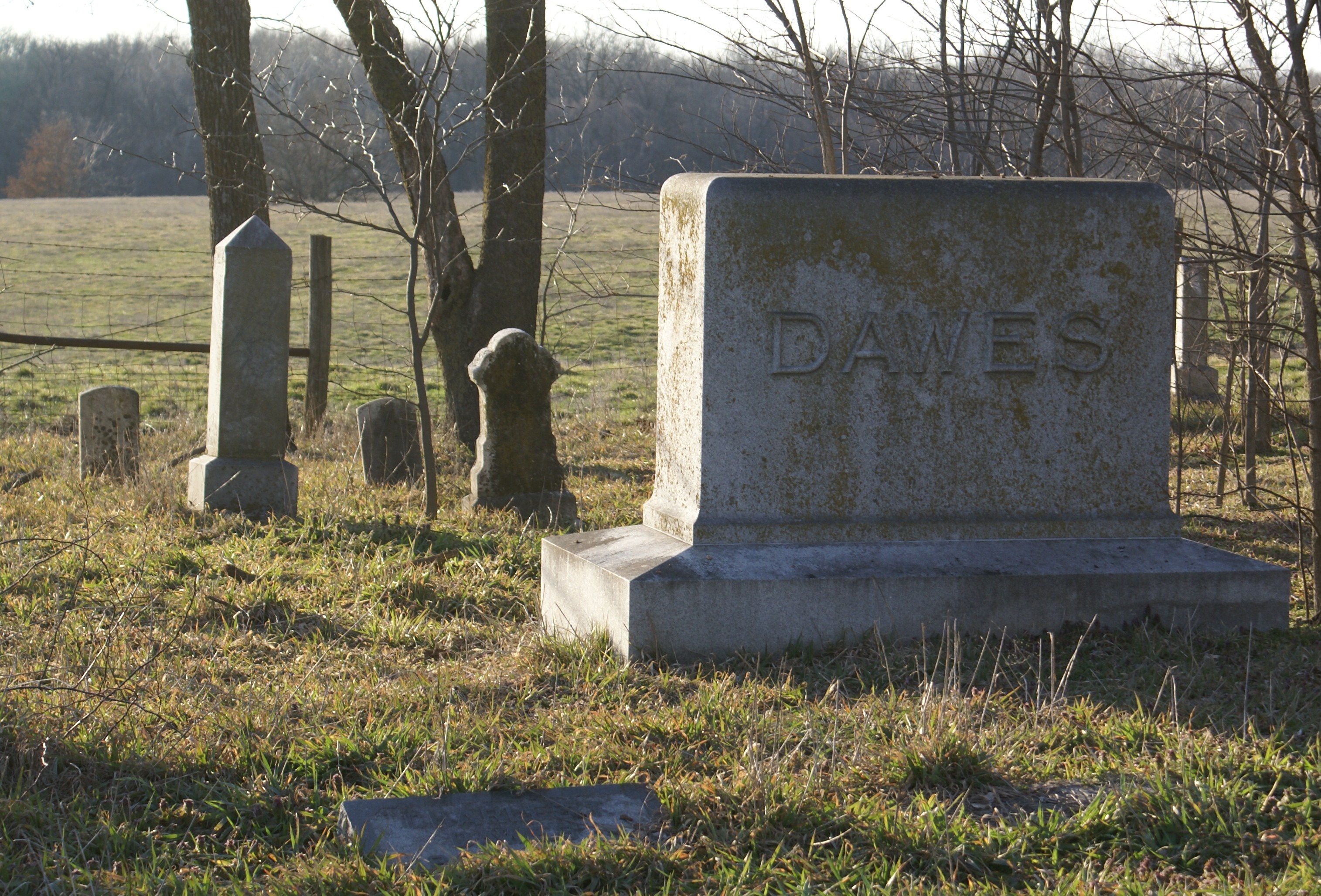
| Description | : | The cemetery is not maintained. It has a netwire (livestock) fence around it, and is in the middle of a pasture about 100 yards west of Missouri 240. The fence was crushed in one spot by a fallen tree. Many of the headstones are fallen, and some are nearly impossible to read. Cemetery is located on private property. The property owners (as of 2012) live at the residence directly north on the same side of Missouri 240. Some of the information regarding the interments was originally compiled by: Shirley Haynes & Avlyn Conley as part of SALINE SENTIMENTS |
frequently asked questions (FAQ):
-
Where is Dawes Durrett Cemetery?
Dawes Durrett Cemetery is located at Township 51N - Range 20W - Section 34 Orearville, Saline County ,Missouri ,USA.
-
Dawes Durrett Cemetery cemetery's updated grave count on graveviews.com?
2 memorials
-
Where are the coordinates of the Dawes Durrett Cemetery?
Latitude: 39.1591580
Longitude: -93.0819650
Nearby Cemetories:
1. Orear Family Cemetery
Orearville, Saline County, USA
Coordinate: 39.1701550, -93.0756410
2. Orearville Cemetery
Orearville, Saline County, USA
Coordinate: 39.1724840, -93.0750080
3. Shiloh Methodist Church Cemetery
Marshall, Saline County, USA
Coordinate: 39.1148470, -93.0957760
4. Pulliam-Hedges-Swisher Cemetery
Marshall, Saline County, USA
Coordinate: 39.1839210, -93.1417940
5. Salem Christian Church Cemetery
Saline County, USA
Coordinate: 39.1062500, -93.0856050
6. Hickman Cemetery
Saline County, USA
Coordinate: 39.2111015, -93.1177979
7. Mount Horeb Cemetery
Slater, Saline County, USA
Coordinate: 39.2111015, -93.1177979
8. Hyland Cemetery
Norton, Saline County, USA
Coordinate: 39.2024640, -93.1584430
9. Rehoboth Cemetery
Slater, Saline County, USA
Coordinate: 39.2323300, -93.0666200
10. Slater City Cemetery
Slater, Saline County, USA
Coordinate: 39.2308273, -93.0570755
11. Mount Moriah Cemetery
Slater, Saline County, USA
Coordinate: 39.2335900, -93.0664100
12. Saline County Poor Farm Cemetery
Marshall, Saline County, USA
Coordinate: 39.1524730, -93.1811930
13. Missouri State School Cemetery
Marshall, Saline County, USA
Coordinate: 39.1341900, -93.1794600
14. Saint Pauls Lutheran Cemetery
Saline City, Saline County, USA
Coordinate: 39.1410370, -92.9800070
15. Odell Cemetery
Marshall, Saline County, USA
Coordinate: 39.1352997, -93.1838989
16. Camp Creek African Baptist Church Cemetery
Napton, Saline County, USA
Coordinate: 39.0767200, -93.0732800
17. Old Catholic Cemetery
Marshall, Saline County, USA
Coordinate: 39.1315700, -93.1846700
18. Ridge Park Cemetery
Marshall, Saline County, USA
Coordinate: 39.1142006, -93.1742020
19. Fairview Cemetery
Marshall, Saline County, USA
Coordinate: 39.1171989, -93.1793976
20. Fish Creek Cemetery
Gilliam, Saline County, USA
Coordinate: 39.1860000, -92.9694100
21. Murray Farm Cemetery
Marshall Township, Saline County, USA
Coordinate: 39.0834120, -93.1512600
22. Concord Church Cemetery
Gilliam, Saline County, USA
Coordinate: 39.1112490, -92.9728990
23. Sappington Cemetery
Clay Township, Saline County, USA
Coordinate: 39.1308300, -92.9595700
24. Sappington Grove Cemetery
Saline City, Saline County, USA
Coordinate: 39.1308110, -92.9595680


