
| Memorials | : | 0 |
| Location | : | Saline County, USA |
| Coordinate | : | 39.2111015, -93.1177979 |
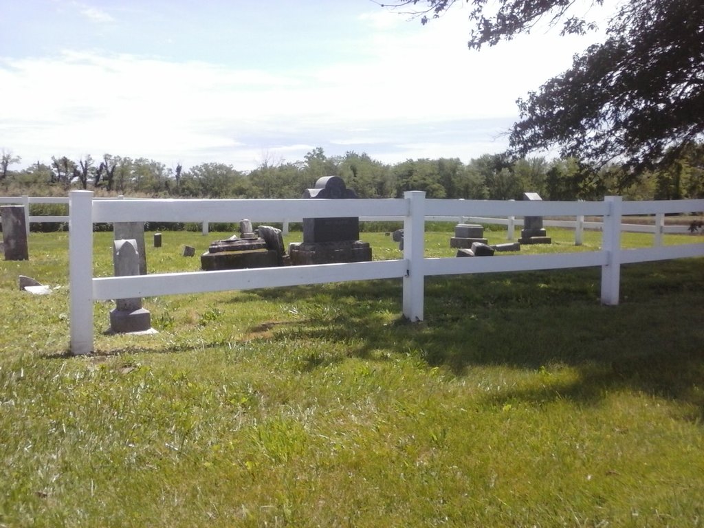
| Description | : | Located on Route O close to Slater, 3.1 miles from intersection of Euclid and Watts Streets in Slater, on the left (south) side of road. GPS 39.211094, -93.122631 (Google Maps). Township 51, Range 20, Section 17. From intersection of Euclid and Watts Streets in Slater, follow Route O, (Watts Street), eastward (out of town) for 3.1 miles. The road has a curve taking you southerly, then another bringing you back easterly. The cemetery is on the left, surrounded by a white rail fence. It is small, you may go past it. (Heading towards Marshall, you will pass Mount Horeb cemetery on... Read More |
frequently asked questions (FAQ):
-
Where is Hickman Cemetery?
Hickman Cemetery is located at Saline County ,Missouri ,USA.
-
Hickman Cemetery cemetery's updated grave count on graveviews.com?
0 memorials
-
Where are the coordinates of the Hickman Cemetery?
Latitude: 39.2111015
Longitude: -93.1177979
Nearby Cemetories:
1. Mount Horeb Cemetery
Slater, Saline County, USA
Coordinate: 39.2111015, -93.1177979
2. Hyland Cemetery
Norton, Saline County, USA
Coordinate: 39.2024640, -93.1584430
3. Pulliam-Hedges-Swisher Cemetery
Marshall, Saline County, USA
Coordinate: 39.1839210, -93.1417940
4. Rehoboth Cemetery
Slater, Saline County, USA
Coordinate: 39.2323300, -93.0666200
5. Mount Moriah Cemetery
Slater, Saline County, USA
Coordinate: 39.2335900, -93.0664100
6. Orearville Cemetery
Orearville, Saline County, USA
Coordinate: 39.1724840, -93.0750080
7. Slater City Cemetery
Slater, Saline County, USA
Coordinate: 39.2308273, -93.0570755
8. Orear Family Cemetery
Orearville, Saline County, USA
Coordinate: 39.1701550, -93.0756410
9. Cow Creek Cemetery
Fairville, Saline County, USA
Coordinate: 39.2182900, -93.1907340
10. Dawes Durrett Cemetery
Orearville, Saline County, USA
Coordinate: 39.1591580, -93.0819650
11. Fairville Cemetery
Fairville, Saline County, USA
Coordinate: 39.2317400, -93.2047900
12. Saline County Poor Farm Cemetery
Marshall, Saline County, USA
Coordinate: 39.1524730, -93.1811930
13. Mount Carmel Cemetery
Fairville, Saline County, USA
Coordinate: 39.2099650, -93.2229850
14. Wolfskill Cemetery
Saline County, USA
Coordinate: 39.2889167, -93.0845000
15. Missouri State School Cemetery
Marshall, Saline County, USA
Coordinate: 39.1341900, -93.1794600
16. Odell Cemetery
Marshall, Saline County, USA
Coordinate: 39.1352997, -93.1838989
17. Bethel Cemetery
Sharon, Saline County, USA
Coordinate: 39.3025600, -93.1349300
18. Old Catholic Cemetery
Marshall, Saline County, USA
Coordinate: 39.1315700, -93.1846700
19. Shiloh Methodist Church Cemetery
Marshall, Saline County, USA
Coordinate: 39.1148470, -93.0957760
20. Harris Cemetery
Slater, Saline County, USA
Coordinate: 39.3098010, -93.0944170
21. Gilliam Cemetery
Gilliam, Saline County, USA
Coordinate: 39.2352982, -92.9906006
22. High Hill Cemetery
Gilliam, Saline County, USA
Coordinate: 39.3046989, -93.0569000
23. Fairview Cemetery
Marshall, Saline County, USA
Coordinate: 39.1171989, -93.1793976
24. Ridge Park Cemetery
Marshall, Saline County, USA
Coordinate: 39.1142006, -93.1742020