
| Memorials | : | 1 |
| Location | : | Coventry, Kent County, USA |
| Coordinate | : | 41.6742325, -71.5968246 |
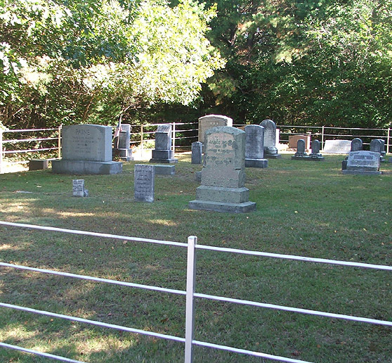
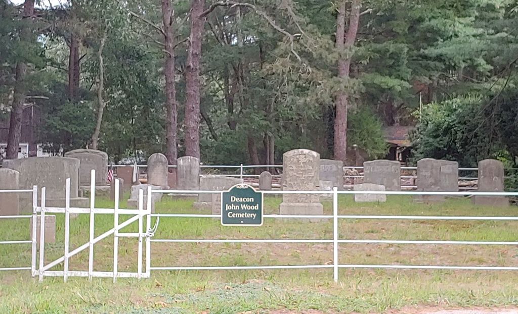
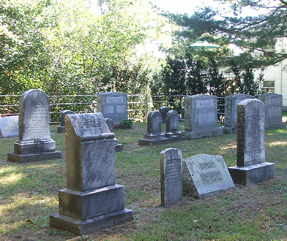
| Description | : | "On the Dea. John Wood place in a lot protected by an iron fence." This cemetery is located off of Route 3, 10 feet northeast of Magnolia Lane, across the street from #6 Magnolia Lane in the Wood Estates development. The cemetery is 80 ft X 55 ft, in excellent condition, and enclosed with a metal fence with an iron gate. There are 51 burials with 39 inscribed stones from 1819 to 1987. |
frequently asked questions (FAQ):
-
Where is Deacon John Wood Cemetery?
Deacon John Wood Cemetery is located at Magnolia Lane Coventry, Kent County ,Rhode Island ,USA.
-
Deacon John Wood Cemetery cemetery's updated grave count on graveviews.com?
1 memorials
-
Where are the coordinates of the Deacon John Wood Cemetery?
Latitude: 41.6742325
Longitude: -71.5968246
Nearby Cemetories:
1. Gorton Lot
Coventry, Kent County, USA
Coordinate: 41.6686897, -71.6060257
2. Barber Lot
Coventry, Kent County, USA
Coordinate: 41.6860600, -71.6026970
3. Elkanah Johnson Lot
Coventry, Kent County, USA
Coordinate: 41.6821747, -71.5767746
4. Philip Matteson Lot
West Greenwich, Kent County, USA
Coordinate: 41.6576650, -71.6029970
5. Goff Lot
Coventry, Kent County, USA
Coordinate: 41.6672790, -71.5720430
6. Battey Family Cemetery
Coventry, Kent County, USA
Coordinate: 41.6676500, -71.5717200
7. Hangmans Hill Lot
West Greenwich, Kent County, USA
Coordinate: 41.6603060, -71.5753060
8. Greene-Johnson Lot
Coventry, Kent County, USA
Coordinate: 41.6638900, -71.6217900
9. Aaron Bowen Lot
Coventry, Kent County, USA
Coordinate: 41.6820946, -71.5679016
10. Bissell-Whipple-Stone Lot
Coventry, Kent County, USA
Coordinate: 41.6889496, -71.5699539
11. Cromwell Whipple Monument
Coventry, Kent County, USA
Coordinate: 41.6884500, -71.5672700
12. Ambrose Rogers Lot
Coventry, Kent County, USA
Coordinate: 41.6842100, -71.5642600
13. Andrews Lot
West Greenwich, Kent County, USA
Coordinate: 41.6480904, -71.6009521
14. Brayton Burial Ground
Coventry, Kent County, USA
Coordinate: 41.6910290, -71.5694780
15. Irwin-Hines Lot
Coventry, Kent County, USA
Coordinate: 41.6876100, -71.5648600
16. Abbott-Colvin Lot
Coventry, Kent County, USA
Coordinate: 41.6984100, -71.5769300
17. Matteson-Whitman-Woodward Lot
West Greenwich, Kent County, USA
Coordinate: 41.6461700, -71.5879500
18. Havens Lot
Coventry, Kent County, USA
Coordinate: 41.6845830, -71.6328610
19. Abel Greene Lot
West Greenwich, Kent County, USA
Coordinate: 41.6502910, -71.5745470
20. Job Harrington Lot
West Greenwich, Kent County, USA
Coordinate: 41.6460000, -71.5868900
21. Oliver Matteson Lot
West Greenwich, Kent County, USA
Coordinate: 41.6455380, -71.6074910
22. Arnold Lot
Coventry, Kent County, USA
Coordinate: 41.7042999, -71.6044006
23. Caleb Whitford Lot
West Greenwich, Kent County, USA
Coordinate: 41.6430280, -71.6045560
24. Jabez Anthony Lot
Coventry, Kent County, USA
Coordinate: 41.6700280, -71.5545830