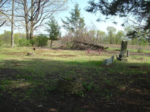
| Memorials | : | 0 |
| Location | : | Winslow, Jefferson County, USA |
| Coordinate | : | 41.0818000, -78.8107000 |
| Description | : | The cemetery is on the former farm of Francis DeLarme with the earliest burials being those of two of his grandchildren. Located along West Liberty Road east of Reynoldsville. From Reynoldsville head east on Rt 322 for about a half mile and bear right onto West Liberty Road. Travel about 2.8 miles and you'll find the cemetery on the right. GPS Coordinates Latitude: 41.081833 Longitude: -78.811033 |
frequently asked questions (FAQ):
-
Where is Delarme Cemetery?
Delarme Cemetery is located at Winslow, Jefferson County ,Pennsylvania ,USA.
-
Delarme Cemetery cemetery's updated grave count on graveviews.com?
0 memorials
-
Where are the coordinates of the Delarme Cemetery?
Latitude: 41.0818000
Longitude: -78.8107000
Nearby Cemetories:
1. Old West Liberty Cemetery
DuBois, Clearfield County, USA
Coordinate: 41.0775100, -78.7871900
2. West Liberty Cemetery
DuBois, Clearfield County, USA
Coordinate: 41.0802400, -78.7836300
3. Prospect Cemetery
Reynoldsville, Jefferson County, USA
Coordinate: 41.0839005, -78.8377991
4. Wayne Cemetery
Sandy Township, Clearfield County, USA
Coordinate: 41.1068860, -78.7934230
5. Holy Trinity Byzantine Catholic Cemetery
Sykesville, Jefferson County, USA
Coordinate: 41.0536003, -78.8268967
6. Mix Family Burial Ground
Reynoldsville, Jefferson County, USA
Coordinate: 41.0797710, -78.8529170
7. Assumption Cemetery
Sykesville, Jefferson County, USA
Coordinate: 41.0550000, -78.8354000
8. Fuller Cemetery
Reynoldsville, Jefferson County, USA
Coordinate: 41.0867120, -78.8582660
9. Sykesville Memorial Cemetery
Sykesville, Jefferson County, USA
Coordinate: 41.0449982, -78.8191986
10. Rumbarger Cemetery
DuBois, Clearfield County, USA
Coordinate: 41.1157990, -78.7742004
11. McCreight Cemetery
Winslow, Jefferson County, USA
Coordinate: 41.0596000, -78.8618000
12. Saint Michaels Cemetery
DuBois, Clearfield County, USA
Coordinate: 41.1227989, -78.7855988
13. Saint Josephs Cemetery
DuBois, Clearfield County, USA
Coordinate: 41.1227989, -78.7822037
14. Saint Catherine Cemetery
DuBois, Clearfield County, USA
Coordinate: 41.1218987, -78.7782974
15. Sons of Israel Cemetery
DuBois, Clearfield County, USA
Coordinate: 41.1228250, -78.7792960
16. Baptist Cemetery
Winslow Township, Jefferson County, USA
Coordinate: 41.0897484, -78.8731155
17. Beulah Land Cemetery
Reynoldsville, Jefferson County, USA
Coordinate: 41.0931015, -78.8743973
18. Salem Methodist Cemetery
DuBois, Clearfield County, USA
Coordinate: 41.0747000, -78.7459000
19. Taylor Cemetery
Falls Creek, Jefferson County, USA
Coordinate: 41.1409683, -78.8108292
20. Reynoldsville Cemetery
Reynoldsville, Jefferson County, USA
Coordinate: 41.0829000, -78.8940000
21. Saint Mary's Catholic Cemetery
Reynoldsville, Jefferson County, USA
Coordinate: 41.1078950, -78.8875100
22. John DuBois Monument
DuBois, Clearfield County, USA
Coordinate: 41.1288240, -78.7515390
23. Sandy Valley Cemetery
Sandy Valley, Jefferson County, USA
Coordinate: 41.1261000, -78.8779000
24. Oklahoma Cemetery
Clearfield County, USA
Coordinate: 41.1142000, -78.7318000

