| Memorials | : | 0 |
| Location | : | Denholme, Metropolitan Borough of Bradford, England |
| Coordinate | : | 53.7883900, -1.8935500 |
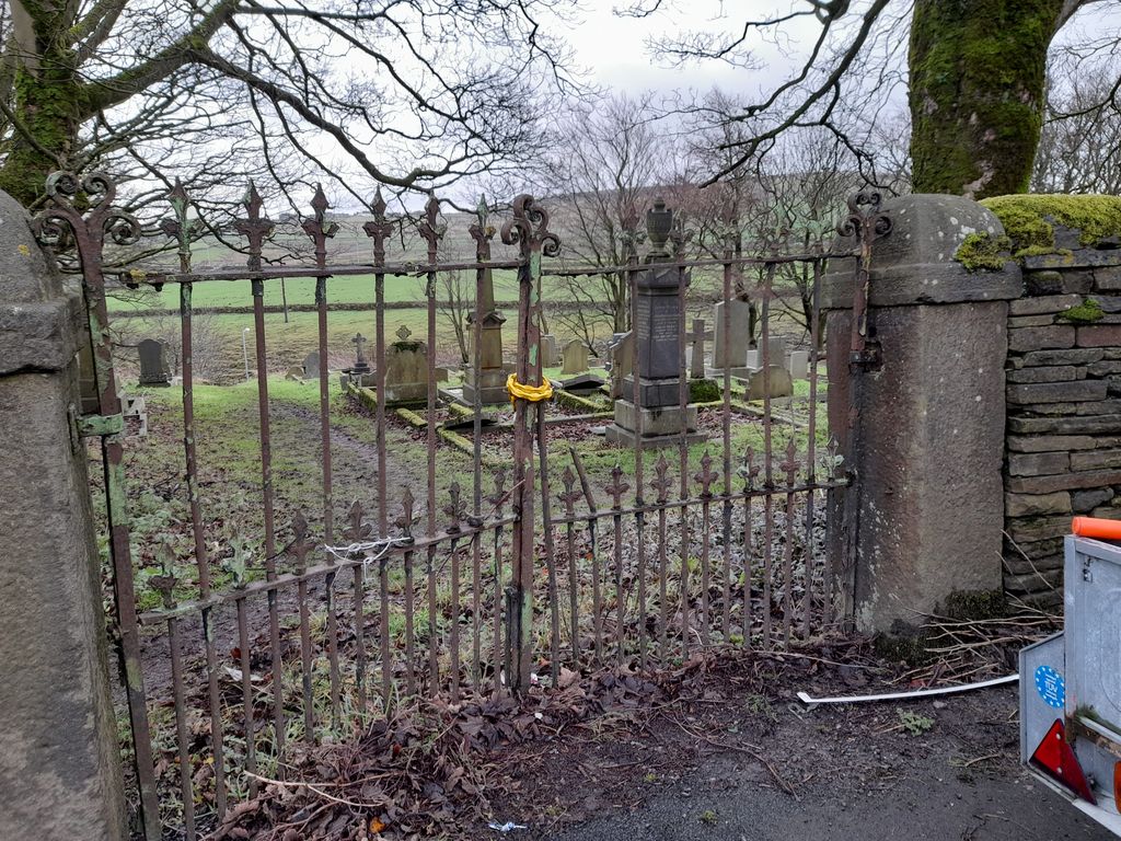
| Description | : | The Primitive Methodist church was originally opposite the burial ground over the road. This was closed and converted to two houses. There was a graveyard by the church but these graves are gone. The burial ground was closed in 1987. |
frequently asked questions (FAQ):
-
Where is Denholme Clough Primitive Methodist Burial Ground?
Denholme Clough Primitive Methodist Burial Ground is located at Halifax Road Denholme, Metropolitan Borough of Bradford ,West Yorkshire , DenholmeEngland.
-
Denholme Clough Primitive Methodist Burial Ground cemetery's updated grave count on graveviews.com?
0 memorials
-
Where are the coordinates of the Denholme Clough Primitive Methodist Burial Ground?
Latitude: 53.7883900
Longitude: -1.8935500
Nearby Cemetories:
1. St Paul Churchyard
Denholme, Metropolitan Borough of Bradford, England
Coordinate: 53.7971450, -1.8929770
2. Thornton Cemetery
Thornton, Metropolitan Borough of Bradford, England
Coordinate: 53.7923160, -1.8682330
3. Denholme Methodist Chapelyard
Denholme, Metropolitan Borough of Bradford, England
Coordinate: 53.8050350, -1.8938640
4. Denholme Shared Church
Denholme, Metropolitan Borough of Bradford, England
Coordinate: 53.8062745, -1.8949800
5. Bethesda Wesleyan Chapelyard
Thornton, Metropolitan Borough of Bradford, England
Coordinate: 53.7928800, -1.8551400
6. St. John's Churchyard
Bradshaw, Metropolitan Borough of Calderdale, England
Coordinate: 53.7649130, -1.8854840
7. Mount Zion Methodist Chapelyard
Halifax, Metropolitan Borough of Calderdale, England
Coordinate: 53.7638870, -1.8979630
8. Kipping Independent Congregational Chapelyard
Thornton, Metropolitan Borough of Bradford, England
Coordinate: 53.7904300, -1.8476700
9. Horkinstone Baptists Burial Ground
Metropolitan Borough of Bradford, England
Coordinate: 53.8050236, -1.9327888
10. St James Church Cemetery
Thornton, Metropolitan Borough of Bradford, England
Coordinate: 53.7903800, -1.8412900
11. Illingworth Moor Methodist Chapelyard
Illingworth, Metropolitan Borough of Calderdale, England
Coordinate: 53.7559000, -1.8956600
12. St Matthew Churchyard
Wilsden, Metropolitan Borough of Bradford, England
Coordinate: 53.8165000, -1.8636600
13. Queensbury Baptist Church
Queensbury, Metropolitan Borough of Bradford, England
Coordinate: 53.7690533, -1.8469805
14. Holy Trinity Churchyard
Queensbury, Metropolitan Borough of Bradford, England
Coordinate: 53.7670300, -1.8485400
15. Queensbury Cemetery
Queensbury, Metropolitan Borough of Bradford, England
Coordinate: 53.7666270, -1.8478510
16. Ambler Thorn United Methodist Burial Ground
Queensbury, Metropolitan Borough of Bradford, England
Coordinate: 53.7601200, -1.8590700
17. St. Mary the Virgin Churchyard
Halifax, Metropolitan Borough of Calderdale, England
Coordinate: 53.7517160, -1.8959410
18. St. John the Evangelist Churchyard
Cullingworth, Metropolitan Borough of Bradford, England
Coordinate: 53.8282300, -1.8991300
19. St. Mary the Virgin Churchyard
Oxenhope, Metropolitan Borough of Bradford, England
Coordinate: 53.8082633, -1.9556365
20. Wilsden Cemetery
Wilsden, Metropolitan Borough of Bradford, England
Coordinate: 53.8225100, -1.8518800
21. Clayton Methodist Chapelyard
Clayton, Metropolitan Borough of Bradford, England
Coordinate: 53.7812800, -1.8232500
22. Moor End United Reform Chapelyard
Moor End, Metropolitan Borough of Calderdale, England
Coordinate: 53.7487700, -1.9194650
23. St John the Baptist Churchyard
Clayton, Metropolitan Borough of Bradford, England
Coordinate: 53.7836900, -1.8210500
24. Mount Pleasant Methodist Free Church Cemetery
Wainstalls, Metropolitan Borough of Calderdale, England
Coordinate: 53.7506090, -1.9296120

