| Memorials | : | 0 |
| Location | : | Cambridge, City of Cambridge, England |
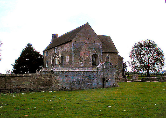
| Description | : | Denny Abbey is a former abbey near Waterbeach, six miles (10 km) north of Cambridge in Cambridgeshire, England which was inhabited by a succession of three different religious orders during its history serving as a monastery. The site, on an ancient road between Cambridge and Ely, was settled by farmers as early as the Roman period. The Domesday Book recorded that it was owned by Edith the Fair (also known as Swanneck), the consort of King Harold, in 1066 when the Normans invaded England and killed her husband. It was owned subsequently by the Breton lord, Alan, 1st Earl of Richmond.[1] |
frequently asked questions (FAQ):
-
Where is Denny Abbey?
Denny Abbey is located at Cambridge, City of Cambridge, England.
-
Denny Abbey cemetery's updated grave count on graveviews.com?
0 memorials
Nearby Cemetories:
1. St Andrew Churchyard
Cherry Hinton, City of Cambridge, England
Coordinate: 52.2160480, 0.1126310
2. St Mary and St Michael Churchyard
Trumpington, City of Cambridge, England
Coordinate: 52.2084330, 0.1190030
3. Trumpington Parish Extension
Trumpington, City of Cambridge, England
Coordinate: 52.2059890, 0.1201900
4. All Saints Churchyard
Cambridge, City of Cambridge, England
Coordinate: 52.2435900, 0.0462900
5. Ascension Parish Burial Ground
Cambridge, City of Cambridge, England
Coordinate: 52.2047670, 0.1165080
6. Barnwell Priory
Cambridge, City of Cambridge, England
Coordinate: 52.2012650, 0.1184580
7. Cambridge City Cemetery
Cambridge, City of Cambridge, England
8. Christ Church Cemetery
Cambridge, City of Cambridge, England
9. Christ's College Chapel
Cambridge, City of Cambridge, England
Coordinate: 52.2009520, 0.1351060
10. Corpus Christi College Chapel
Cambridge, City of Cambridge, England
11. Emmanuel College
Cambridge, City of Cambridge, England
Coordinate: 52.2009000, 0.1184000
12. Gonville and Caius College
Cambridge, City of Cambridge, England
Coordinate: 52.2023456, 0.1162151
13. Histon Road Cemetery
Cambridge, City of Cambridge, England
Coordinate: 52.2160480, 0.1126310
14. Holy Sepulchre
Cambridge, City of Cambridge, England
Coordinate: 52.2084330, 0.1190030
15. Holy Trinity Church
Cambridge, City of Cambridge, England
Coordinate: 52.2059890, 0.1201900
16. Huntingdon Road Cemetery
Cambridge, City of Cambridge, England
Coordinate: 52.2435900, 0.0462900
17. Kings College Chapel
Cambridge, City of Cambridge, England
Coordinate: 52.2047670, 0.1165080
18. Little Saint Mary Churchyard
Cambridge, City of Cambridge, England
Coordinate: 52.2012650, 0.1184580
19. Lucy Cavendish College Gardens
Cambridge, City of Cambridge, England
20. Memorial Church
Cambridge, City of Cambridge, England
21. Mill Road Cemetery
Cambridge, City of Cambridge, England
Coordinate: 52.2009520, 0.1351060
22. Pembroke College Chapel
Cambridge, City of Cambridge, England
23. Peterhouse College
Cambridge, City of Cambridge, England
Coordinate: 52.2009000, 0.1184000
24. Queen's College Chapel
Cambridge, City of Cambridge, England
Coordinate: 52.2023456, 0.1162151

