
| Memorials | : | 4 |
| Location | : | Madison, Madison County, USA |
| Coordinate | : | 30.6463450, -83.5505930 |
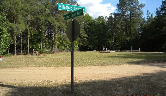
| Description | : | This cemetery is located on the Brooks County, Georgia and Madison County, Florida line. At highway 90 in the city of Madison, take hwy 53 north to highway 146 west and make a left onto 146 which is named Little Cat Road. Follow this road about 13 miles at about mile 10 the road should become more of a northwest direction. Stay on the road until you almost reach a railroad crossing. Just before you cross the railroad tracks there is a dirt road on the right named NW Radford-Denson Rd. Turn right on to this dirt road and... Read More |
frequently asked questions (FAQ):
-
Where is Denson Cemetery?
Denson Cemetery is located at NW Radford-Denson Road / NW 187th Street Madison, Madison County ,Florida , 32331USA.
-
Denson Cemetery cemetery's updated grave count on graveviews.com?
4 memorials
-
Where are the coordinates of the Denson Cemetery?
Latitude: 30.6463450
Longitude: -83.5505930
Nearby Cemetories:
1. Pineview Cemetery
Brooks County, USA
Coordinate: 30.6496120, -83.5752120
2. The Church of The Lord Jesus Christ Cemetery
Quitman, Brooks County, USA
Coordinate: 30.6552970, -83.5739490
3. Union Baptist Church Cemetery
Nankin, Brooks County, USA
Coordinate: 30.6739940, -83.5370190
4. Union Church Cemetery
Empress, Brooks County, USA
Coordinate: 30.6766240, -83.5529460
5. Shiloh Methodist Church Cemetery
Madison County, USA
Coordinate: 30.6179960, -83.5284110
6. Concord Missionary Baptist Church Cemetery
Lovett, Madison County, USA
Coordinate: 30.6102619, -83.5355988
7. Saint Philips Cemetery
Nankin, Brooks County, USA
Coordinate: 30.6807500, -83.5292000
8. Harmony Baptist Church Cemetery
Greenville, Madison County, USA
Coordinate: 30.6242580, -83.4906110
9. Columbia Primitive Baptist Church Cemetery
Nankin, Brooks County, USA
Coordinate: 30.6623001, -83.4776382
10. Blackwater Plantation Cemetery
Quitman, Brooks County, USA
Coordinate: 30.6705590, -83.6238980
11. Wade Cemetery
Brooks County, USA
Coordinate: 30.6677800, -83.4694500
12. Summer Hill Missionary Baptist Church Cemetery
Quitman, Brooks County, USA
Coordinate: 30.6669006, -83.6324997
13. Liberty Baptist Church Cemetery
Quitman, Brooks County, USA
Coordinate: 30.7138520, -83.5912250
14. Antioch Cemetery
Cherry Lake, Madison County, USA
Coordinate: 30.6302222, -83.4639798
15. John McMullen Cemetery
Grooverville, Brooks County, USA
Coordinate: 30.6547620, -83.6449360
16. Howard-Bellamy Cemetery
Ashville, Jefferson County, USA
Coordinate: 30.6186030, -83.6427810
17. Hickory Head Baptist Church Cemetery
Quitman, Brooks County, USA
Coordinate: 30.7131490, -83.6110270
18. Worn Cemetery
Quitman, Brooks County, USA
Coordinate: 30.7327995, -83.5355988
19. Sweetfield Missionary Baptist Church Cemetery
Nankin, Brooks County, USA
Coordinate: 30.7336470, -83.5229590
20. Ebenezer United Methodist Church Cemetery
Madison, Madison County, USA
Coordinate: 30.5560690, -83.5308790
21. Ashville Community Cemetery
Ashville, Jefferson County, USA
Coordinate: 30.6108330, -83.6589810
22. Elam Missionary Baptist Church Cemetery
Nankin, Brooks County, USA
Coordinate: 30.6731160, -83.4338410
23. Johnson Cemetery
Quitman, Brooks County, USA
Coordinate: 30.7504660, -83.5577420
24. Lyndhurst Plantation Cemetery
Ashville, Jefferson County, USA
Coordinate: 30.5877300, -83.6519100