
| Memorials | : | 1 |
| Location | : | Ashville, Jefferson County, USA |
| Coordinate | : | 30.5877300, -83.6519100 |
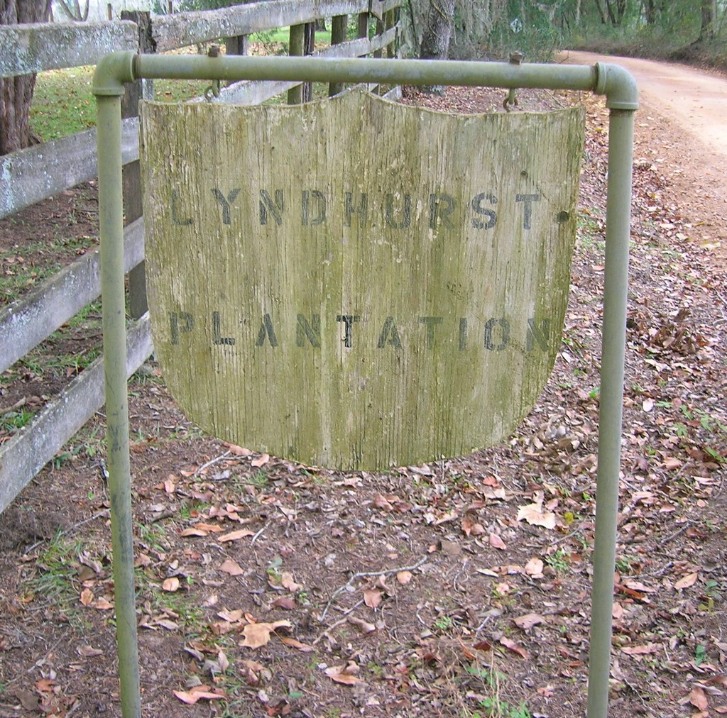
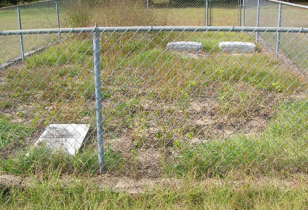
| Description | : | Burial site of William J. Bailey, his wife, Eliza, and a few infant family members. Lyndhurst was completed in 1850 by Bailey and is still in use as a private residence. On April 2, 1973, Lyndhurst Plantation was added to the U.S. National Register of Historic Places. |
frequently asked questions (FAQ):
-
Where is Lyndhurst Plantation Cemetery?
Lyndhurst Plantation Cemetery is located at Ashville, Jefferson County ,Florida ,USA.
-
Lyndhurst Plantation Cemetery cemetery's updated grave count on graveviews.com?
1 memorials
-
Where are the coordinates of the Lyndhurst Plantation Cemetery?
Latitude: 30.5877300
Longitude: -83.6519100
Nearby Cemetories:
1. Ashville Community Cemetery
Ashville, Jefferson County, USA
Coordinate: 30.6108330, -83.6589810
2. Howard-Bellamy Cemetery
Ashville, Jefferson County, USA
Coordinate: 30.6186030, -83.6427810
3. Young Reaper Missionary Baptist Church Cemetery
Madison County, USA
Coordinate: 30.5349998, -83.6235962
4. John McMullen Cemetery
Grooverville, Brooks County, USA
Coordinate: 30.6547620, -83.6449360
5. Pinckney Hill Plantation Cemetery
Monticello, Jefferson County, USA
Coordinate: 30.5912160, -83.7425430
6. Summer Hill Missionary Baptist Church Cemetery
Quitman, Brooks County, USA
Coordinate: 30.6669006, -83.6324997
7. Mount Nebo Church Cemetery
Greenville, Madison County, USA
Coordinate: 30.5266730, -83.5826160
8. Blackwater Plantation Cemetery
Quitman, Brooks County, USA
Coordinate: 30.6705590, -83.6238980
9. New Bethel AME Church Cemetery
Monticello, Jefferson County, USA
Coordinate: 30.5848690, -83.7551580
10. Pineview Cemetery
Brooks County, USA
Coordinate: 30.6496120, -83.5752120
11. Bethel AME Church Cemetery
Aucilla, Jefferson County, USA
Coordinate: 30.5884020, -83.7580120
12. Hampton Cemetery
Aucilla, Jefferson County, USA
Coordinate: 30.5820380, -83.7584460
13. Redding Hammock Cemetery
Madison County, USA
Coordinate: 30.5058002, -83.6031036
14. Pleasant Grove Missionary Baptist Church Cemetery
Aucilla, Jefferson County, USA
Coordinate: 30.5665610, -83.7565230
15. Brown Cemetery
Dills, Jefferson County, USA
Coordinate: 30.6327890, -83.7468660
16. Faglie Cemetery
Dills, Jefferson County, USA
Coordinate: 30.6327900, -83.7471460
17. Sanders Cemetery
Dills, Jefferson County, USA
Coordinate: 30.6329530, -83.7471590
18. Stokes Cemetery
Dills, Jefferson County, USA
Coordinate: 30.6329110, -83.7480550
19. Smith Cemetery
Madison County, USA
Coordinate: 30.5060997, -83.5955963
20. The Church of The Lord Jesus Christ Cemetery
Quitman, Brooks County, USA
Coordinate: 30.6552970, -83.5739490
21. New Hopewell Cemetery
Greenville, Madison County, USA
Coordinate: 30.4925003, -83.6517029
22. Redding Cemetery
Madison County, USA
Coordinate: 30.5021992, -83.5924988
23. Concord Missionary Baptist Church Cemetery
Lovett, Madison County, USA
Coordinate: 30.6102619, -83.5355988
24. Denson Cemetery
Madison, Madison County, USA
Coordinate: 30.6463450, -83.5505930