
| Memorials | : | 0 |
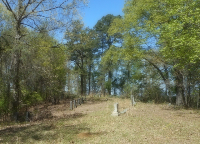
| Location | : | Montpelier, Clay County, USA |
| Coordinate | : | 33.7631510, -88.8762470 |
| Description | : | From West Point, Miss., take Hwy 50 West 4.8 miles, and turn right on Hwy 47. Go 14.8 miles and turn left onto Fire Tower Road, at Foster's Chapel. Go 1.4 miles and turn right onto a small dirt road, take the second right and follow to the top of the hill. |
frequently asked questions (FAQ):
-
Where is Dexter Cemetery?
Dexter Cemetery is located at Montpelier, Clay County ,Mississippi ,USA.
-
Dexter Cemetery cemetery's updated grave count on graveviews.com?
0 memorials
-
Where are the coordinates of the Dexter Cemetery?
Latitude: 33.7631510
Longitude: -88.8762470
Nearby Cemetories:
1. Kilgore Cemetery
Whites, Clay County, USA
Coordinate: 33.7641960, -88.9019850
2. Hatchett Cemetery
Clay County, USA
Coordinate: 33.7835999, -88.8871994
3. Rocky Hill Cemetery
Clay County, USA
Coordinate: 33.7322006, -88.8566971
4. Saint Robertson Cemetery
Clay County, USA
Coordinate: 33.7442017, -88.8332977
5. Mixon Cemetery
Una, Clay County, USA
Coordinate: 33.8093987, -88.8494034
6. McCondy Baptist Church Cemetery
McCondy, Chickasaw County, USA
Coordinate: 33.8122010, -88.8456600
7. Shady Grove Cemetery
Clay County, USA
Coordinate: 33.8048090, -88.8316940
8. Hughes Cemetery
Chickasaw County, USA
Coordinate: 33.7916985, -88.9366989
9. Saint Paul Cemetery
Clay County, USA
Coordinate: 33.7094002, -88.9143982
10. Palestine Cemetery
Montpelier, Clay County, USA
Coordinate: 33.7106018, -88.9207993
11. Enon Cemetery
Enon, Chickasaw County, USA
Coordinate: 33.8271000, -88.8961700
12. Enon Baptist Cemetery
Cairo, Clay County, USA
Coordinate: 33.6961710, -88.8663110
13. Amity Cemetery
Sparta, Chickasaw County, USA
Coordinate: 33.7834240, -88.9578240
14. Old Montpelier Cemetery
Clay County, USA
Coordinate: 33.6949997, -88.8996964
15. Shadow Ridge Cemetery
Houston, Chickasaw County, USA
Coordinate: 33.8340933, -88.8818656
16. Oak Grove Cemetery
Sparta, Chickasaw County, USA
Coordinate: 33.7691994, -88.9653015
17. Pleasant Grove Methodist Church Cemetery
Una, Clay County, USA
Coordinate: 33.7962320, -88.7939270
18. Palo Alto Cemetery
Palo Alto, Clay County, USA
Coordinate: 33.7089005, -88.8106003
19. New Hope Cemetery
Trebloc, Chickasaw County, USA
Coordinate: 33.8403015, -88.8788986
20. Catholic Cemetery
Montpelier, Clay County, USA
Coordinate: 33.7064580, -88.9479520
21. Old Arbor Grove Cemetery
Houston, Chickasaw County, USA
Coordinate: 33.8255600, -88.9417200
22. Cantrell Cemetery
Clay County, USA
Coordinate: 33.7807999, -88.7789001
23. Lake Grove Missionary Baptist Church Cemetery
Una, Clay County, USA
Coordinate: 33.7666180, -88.7753320
24. Arbor Grove Baptist Cemetery
Houston, Chickasaw County, USA
Coordinate: 33.8264618, -88.9434433