
| Memorials | : | 0 |
| Location | : | Lawton, Comanche County, USA |
| Coordinate | : | 34.5875015, -98.5447006 |
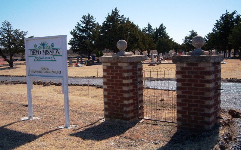
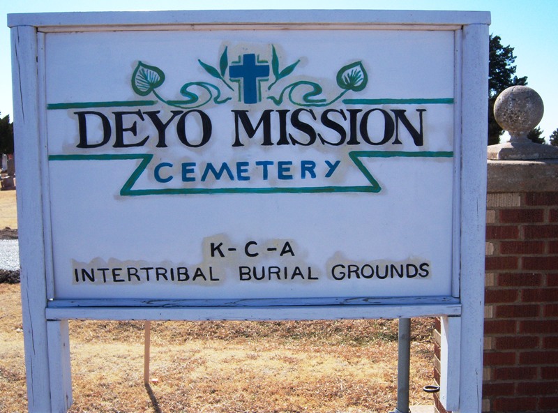
| Description | : | The Deyo Mission Chapel is located near the cemetery. In fact, to enter the cemetery area, a person has to drive in the gate at the entrance at Deyo Mission Chapel. This part of Oklahoma is in the section that was known as the Kiowa-Comanche-Apache Reservation, hence the name. It was opened for settlement in a land lottery on August 6, 1901. |
frequently asked questions (FAQ):
-
Where is Deyo Mission Cemetery?
Deyo Mission Cemetery is located at Lawton, Comanche County ,Oklahoma ,USA.
-
Deyo Mission Cemetery cemetery's updated grave count on graveviews.com?
0 memorials
-
Where are the coordinates of the Deyo Mission Cemetery?
Latitude: 34.5875015
Longitude: -98.5447006
Nearby Cemetories:
1. Sunset Memorial Gardens
Lawton, Comanche County, USA
Coordinate: 34.6213989, -98.5064011
2. Cache Cemetery
Cache, Comanche County, USA
Coordinate: 34.6274986, -98.5789032
3. Pecan Cemetery
Lawton, Comanche County, USA
Coordinate: 34.5367012, -98.5192032
4. Cache Kiowa Comanche Apache Intertribal Cemetery
Comanche County, USA
Coordinate: 34.6214000, -98.6564100
5. First United Methodist Church Columbarium
Lawton, Comanche County, USA
Coordinate: 34.6152870, -98.4261090
6. Saint Andrews Episcopal Church Columbarium
Lawton, Comanche County, USA
Coordinate: 34.6048400, -98.4086090
7. Highland Cemetery
Lawton, Comanche County, USA
Coordinate: 34.6319008, -98.4002991
8. Indian Agency Cemetery
Fort Sill, Comanche County, USA
Coordinate: 34.6423000, -98.3924100
9. Faxon Cemetery
Faxon, Comanche County, USA
Coordinate: 34.4510994, -98.6016998
10. Fort Sill Post Cemetery
Fort Sill, Comanche County, USA
Coordinate: 34.6693760, -98.3957700
11. Fort Sill Pet Cemetery Annex
Fort Sill, Comanche County, USA
Coordinate: 34.6687700, -98.3942000
12. Pet Memorial Cemetery
Medicine Park, Comanche County, USA
Coordinate: 34.7242500, -98.4462000
13. Flower Mound Cemetery
Lawton, Comanche County, USA
Coordinate: 34.5790100, -98.3518600
14. Old Catholic Cemetery
Chattanooga, Comanche County, USA
Coordinate: 34.4352000, -98.6402000
15. Indiahoma IOOF Cemetery
Indiahoma, Comanche County, USA
Coordinate: 34.5806007, -98.7566986
16. Apache South Cemetery
Lawton, Comanche County, USA
Coordinate: 34.6946983, -98.3711014
17. Beef Creek Apache Cemetery
Lawton, Comanche County, USA
Coordinate: 34.6969100, -98.3704500
18. Post Oak Cemetery
Indiahoma, Comanche County, USA
Coordinate: 34.6231003, -98.7596970
19. Apache North Cemetery
Lawton, Comanche County, USA
Coordinate: 34.6958008, -98.3681030
20. Chief Chihuahua Apache Cemetery
Elgin, Comanche County, USA
Coordinate: 34.7003350, -98.3677160
21. Chattanooga Cemetery
Chattanooga, Tillman County, USA
Coordinate: 34.4350014, -98.6793976
22. Otipoby Comanche Cemetery
Lawton, Comanche County, USA
Coordinate: 34.7132330, -98.3694950
23. Mount Scott Cemetery
Meers, Comanche County, USA
Coordinate: 34.7756600, -98.4923500
24. Mount Scott Kiowa Tribal Cemetery
Meers, Comanche County, USA
Coordinate: 34.7757000, -98.4923500