
| Memorials | : | 0 |
| Location | : | Fort Sill, Comanche County, USA |
| Coordinate | : | 34.6423000, -98.3924100 |
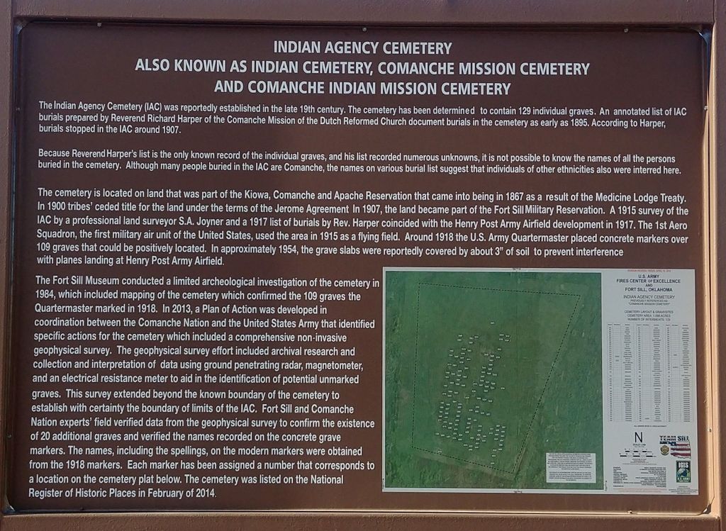
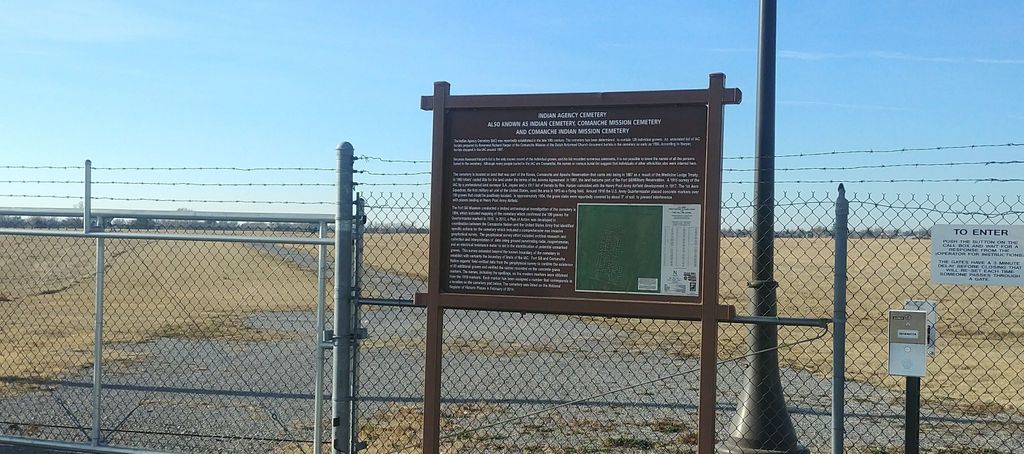
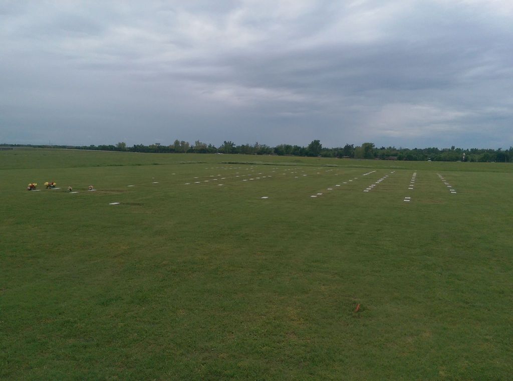
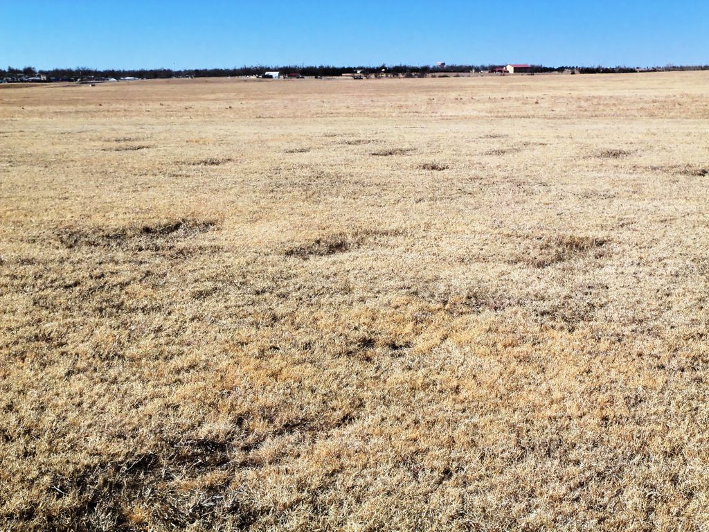
| Description | : | This cemetery, aka Comanche Mission Cemetery, with no headstones, is located just inside Gate 2 on Fort Sill, on the east side of the airfield. There is a big marker, which gives descriptive historical details. Established in the late 1890s and defunct in 1907. Most burials are Comanche children who died as result of the 1898-99 Small Pox epidemic; few burials are Anglos, some Mexican captives, and Kiowa people. It is part of the Fort Sill museum complex. |
frequently asked questions (FAQ):
-
Where is Indian Agency Cemetery?
Indian Agency Cemetery is located at Fort Sill, Comanche County ,Oklahoma ,USA.
-
Indian Agency Cemetery cemetery's updated grave count on graveviews.com?
0 memorials
-
Where are the coordinates of the Indian Agency Cemetery?
Latitude: 34.6423000
Longitude: -98.3924100
Nearby Cemetories:
1. Highland Cemetery
Lawton, Comanche County, USA
Coordinate: 34.6319008, -98.4002991
2. Fort Sill Pet Cemetery Annex
Fort Sill, Comanche County, USA
Coordinate: 34.6687700, -98.3942000
3. Fort Sill Post Cemetery
Fort Sill, Comanche County, USA
Coordinate: 34.6693760, -98.3957700
4. First United Methodist Church Columbarium
Lawton, Comanche County, USA
Coordinate: 34.6152870, -98.4261090
5. Saint Andrews Episcopal Church Columbarium
Lawton, Comanche County, USA
Coordinate: 34.6048400, -98.4086090
6. Apache South Cemetery
Lawton, Comanche County, USA
Coordinate: 34.6946983, -98.3711014
7. Apache North Cemetery
Lawton, Comanche County, USA
Coordinate: 34.6958008, -98.3681030
8. Beef Creek Apache Cemetery
Lawton, Comanche County, USA
Coordinate: 34.6969100, -98.3704500
9. Chief Chihuahua Apache Cemetery
Elgin, Comanche County, USA
Coordinate: 34.7003350, -98.3677160
10. Flower Mound Cemetery
Lawton, Comanche County, USA
Coordinate: 34.5790100, -98.3518600
11. Otipoby Comanche Cemetery
Lawton, Comanche County, USA
Coordinate: 34.7132330, -98.3694950
12. Pet Memorial Cemetery
Medicine Park, Comanche County, USA
Coordinate: 34.7242500, -98.4462000
13. Sunset Memorial Gardens
Lawton, Comanche County, USA
Coordinate: 34.6213989, -98.5064011
14. Fort Sill National Cemetery
Elgin, Comanche County, USA
Coordinate: 34.7660200, -98.3510200
15. Deyo Mission Cemetery
Lawton, Comanche County, USA
Coordinate: 34.5875015, -98.5447006
16. Pecan Cemetery
Lawton, Comanche County, USA
Coordinate: 34.5367012, -98.5192032
17. Cache Cemetery
Cache, Comanche County, USA
Coordinate: 34.6274986, -98.5789032
18. Mount Scott Cemetery
Meers, Comanche County, USA
Coordinate: 34.7756600, -98.4923500
19. Paradise Valley Cemetery
Elgin, Comanche County, USA
Coordinate: 34.7835999, -98.4747009
20. Mount Scott Kiowa Tribal Cemetery
Meers, Comanche County, USA
Coordinate: 34.7757000, -98.4923500
21. Letitia Cemetery
Lawton, Comanche County, USA
Coordinate: 34.5823500, -98.2119500
22. Mount Scott Cemetery
Meers, Comanche County, USA
Coordinate: 34.7772600, -98.5003800
23. Allendale Cemetery
Comanche County, USA
Coordinate: 34.4933014, -98.3143997
24. Devine Cemetery
Geronimo, Comanche County, USA
Coordinate: 34.4926300, -98.3131400