
| Memorials | : | 0 |
| Location | : | Diekirch, Canton de Diekirch, Luxembourg |
| Coordinate | : | 49.8665800, 6.1493300 |
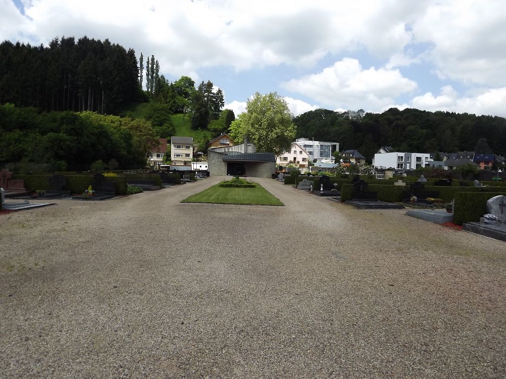
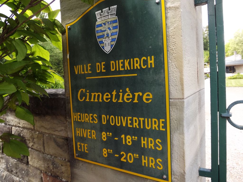
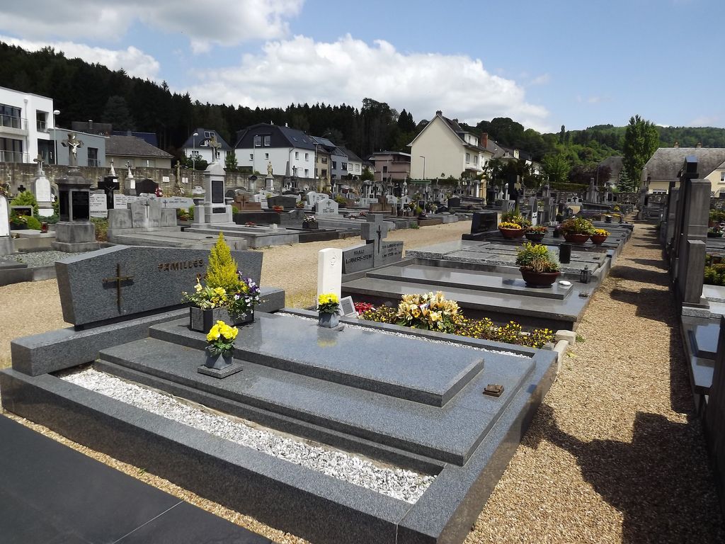
| Description | : | The town of Diekirch is situated 34 kilometres north of the city of Luxembourg on the N7. Driving along the N7 from Ettelbruck to Diekirch there is a Q8 garage on the left hand side of the road; turn left by the garage and follow this road over the level crossing. After the level crossing turn left into Rue de Cimetiere, and the cemetery is at the end of this road. The one Second World War Commonwealth war grave is at the rear left of the cemetery. GPS Co-ordinates: Longitude 06°08'57", Latitude 47°51'59" Diekirch Communal Cemetery contains the grave... Read More |
frequently asked questions (FAQ):
-
Where is Diekirch Communal Cemetery?
Diekirch Communal Cemetery is located at Diekirch, Canton de Diekirch ,Diekirch ,Luxembourg.
-
Diekirch Communal Cemetery cemetery's updated grave count on graveviews.com?
0 memorials
-
Where are the coordinates of the Diekirch Communal Cemetery?
Latitude: 49.8665800
Longitude: 6.1493300
Nearby Cemetories:
1. Cimetière Ingeldorf
Erpeldange-sur-Sure, Canton de Diekirch, Luxembourg
Coordinate: 49.8534600, 6.1301500
2. Stegen Luxembourg
Stegen, Canton de Diekirch, Luxembourg
Coordinate: 49.8282212, 6.1689088
3. Brandenbourg Catholic Church Cemetery
Brandenbourg, Canton de Vianden, Luxembourg
Coordinate: 49.9116813, 6.1363176
4. Cimetière de Schrondweiler
Schrondweiler, Canton de Mersch, Luxembourg
Coordinate: 49.8020980, 6.1527730
5. St. Johannes d. Täufer Friedhof
Gentingen, Landkreis Bitburg-Prüm, Germany
Coordinate: 49.8994189, 6.2360417
6. Bourscheid
Bourscheid, Canton de Diekirch, Luxembourg
Coordinate: 49.9101140, 6.0651400
7. Friedhof Bettel
Bettel, Canton de Vianden, Luxembourg
Coordinate: 49.9192925, 6.2235181
8. Eglise de la Nativite de la Verge
Nommern, Canton de Mersch, Luxembourg
Coordinate: 49.7944035, 6.1734464
9. Friedhof Merscheid les Putscheid
Hoscheid, Canton de Clervaux, Luxembourg
Coordinate: 49.9543997, 6.1077700
10. Cimetiere de Pettingen
Pettingen, Canton de Mersch, Luxembourg
Coordinate: 49.7702427, 6.1083073
11. Cimetiere de Moesdorf
Moesdorf, Canton de Mersch, Luxembourg
Coordinate: 49.7659262, 6.1149289
12. Cimetiere de la commune de Heffingen
Heffingen, Canton de Mersch, Luxembourg
Coordinate: 49.7698515, 6.2403209
13. Kriegsgräberstätte Kruchten-Schwarzenbruch
Kruchten, Landkreis Bitburg-Prüm, Germany
Coordinate: 49.8908200, 6.3379700
14. Grosbous
Grosbous, Canton de Redange, Luxembourg
Coordinate: 49.8245559, 5.9681146
15. Cimetière de Boevange-sur-Attert
Boevange-sur-Attert, Canton de Mersch, Luxembourg
Coordinate: 49.7750820, 6.0128340
16. Friedhof St. Bernhard
Berscheid, Landkreis Bitburg-Prüm, Germany
Coordinate: 49.9821441, 6.2318521
17. Sankt Jacobus Friedhof
Rodershausen, Landkreis Bitburg-Prüm, Germany
Coordinate: 49.9907782, 6.1947130
18. Dahl Cemetery
Dahl, Canton de Wiltz, Luxembourg
Coordinate: 49.9353190, 5.9726590
19. Cimetiere de Berdorf
Berdorf, Canton d'Echternach, Luxembourg
Coordinate: 49.8256538, 6.3456596
20. Sankt Michael Katholischer Friedhof
Bollendorf, Landkreis Bitburg-Prüm, Germany
Coordinate: 49.8525044, 6.3617986
21. Friedhof Niedergeckler
Niedergeckler, Landkreis Bitburg-Prüm, Germany
Coordinate: 49.9702241, 6.3057402
22. St. Peter Friedhof
Scheitenkorb, Landkreis Bitburg-Prüm, Germany
Coordinate: 50.0069152, 6.2099562
23. Junglinster Cemetery
Junglinster, Canton de Grevenmacher, Luxembourg
Coordinate: 49.7171047, 6.2465985
24. Sankt Luzia Katholischer Friedhof
Ferschweiler, Landkreis Bitburg-Prüm, Germany
Coordinate: 49.8618207, 6.4030748