
| Memorials | : | 0 |
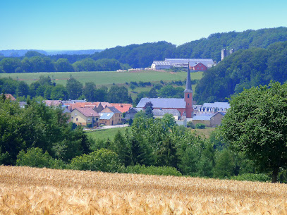
| Location | : | Boevange-sur-Attert, Canton de Mersch, Luxembourg |
| Coordinate | : | 49.7750820, 6.0128340 |
frequently asked questions (FAQ):
-
Where is Cimetière de Boevange-sur-Attert?
Cimetière de Boevange-sur-Attert is located at Boevange-sur-Attert, Canton de Mersch ,Luxembourg , L-8711Luxembourg.
-
Cimetière de Boevange-sur-Attert cemetery's updated grave count on graveviews.com?
0 memorials
-
Where are the coordinates of the Cimetière de Boevange-sur-Attert?
Latitude: 49.7750820
Longitude: 6.0128340
Nearby Cemetories:
1. Grosbous
Grosbous, Canton de Redange, Luxembourg
Coordinate: 49.8245559, 5.9681146
2. Cimetiere de Pettingen
Pettingen, Canton de Mersch, Luxembourg
Coordinate: 49.7702427, 6.1083073
3. Cimetiere de Moesdorf
Moesdorf, Canton de Mersch, Luxembourg
Coordinate: 49.7659262, 6.1149289
4. Greisch Cemetery
Greisch, Canton de Capellen, Luxembourg
Coordinate: 49.7086980, 5.9888040
5. Cimetière de Redange
Redange-sur-Attert, Canton de Redange, Luxembourg
Coordinate: 49.7633470, 5.8882370
6. Simmer-Septfontaines Old Cemetery
Septfontaines, Canton de Capellen, Luxembourg
Coordinate: 49.6996320, 5.9645300
7. Simmer-Septfontaines New Cemetery
Septfontaines, Canton de Capellen, Luxembourg
Coordinate: 49.6956590, 5.9647390
8. Cimetière de Schrondweiler
Schrondweiler, Canton de Mersch, Luxembourg
Coordinate: 49.8020980, 6.1527730
9. Cimetiere de Nospelt
Nospelt, Canton de Capellen, Luxembourg
Coordinate: 49.6739662, 6.0074374
10. Cimetière Communal d'Ell
Ell, Canton de Redange, Luxembourg
Coordinate: 49.7626659, 5.8526296
11. Eglise de la Nativite de la Verge
Nommern, Canton de Mersch, Luxembourg
Coordinate: 49.7944035, 6.1734464
12. Kehlen
Kehlen, Canton de Capellen, Luxembourg
Coordinate: 49.6713150, 6.0443040
13. Cimetière Ingeldorf
Erpeldange-sur-Sure, Canton de Diekirch, Luxembourg
Coordinate: 49.8534600, 6.1301500
14. Stegen Luxembourg
Stegen, Canton de Diekirch, Luxembourg
Coordinate: 49.8282212, 6.1689088
15. Cimetiere de Koerich
Koerich, Canton de Capellen, Luxembourg
Coordinate: 49.6683130, 5.9502520
16. Guirsch Churchyard
Arlon, Arrondissement d'Arlon, Belgium
Coordinate: 49.7181100, 5.8523500
17. Folschette Churchyard
Rambrouch, Canton de Redange, Luxembourg
Coordinate: 49.8299700, 5.8467200
18. Cimetière de Bridel
Bridel, Canton de Capellen, Luxembourg
Coordinate: 49.6555900, 6.0765800
19. Diekirch Communal Cemetery
Diekirch, Canton de Diekirch, Luxembourg
Coordinate: 49.8665800, 6.1493300
20. Bourscheid
Bourscheid, Canton de Diekirch, Luxembourg
Coordinate: 49.9101140, 6.0651400
21. Abbaye de Clairefontaine
Arlon, Arrondissement d'Arlon, Belgium
Coordinate: 49.6658300, 5.8659720
22. Cimetiere de la commune de Heffingen
Heffingen, Canton de Mersch, Luxembourg
Coordinate: 49.7698515, 6.2403209
23. Holtz Catholic Church
Holtz, Canton de Redange, Luxembourg
Coordinate: 49.8060629, 5.7887440
24. Sterpenich Cemetery
Arlon, Arrondissement d'Arlon, Belgium
Coordinate: 49.6497751, 5.8890265