
| Memorials | : | 0 |
| Location | : | Janesville, Rock County, USA |
| Coordinate | : | 42.7221500, -89.0035000 |
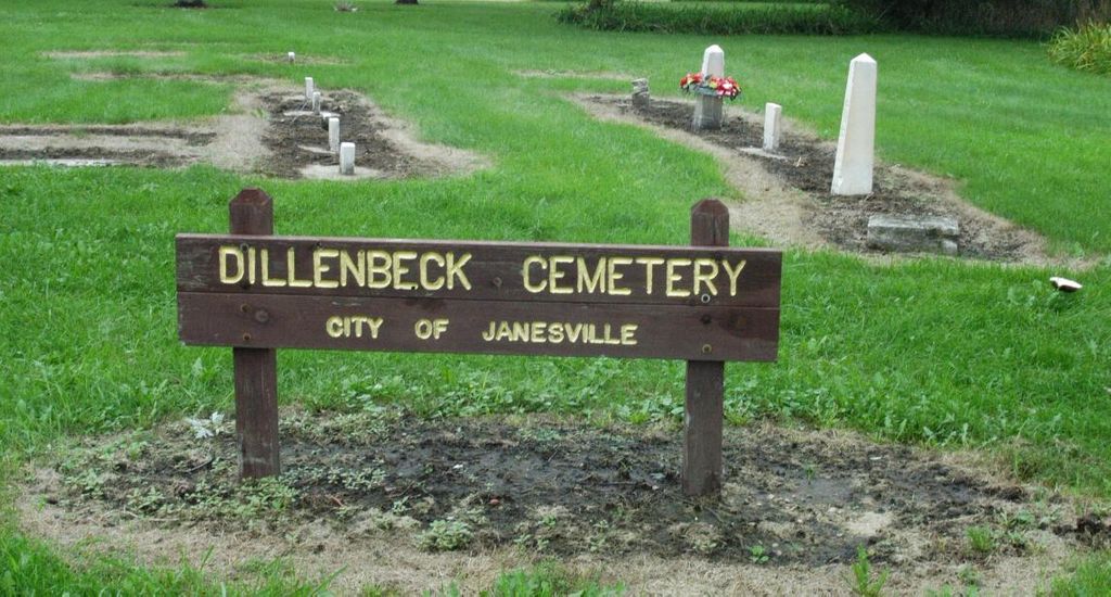
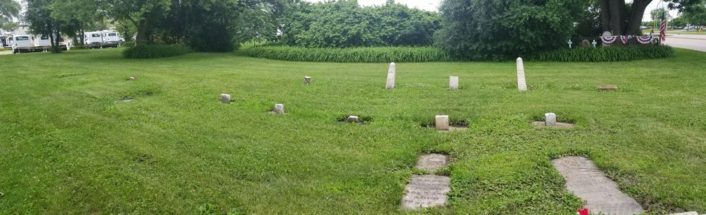
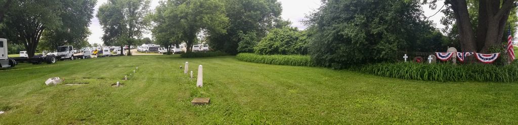
| Description | : | The cemetery is located on the north side of Highway 14, just east of Kennedy Road and the railroad tracks. Located in Section 18, Rock County, Wisconsin. This cemetery was originally located in Harmony Township, but was incorporated into the city limits of Janesville in 1967. This is a small cemetery that was on land owned by Henry Dillenbeck. A newspaper article claimed that this cemetery was larger before Highway 14 was widened. Some gravestones are inside a fenced in area, but day lillies totally cover the ground inside the fence. |
frequently asked questions (FAQ):
-
Where is Dillenbeck Cemetery?
Dillenbeck Cemetery is located at U.S. Highway 14 Janesville, Rock County ,Wisconsin ,USA.
-
Dillenbeck Cemetery cemetery's updated grave count on graveviews.com?
0 memorials
-
Where are the coordinates of the Dillenbeck Cemetery?
Latitude: 42.7221500
Longitude: -89.0035000
Nearby Cemetories:
1. Milton Lawns Memorial Park
Janesville, Rock County, USA
Coordinate: 42.7089005, -89.0010986
2. Rock County Farm Cemetery
Janesville, Rock County, USA
Coordinate: 42.7235600, -89.0344930
3. Mount Pleasant Cemetery
Janesville, Rock County, USA
Coordinate: 42.7436500, -89.0235600
4. Mount Olivet Cemetery
Janesville, Rock County, USA
Coordinate: 42.7056007, -89.0421982
5. Oak Hill Cemetery
Janesville, Rock County, USA
Coordinate: 42.7036010, -89.0460780
6. Trinity Episcopal Columbarium
Janesville, Rock County, USA
Coordinate: 42.6839500, -89.0184800
7. Corn Exchange Park
Janesville, Rock County, USA
Coordinate: 42.6820500, -89.0258200
8. Saint Mary Cemetery
Milton, Rock County, USA
Coordinate: 42.7744800, -88.9674600
9. Mount Olive Sandy Sink Cemetery
Indianford, Rock County, USA
Coordinate: 42.7741600, -89.0434000
10. Magee Burial Site
Janesville, Rock County, USA
Coordinate: 42.7387300, -89.0918500
11. Saint John Family Cemetery
Janesville, Rock County, USA
Coordinate: 42.6541600, -89.0114300
12. Milton Junction Cemetery
Milton, Rock County, USA
Coordinate: 42.7833000, -88.9579000
13. Mount Zion Cemetery
Janesville, Rock County, USA
Coordinate: 42.6953011, -88.9132996
14. Milton Cemetery
Milton, Rock County, USA
Coordinate: 42.7801000, -88.9379000
15. Beardsley Cemetery
Fulton, Rock County, USA
Coordinate: 42.8039800, -89.0135500
16. North Johnstown Cemetery
Milton, Rock County, USA
Coordinate: 42.7425003, -88.8713989
17. Rock River Cemetery
Milton, Rock County, USA
Coordinate: 42.8218994, -88.9946976
18. Goodrich Cemetery
Edgerton, Rock County, USA
Coordinate: 42.8285200, -89.0265500
19. Otter Creek Cemetery
Milton, Rock County, USA
Coordinate: 42.8196983, -88.9372025
20. Emerald Grove Cemetery
Emerald Grove, Rock County, USA
Coordinate: 42.6547100, -88.8858600
21. Lyman Inman Cemetery
Afton, Rock County, USA
Coordinate: 42.6137300, -89.0648100
22. Jenson Cemetery
Edgerton, Rock County, USA
Coordinate: 42.8240013, -89.0839996
23. Town of Rock Cemetery
Afton, Rock County, USA
Coordinate: 42.6203200, -89.0840600
24. Fassett Cemetery
Edgerton, Rock County, USA
Coordinate: 42.8255997, -89.0808029