
| Memorials | : | 14 |
| Location | : | Emerald Grove, Rock County, USA |
| Coordinate | : | 42.6547100, -88.8858600 |
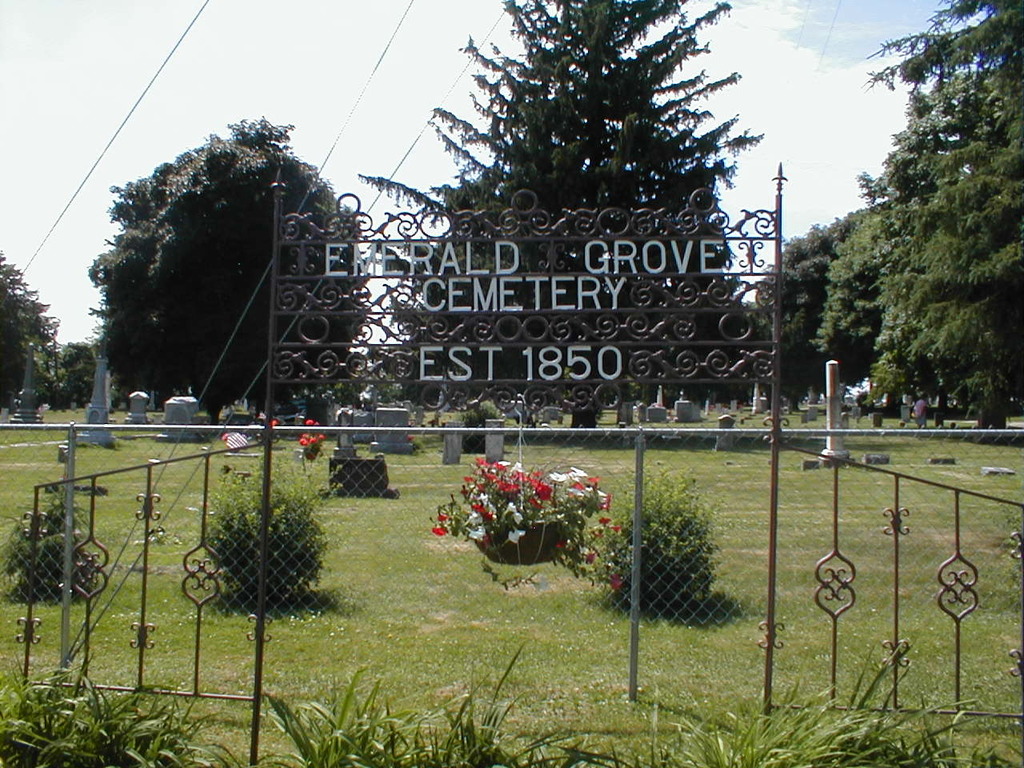
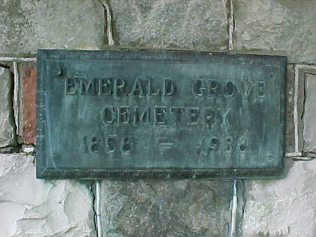
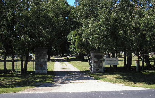
| Description | : | Just south of Highway 14, at the intersection of Cemetery Road and Emerald Grove Road. Located in Section 7 of Bradford Township, Rock County, Wisconsin. The sign at the entrance has the date of 1850, but there are many burials from an earlier cemetery across the road to the north. Each family was responsible for moving their family graves to the new cemetery. |
frequently asked questions (FAQ):
-
Where is Emerald Grove Cemetery?
Emerald Grove Cemetery is located at Emerald Grove Road & Cemetery Road Emerald Grove, Rock County ,Wisconsin ,USA.
-
Emerald Grove Cemetery cemetery's updated grave count on graveviews.com?
10 memorials
-
Where are the coordinates of the Emerald Grove Cemetery?
Latitude: 42.6547100
Longitude: -88.8858600
Nearby Cemetories:
1. Mount Zion Cemetery
Janesville, Rock County, USA
Coordinate: 42.6953011, -88.9132996
2. Johnstown Center Cemetery
Johnstown Center, Rock County, USA
Coordinate: 42.6975700, -88.8356500
3. Bradford Cemetery
Avalon, Rock County, USA
Coordinate: 42.6281013, -88.8158035
4. Rock County Poor Farm Cemetery
Johnstown, Rock County, USA
Coordinate: 42.6988220, -88.8287870
5. Whichman Gravesite
Johnstown, Rock County, USA
Coordinate: 42.7052600, -88.8272000
6. Carvers Rock Cemetery
Avalon, Rock County, USA
Coordinate: 42.6009600, -88.8285000
7. Old Johnstown Cemetery
Johnstown, Rock County, USA
Coordinate: 42.7000008, -88.8000031
8. Fairfield Cemetery
Fairfield, Walworth County, USA
Coordinate: 42.6333300, -88.7728800
9. North Johnstown Cemetery
Milton, Rock County, USA
Coordinate: 42.7425003, -88.8713989
10. Clinton Cemetery
Clinton, Rock County, USA
Coordinate: 42.5677986, -88.8589020
11. Saint John Family Cemetery
Janesville, Rock County, USA
Coordinate: 42.6541600, -89.0114300
12. Shopiere Cemetery
Shopiere, Rock County, USA
Coordinate: 42.5675011, -88.9385986
13. Milton Lawns Memorial Park
Janesville, Rock County, USA
Coordinate: 42.7089005, -89.0010986
14. Clinton Corners Cemetery
Clinton, Rock County, USA
Coordinate: 42.5539017, -88.8918991
15. Trinity Episcopal Columbarium
Janesville, Rock County, USA
Coordinate: 42.6839500, -89.0184800
16. Mount Philip Cemetery
Clinton, Rock County, USA
Coordinate: 42.5819016, -88.7857971
17. Summerville Cemetery
Clinton, Rock County, USA
Coordinate: 42.5713530, -88.8007520
18. Turtleville Cemetery
Shopiere, Rock County, USA
Coordinate: 42.5685997, -88.9677963
19. Corn Exchange Park
Janesville, Rock County, USA
Coordinate: 42.6820500, -89.0258200
20. Dillenbeck Cemetery
Janesville, Rock County, USA
Coordinate: 42.7221500, -89.0035000
21. Hollister Cemetery
Darien, Walworth County, USA
Coordinate: 42.6600000, -88.7360000
22. Happy Hollow Cemetery
Afton, Rock County, USA
Coordinate: 42.6015090, -89.0251140
23. Richmond Cemetery
Richmond, Walworth County, USA
Coordinate: 42.7193985, -88.7482986
24. Utters Corners Cemetery
Lima Center, Rock County, USA
Coordinate: 42.7556000, -88.7840000