
| Memorials | : | 4 |
| Location | : | Ellenboro, Rutherford County, USA |
| Coordinate | : | 35.3369410, -81.7163310 |
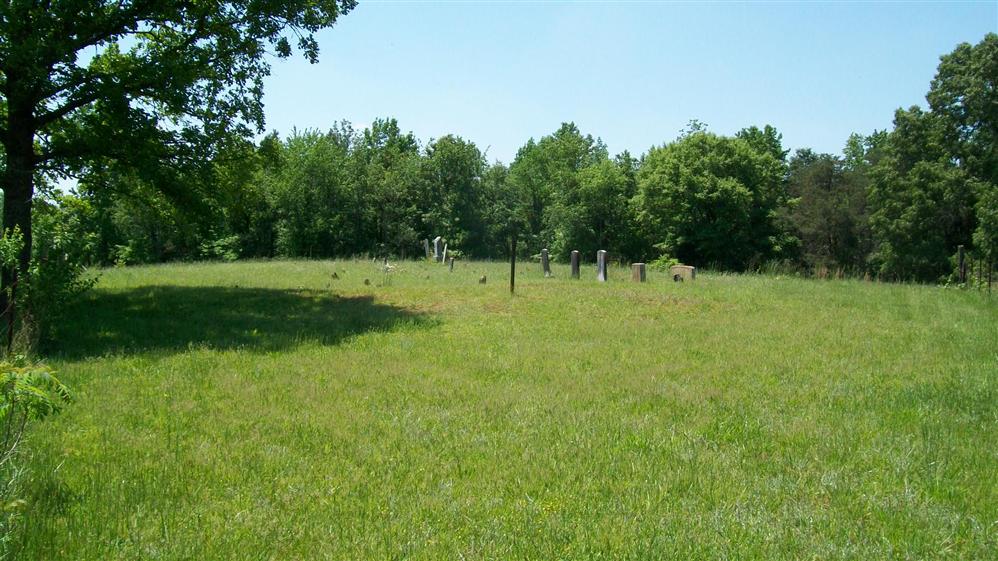
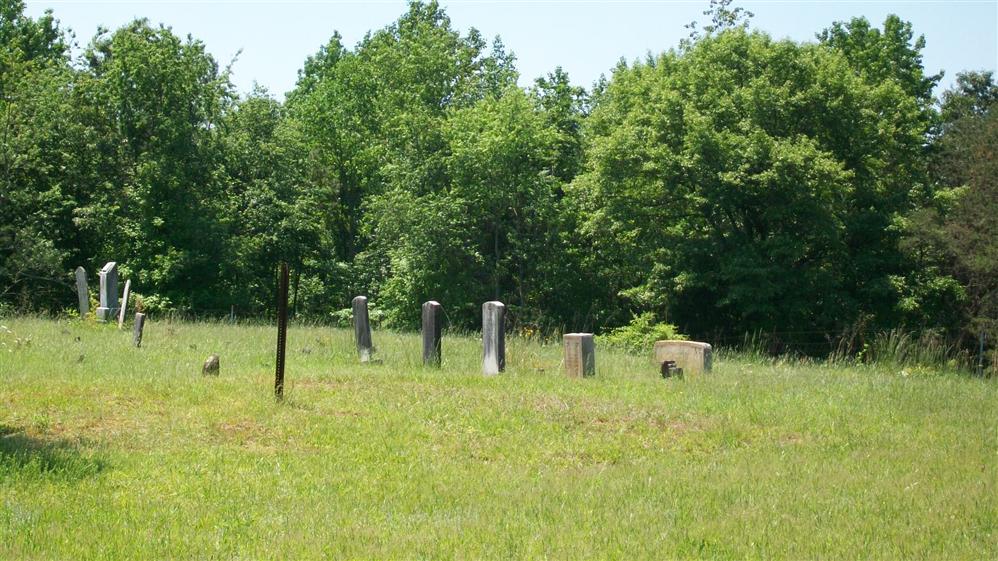
| Description | : | County Road 1779 Ellenboro Rutherford County North Carolina USA The cemetery sits on top of a small hill in a pasture. It will be no more than a thousand feet after you turn off the New House road. The Dobbins Cemeteryis located in the vicinity of the present day Drury Dobbins Baptist Church in Rutherford County, NC. South side of an unpaved road No 1779 on East side of Ellenboro - Polkville Rd Co Rd No1762 some 2.5miles North of Bethal Baptist Church on Highw ay 74 in Ellenboro. The cemetery is some 1000 feet off the county road 1779. It contains many graves marked... Read More |
frequently asked questions (FAQ):
-
Where is Dobbins Cemetery?
Dobbins Cemetery is located at Ellenboro, Rutherford County ,North Carolina ,USA.
-
Dobbins Cemetery cemetery's updated grave count on graveviews.com?
4 memorials
-
Where are the coordinates of the Dobbins Cemetery?
Latitude: 35.3369410
Longitude: -81.7163310
Nearby Cemetories:
1. Drury Dobbins Church Cemetery
Ellenboro, Rutherford County, USA
Coordinate: 35.3403200, -81.7093340
2. Drury Dobbins Baptist Church Cemetery
Lattimore, Cleveland County, USA
Coordinate: 35.3386540, -81.7065240
3. Beam Cemetery
Ellenboro, Rutherford County, USA
Coordinate: 35.3497009, -81.7127991
4. Edwards Cemetery
Ellenboro, Rutherford County, USA
Coordinate: 35.3445590, -81.7403870
5. Campfield Memorial Baptist Cemetery
Ellenboro, Rutherford County, USA
Coordinate: 35.3147202, -81.7288895
6. Zachariah McDaniel Cemetery
Ellenboro, Rutherford County, USA
Coordinate: 35.3213300, -81.7416800
7. Glover Cemetery
Ellenboro, Rutherford County, USA
Coordinate: 35.3521996, -81.7472000
8. Daily-Brooks Graveyard
Ellenboro, Rutherford County, USA
Coordinate: 35.3060141, -81.7232363
9. Elizabeth Edwards Gravesite
Ellenboro, Rutherford County, USA
Coordinate: 35.3567930, -81.7468030
10. Thomas Walker Family Cemetery
Rutherford County, USA
Coordinate: 35.3693990, -81.7184830
11. Bethel Baptist Church Cemetery
Ellenboro, Rutherford County, USA
Coordinate: 35.3258810, -81.7544180
12. Youngs Chapel AME Zion
Mooresboro, Cleveland County, USA
Coordinate: 35.3032750, -81.6978580
13. Liberty Baptist Cemetery
Ellenboro, Rutherford County, USA
Coordinate: 35.3034477, -81.7356873
14. Heavenbound Baptist Church Cemetery
Ellenboro, Rutherford County, USA
Coordinate: 35.3307330, -81.7623250
15. Plain View Baptist Cemetery
Ellenboro, Rutherford County, USA
Coordinate: 35.2988750, -81.7410280
16. Sandy Run Baptist Church Cemetery
Mooresboro, Cleveland County, USA
Coordinate: 35.2963700, -81.6963300
17. Piney Mountain Baptist Cemetery
Ellenboro, Rutherford County, USA
Coordinate: 35.3454310, -81.7706050
18. Webb Baptist Cemetery
Ellenboro, Rutherford County, USA
Coordinate: 35.3231900, -81.7696300
19. Hopewell Community Cemetery
Ellenboro, Rutherford County, USA
Coordinate: 35.3821440, -81.7343430
20. Old Hopewell Church Cemetery
Ellenboro, Rutherford County, USA
Coordinate: 35.3863889, -81.7130556
21. Race Path Baptist Church Cemetery
Ellenboro, Rutherford County, USA
Coordinate: 35.2944250, -81.7507420
22. Dobbins Hawkins Cemetery
Boiling Springs, Cleveland County, USA
Coordinate: 35.2813070, -81.7148160
23. Harrill Cemetery
Lattimore, Cleveland County, USA
Coordinate: 35.3168410, -81.6515920
24. Sandy Plains Baptist Church Cemetery
New House, Cleveland County, USA
Coordinate: 35.3895200, -81.6891200