
| Memorials | : | 0 |
| Location | : | Boiling Springs, Cleveland County, USA |
| Coordinate | : | 35.2813070, -81.7148160 |
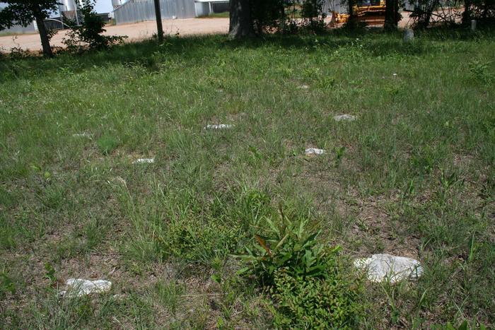
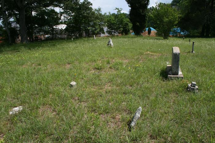
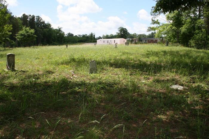
| Description | : | To get to this cemetery from Boiling Springs, NC take the Boiling Springs- Cliffisde Road to the top of the hill after you cross Sandy Run Creek and find McKinney Rd. going off to the right. Follow McKinney Rd. for a thousand feet or so and find Trinity Church Road off to the right. Follow Trinity Church Road to the intersection with Gantt's Grove Road and turn to the right. Go to the first house on the right house number 457. The cemetery is in the woods behind the house. Follow along the edge of the woods and find the road going through the woods to the... Read More |
frequently asked questions (FAQ):
-
Where is Dobbins Hawkins Cemetery?
Dobbins Hawkins Cemetery is located at Boiling Springs, Cleveland County ,North Carolina ,USA.
-
Dobbins Hawkins Cemetery cemetery's updated grave count on graveviews.com?
0 memorials
-
Where are the coordinates of the Dobbins Hawkins Cemetery?
Latitude: 35.2813070
Longitude: -81.7148160
Nearby Cemetories:
1. Gantts Grove Baptist Church Cemetery
Mooresboro, Cleveland County, USA
Coordinate: 35.2767067, -81.7276077
2. Jonas Rollins Cemetery
Mooresboro, Cleveland County, USA
Coordinate: 35.2699210, -81.7180040
3. Bridges Family Cemetery
Mooresboro, Cleveland County, USA
Coordinate: 35.2622200, -81.7194000
4. Trinity Baptist Church Cemetery
Mooresboro, Cleveland County, USA
Coordinate: 35.2601280, -81.7133865
5. Sandy Run Baptist Church Cemetery
Mooresboro, Cleveland County, USA
Coordinate: 35.2963700, -81.6963300
6. Goode Graveyard
Six Points, Rutherford County, USA
Coordinate: 35.2796440, -81.7439270
7. Daily-Brooks Graveyard
Ellenboro, Rutherford County, USA
Coordinate: 35.3060141, -81.7232363
8. Youngs Chapel AME Zion
Mooresboro, Cleveland County, USA
Coordinate: 35.3032750, -81.6978580
9. Plain View Baptist Cemetery
Ellenboro, Rutherford County, USA
Coordinate: 35.2988750, -81.7410280
10. Liberty Baptist Cemetery
Ellenboro, Rutherford County, USA
Coordinate: 35.3034477, -81.7356873
11. Lovelace-McSwain Cemetery
Mooresboro, Cleveland County, USA
Coordinate: 35.2777680, -81.6781180
12. Race Path Baptist Church Cemetery
Ellenboro, Rutherford County, USA
Coordinate: 35.2944250, -81.7507420
13. Goodes Grove Baptist Cemetery
Mooresboro, Cleveland County, USA
Coordinate: 35.2562027, -81.7421036
14. Thomas Pruett Cemetery
Boiling Springs, Cleveland County, USA
Coordinate: 35.2557800, -81.6868630
15. Campfield Memorial Baptist Cemetery
Ellenboro, Rutherford County, USA
Coordinate: 35.3147202, -81.7288895
16. McBrayer Cemetery
Cleveland County, USA
Coordinate: 35.2839012, -81.6691971
17. New Green Bethel Cemetery
Boiling Springs, Cleveland County, USA
Coordinate: 35.2671800, -81.6711600
18. John Matheny Family Cemetery
Mooresboro, Cleveland County, USA
Coordinate: 35.2492500, -81.7438310
19. Zachariah McDaniel Cemetery
Ellenboro, Rutherford County, USA
Coordinate: 35.3213300, -81.7416800
20. Pleasant Ridge Baptist Church Cemetery
Swainsville, Cleveland County, USA
Coordinate: 35.2874980, -81.6587980
21. Green Bethel Baptist Cemetery
Boiling Springs, Cleveland County, USA
Coordinate: 35.2542500, -81.6651200
22. Mount Pleasant Baptist Church Cemetery
Mooresboro, Cleveland County, USA
Coordinate: 35.2320100, -81.7280800
23. High Shoal Baptist Cemetery
Henrietta, Rutherford County, USA
Coordinate: 35.2659800, -81.7777450
24. Cliffside Cemetery
Cliffside, Rutherford County, USA
Coordinate: 35.2460220, -81.7651250