
| Memorials | : | 0 |
| Location | : | Mooresboro, Cleveland County, USA |
| Coordinate | : | 35.2492500, -81.7438310 |
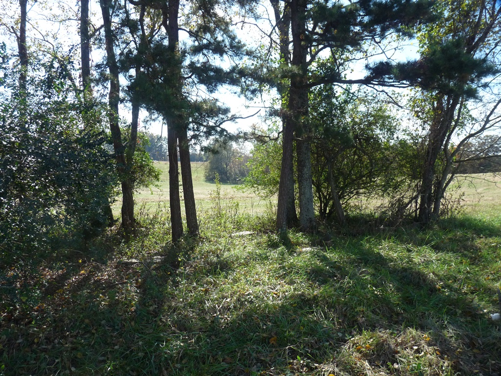
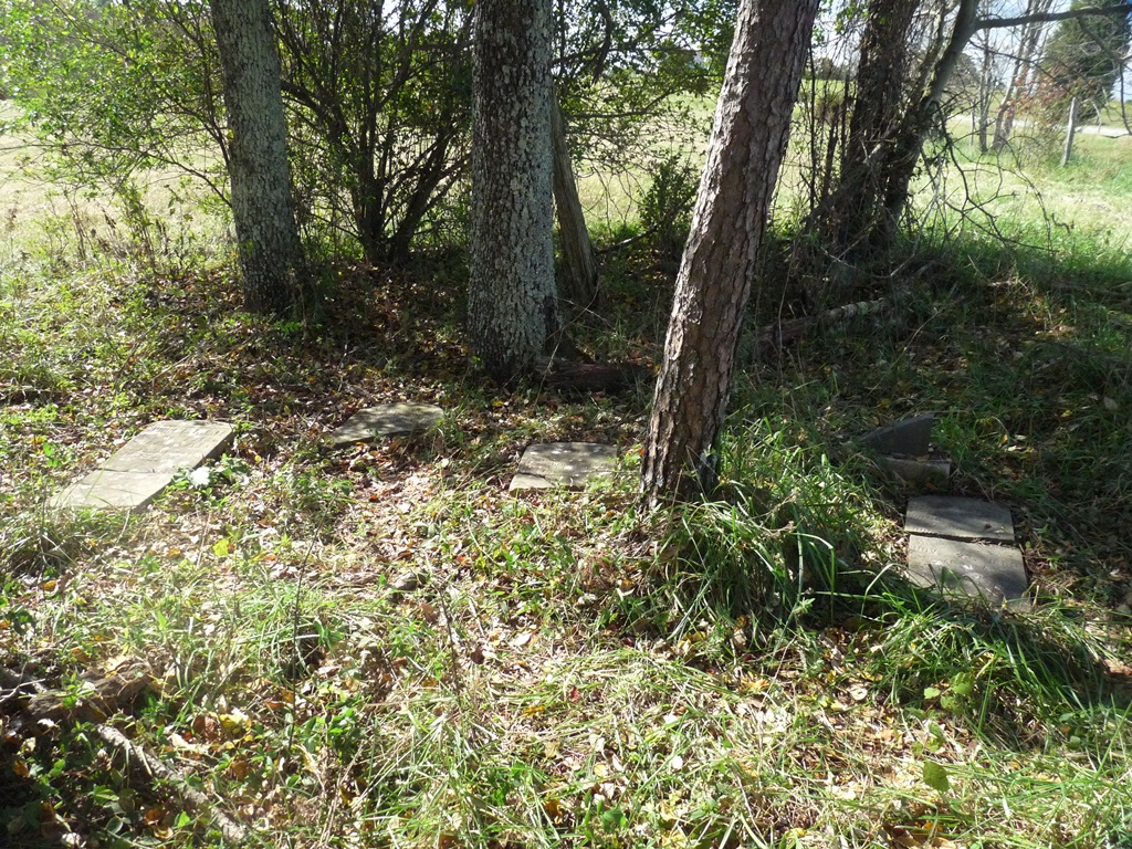
| Description | : | The John Matheny Cemetery is a very old, small family cemetery on the land that belonged to the Matheny family for many years. The cemetery is in very bad shape. The larger markers are broken off and in very bad condition. There are 5 head stones with names and dates that are difficult to read, and several other small markers that cannot be read at all. |
frequently asked questions (FAQ):
-
Where is John Matheny Family Cemetery?
John Matheny Family Cemetery is located at 902 Goodes Grove Church Rd. Mooresboro, Cleveland County ,North Carolina , 28114USA.
-
John Matheny Family Cemetery cemetery's updated grave count on graveviews.com?
0 memorials
-
Where are the coordinates of the John Matheny Family Cemetery?
Latitude: 35.2492500
Longitude: -81.7438310

Nearby Cemetories:
1. Goodes Grove Baptist Cemetery
Mooresboro, Cleveland County, USA
Coordinate: 35.2562027, -81.7421036
2. Cliffside Cemetery
Cliffside, Rutherford County, USA
Coordinate: 35.2460220, -81.7651250
3. Mount Pleasant Baptist Church Cemetery
Mooresboro, Cleveland County, USA
Coordinate: 35.2320100, -81.7280800
4. Bridges Family Cemetery
Mooresboro, Cleveland County, USA
Coordinate: 35.2622200, -81.7194000
5. Haynes Grove Cemetery
Cliffside, Rutherford County, USA
Coordinate: 35.2471930, -81.7735250
6. Trinity Baptist Church Cemetery
Mooresboro, Cleveland County, USA
Coordinate: 35.2601280, -81.7133865
7. Scruggs Cemetery
Cliffside, Rutherford County, USA
Coordinate: 35.2264000, -81.7639000
8. Jonas Rollins Cemetery
Mooresboro, Cleveland County, USA
Coordinate: 35.2699210, -81.7180040
9. Goode Graveyard
Six Points, Rutherford County, USA
Coordinate: 35.2796440, -81.7439270
10. Gantts Grove Baptist Church Cemetery
Mooresboro, Cleveland County, USA
Coordinate: 35.2767067, -81.7276077
11. High Shoal Baptist Cemetery
Henrietta, Rutherford County, USA
Coordinate: 35.2659800, -81.7777450
12. Scruggs Cemetery
Rutherford County, USA
Coordinate: 35.2325800, -81.7814220
13. Hammes Family Gravesite
Cleveland County, USA
Coordinate: 35.2160590, -81.7293390
14. Hames Graveyard
Cleveland County, USA
Coordinate: 35.2160300, -81.7293100
15. Dobbins Hawkins Cemetery
Boiling Springs, Cleveland County, USA
Coordinate: 35.2813070, -81.7148160
16. Race Path Baptist Church Cemetery
Ellenboro, Rutherford County, USA
Coordinate: 35.2944250, -81.7507420
17. Thomas Pruett Cemetery
Boiling Springs, Cleveland County, USA
Coordinate: 35.2557800, -81.6868630
18. Caroleen Avondale Henrietta Cemetery
Avondale, Rutherford County, USA
Coordinate: 35.2753940, -81.7925690
19. New Zion Baptist Cemetery
Rutherford County, USA
Coordinate: 35.2595770, -81.8014850
20. Plain View Baptist Cemetery
Ellenboro, Rutherford County, USA
Coordinate: 35.2988750, -81.7410280
21. Sarratt #4 F.C. Cemetery
Mooresboro, Cleveland County, USA
Coordinate: 35.2160850, -81.6972300
22. Prospect Baptist Church Cemetery
Mooresboro, Cleveland County, USA
Coordinate: 35.1972420, -81.7576240
23. Liberty Baptist Cemetery
Ellenboro, Rutherford County, USA
Coordinate: 35.3034477, -81.7356873
24. Calvary Baptist Cemetery
Cliffside, Rutherford County, USA
Coordinate: 35.2383995, -81.8110657