
| Memorials | : | 151 |
| Location | : | Donington, South Holland District, England |
| Coordinate | : | 52.9071410, -0.2059100 |
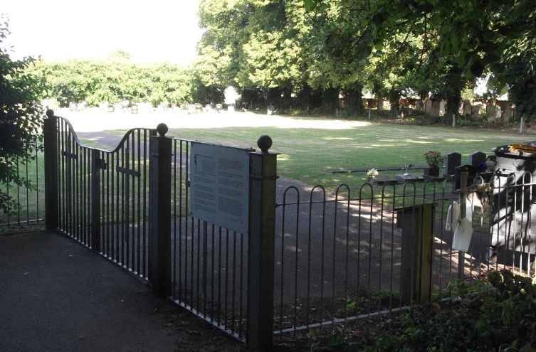
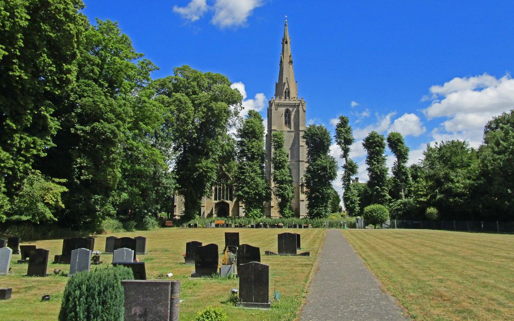
| Description | : | Donington New Cemetery is located at Hunter Way, which is directly behind St Mary and the Holy Rood Church in Donington, Lincolnshire. The village is on the A52 ten miles south-west of Boston. If you intend to visit turn off the A52 directly onto Church Street. Walk through St Mary and Holy Rood churchyard, the new cemetery entrance is at the back of the churchyard. |
frequently asked questions (FAQ):
-
Where is Donington New Cemetery?
Donington New Cemetery is located at Donington, South Holland District ,Lincolnshire ,England.
-
Donington New Cemetery cemetery's updated grave count on graveviews.com?
151 memorials
-
Where are the coordinates of the Donington New Cemetery?
Latitude: 52.9071410
Longitude: -0.2059100
Nearby Cemetories:
1. St. Mary and the Holy Rood Churchyard
Donington, South Holland District, England
Coordinate: 52.9072790, -0.2050080
2. Donington Old Cemetery
Donington, South Holland District, England
Coordinate: 52.9091670, -0.2055560
3. St. Margaret's Churchyard
Quadring, South Holland District, England
Coordinate: 52.8903400, -0.1819700
4. St. Swithin's Churchyard
Bicker, Boston Borough, England
Coordinate: 52.9242080, -0.1798800
5. Bicker Cemetery
Bicker, Boston Borough, England
Coordinate: 52.9261110, -0.1794440
6. St. Peter and St. Paul Churchyard
Gosberton, South Holland District, England
Coordinate: 52.8690870, -0.1629740
7. St. Mary's Churchyard
Swineshead, Boston Borough, England
Coordinate: 52.9446490, -0.1596530
8. Gosberton Cemetery
Gosberton, South Holland District, England
Coordinate: 52.8659400, -0.1623000
9. St. Peter and St. Paul's Churchyard
Wigtoft, Boston Borough, England
Coordinate: 52.9083330, -0.1236110
10. Gosberton Baptist Church
Gosberton, South Holland District, England
Coordinate: 52.8651820, -0.1533940
11. St Gilbert and St Hugh Churchyard
Gosberton Clough, South Holland District, England
Coordinate: 52.8518081, -0.2166268
12. St. Mary The Virgin Churchyard
Sutterton, Boston Borough, England
Coordinate: 52.9016700, -0.0911111
13. Sutterton Village Cemetery
Sutterton, Boston Borough, England
Coordinate: 52.8994440, -0.0900000
14. South Lincolnshire Crematorium
Surfleet, South Holland District, England
Coordinate: 52.8451100, -0.1475110
15. St. Peter and St. Paul Churchyard
Algarkirk, Boston Borough, England
Coordinate: 52.8995000, -0.0817800
16. St Andrews Churchyard
Helpringham, North Kesteven District, England
Coordinate: 52.9519900, -0.3065200
17. St Andrew's Churchyard
Helpringham, North Kesteven District, England
Coordinate: 52.9521000, -0.3065000
18. Surfleet Cemetery
Surfleet, South Holland District, England
Coordinate: 52.8391670, -0.1383330
19. St. Laurence Churchyard
Surfleet, South Holland District, England
Coordinate: 52.8369500, -0.1436110
20. St Andrew Churchyard
Horbling, South Kesteven District, England
Coordinate: 52.9028460, -0.3380407
21. Great Hale New Cemetery
Great Hale, North Kesteven District, England
Coordinate: 52.9678690, -0.2940500
22. St. Andrew's Churchyard
Billingborough, South Kesteven District, England
Coordinate: 52.8940140, -0.3397660
23. St John the Baptist Churchyard
Great Hale, North Kesteven District, England
Coordinate: 52.9712140, -0.2914550
24. Billingborough Cemetery
Billingborough, South Kesteven District, England
Coordinate: 52.8907700, -0.3497700