
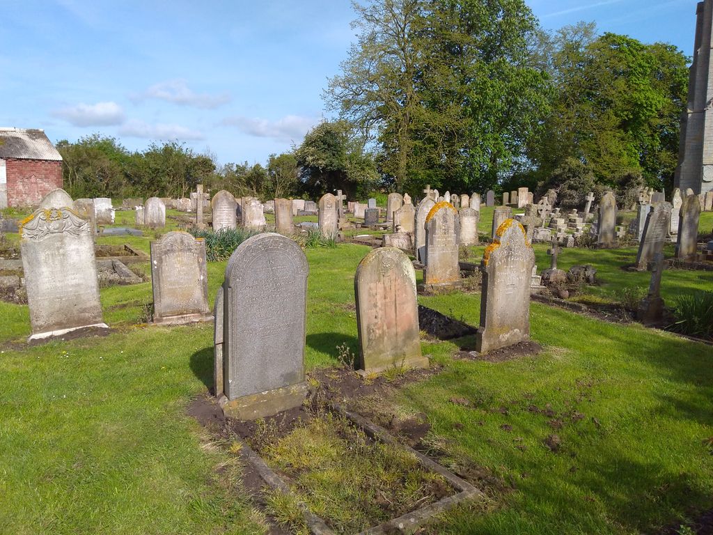
| Memorials | : | 42 |
| Location | : | Quadring, South Holland District, England |
| Coordinate | : | 52.8903400, -0.1819700 |
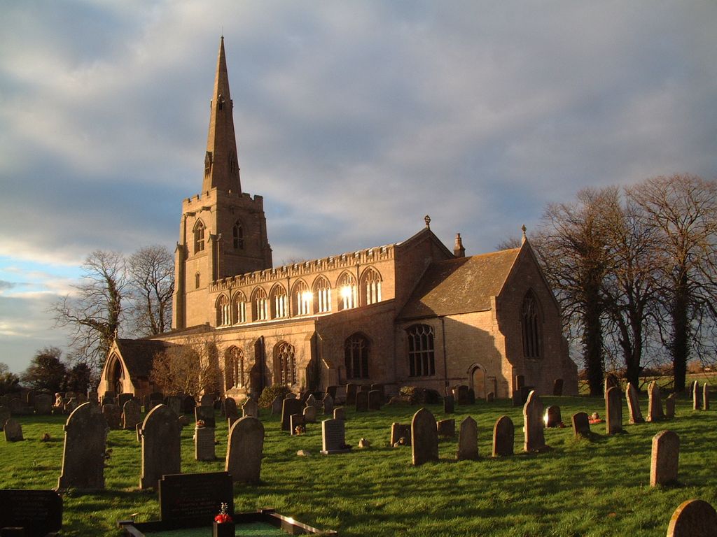
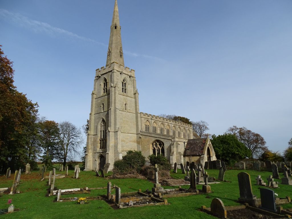
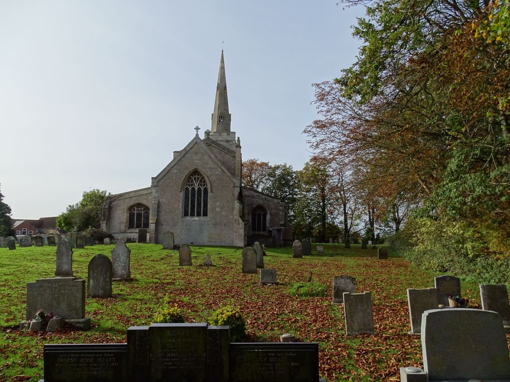
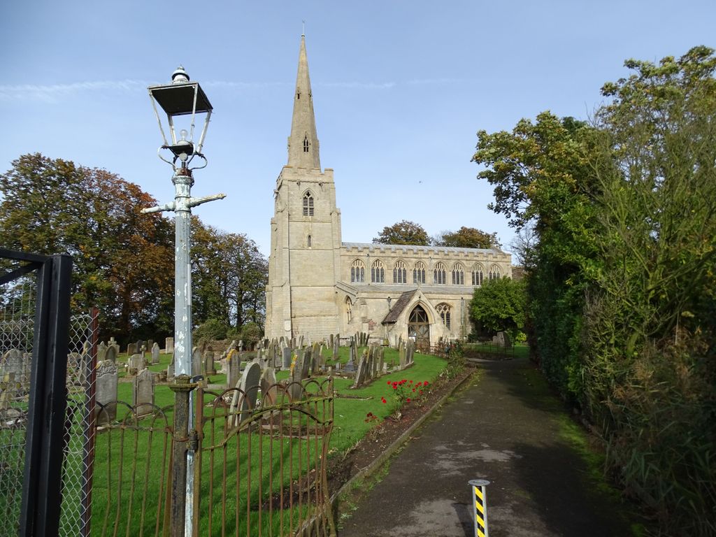
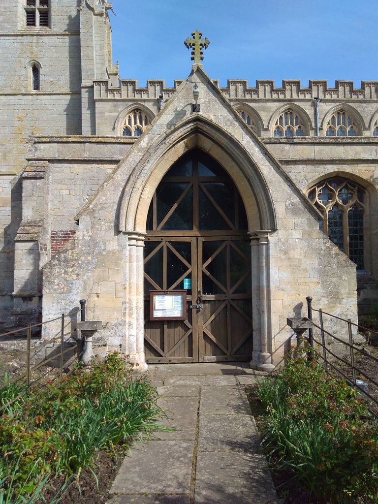
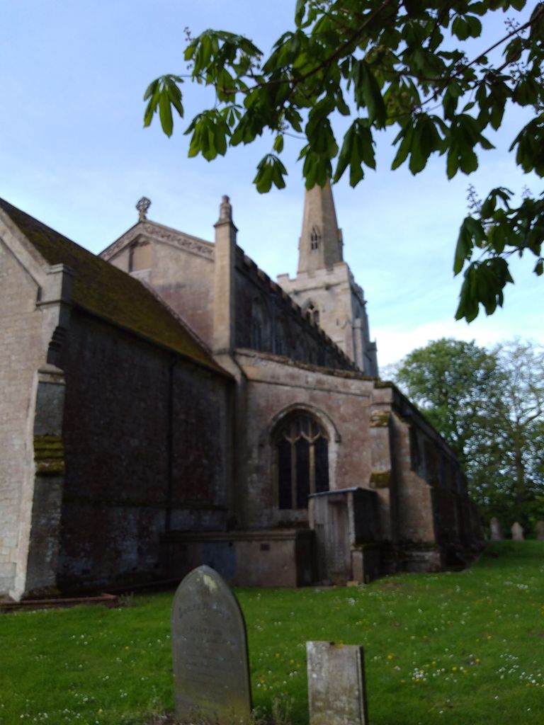
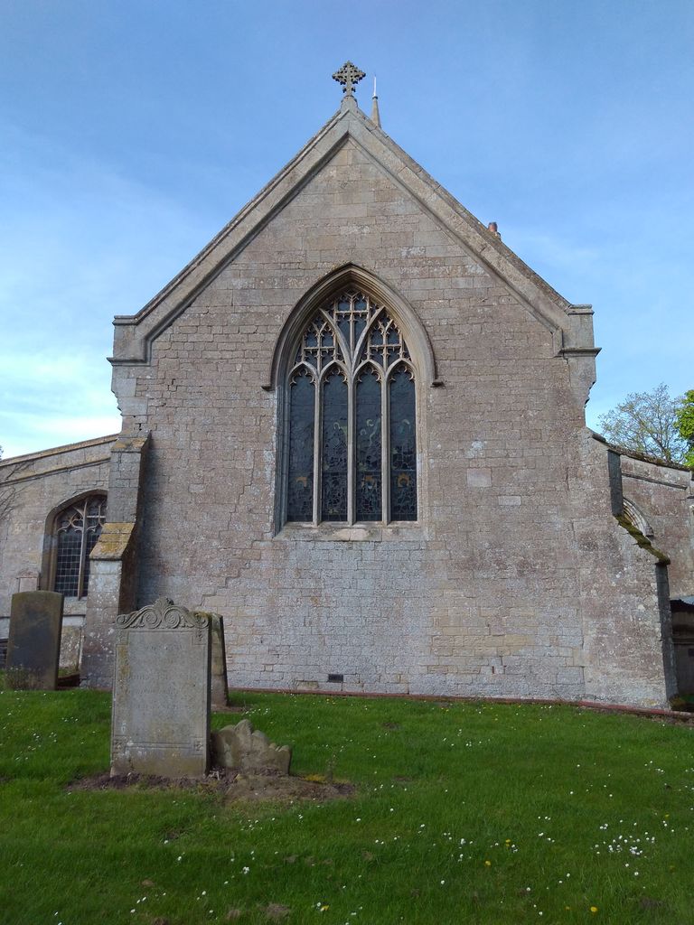
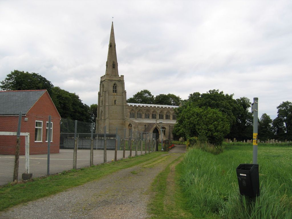
| Description | : | The Grade I listed village church,dedicated to St Margaret of Antioch,lies north of, and separate from, the village. Mainly an example of Perpendicular architecture, it was rebuilt in 1872. |
frequently asked questions (FAQ):
-
Where is St. Margaret's Churchyard?
St. Margaret's Churchyard is located at Quadring, South Holland District ,Lincolnshire ,England.
-
St. Margaret's Churchyard cemetery's updated grave count on graveviews.com?
5 memorials
-
Where are the coordinates of the St. Margaret's Churchyard?
Latitude: 52.8903400
Longitude: -0.1819700
Nearby Cemetories:
1. St. Mary and the Holy Rood Churchyard
Donington, South Holland District, England
Coordinate: 52.9072790, -0.2050080
2. Donington New Cemetery
Donington, South Holland District, England
Coordinate: 52.9071410, -0.2059100
3. Donington Old Cemetery
Donington, South Holland District, England
Coordinate: 52.9091670, -0.2055560
4. St. Peter and St. Paul Churchyard
Gosberton, South Holland District, England
Coordinate: 52.8690870, -0.1629740
5. Gosberton Cemetery
Gosberton, South Holland District, England
Coordinate: 52.8659400, -0.1623000
6. Gosberton Baptist Church
Gosberton, South Holland District, England
Coordinate: 52.8651820, -0.1533940
7. St. Swithin's Churchyard
Bicker, Boston Borough, England
Coordinate: 52.9242080, -0.1798800
8. Bicker Cemetery
Bicker, Boston Borough, England
Coordinate: 52.9261110, -0.1794440
9. St. Peter and St. Paul's Churchyard
Wigtoft, Boston Borough, England
Coordinate: 52.9083330, -0.1236110
10. St Gilbert and St Hugh Churchyard
Gosberton Clough, South Holland District, England
Coordinate: 52.8518081, -0.2166268
11. South Lincolnshire Crematorium
Surfleet, South Holland District, England
Coordinate: 52.8451100, -0.1475110
12. St. Mary's Churchyard
Swineshead, Boston Borough, England
Coordinate: 52.9446490, -0.1596530
13. St. Mary The Virgin Churchyard
Sutterton, Boston Borough, England
Coordinate: 52.9016700, -0.0911111
14. Sutterton Village Cemetery
Sutterton, Boston Borough, England
Coordinate: 52.8994440, -0.0900000
15. Surfleet Cemetery
Surfleet, South Holland District, England
Coordinate: 52.8391670, -0.1383330
16. St. Laurence Churchyard
Surfleet, South Holland District, England
Coordinate: 52.8369500, -0.1436110
17. St. Peter and St. Paul Churchyard
Algarkirk, Boston Borough, England
Coordinate: 52.8995000, -0.0817800
18. St. Mary's Churchyard
Pinchbeck, South Holland District, England
Coordinate: 52.8135340, -0.1589220
19. All Saints Churchyard
Fosdyke, Boston Borough, England
Coordinate: 52.8811100, -0.0469440
20. Church of St. Peter and St. Paul
Kirton, Boston Borough, England
Coordinate: 52.9280560, -0.0597220
21. Fosdyke Village Cemetery
Fosdyke, Boston Borough, England
Coordinate: 52.8808330, -0.0447220
22. St Bartholomew's Church West Pinchbeck
Pinchbeck, South Holland District, England
Coordinate: 52.8080873, -0.2216285
23. Kirton in Holland New Cemetery
Kirton, Boston Borough, England
Coordinate: 52.9361110, -0.0597220
24. Kirton in Holland Old Cemetery
Kirton, Boston Borough, England
Coordinate: 52.9352780, -0.0583330