
| Memorials | : | 0 |
| Location | : | Springfield, Greene County, USA |
| Coordinate | : | 37.1036470, -93.2364820 |
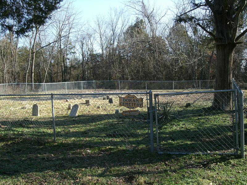
| Description | : | Section 28 Township 28 Range 21 Clay Township. Directions: From US Hiway 65 Springfield, Greene, MO. 2 miles South of 65 and US Hiway 60 Interchange. Use the Evans Rd. exit onto outer road. Evans Road intersects with Farm Rd. 177 on north side of road. On the south side of the road is a privat drive, leading to a private dwelling. Turn into the private dwelling and continue past into a grassy lane which curves west. Follow land approx. 1/4 mile. Cemetery on the north adjacent to the lane covering an area of 45x75 ft. enclosed by chain link fence.... Read More |
frequently asked questions (FAQ):
-
Where is Doran Cemetery?
Doran Cemetery is located at 3036 East Evans Road Springfield, Greene County ,Missouri , 65721USA.
-
Doran Cemetery cemetery's updated grave count on graveviews.com?
0 memorials
-
Where are the coordinates of the Doran Cemetery?
Latitude: 37.1036470
Longitude: -93.2364820
Nearby Cemetories:
1. Missouri Veterans Cemetery at Springfield
Springfield, Greene County, USA
Coordinate: 37.1194191, -93.2351303
2. Gibson-Porter Cemetery
Greene County, USA
Coordinate: 37.0988998, -93.2114029
3. Lakeland Pet Cemetery
Springfield, Greene County, USA
Coordinate: 37.1312700, -93.2343500
4. Galloway Cemetery
Springfield, Greene County, USA
Coordinate: 37.1319000, -93.2322000
5. Rivermonte Memorial Gardens
Springfield, Greene County, USA
Coordinate: 37.1319008, -93.2322006
6. Tillman Family Cemetery
Ozark, Christian County, USA
Coordinate: 37.0722000, -93.2460200
7. Hopedale Cemetery
Ozark, Christian County, USA
Coordinate: 37.0695000, -93.2193985
8. Dodson Cemetery
Mentor, Greene County, USA
Coordinate: 37.1128998, -93.1911011
9. Kinser-Lee Cemetery
Greene County, USA
Coordinate: 37.1260986, -93.1941986
10. All Saints Anglican Church Columbarium
Springfield, Greene County, USA
Coordinate: 37.1476399, -93.2417455
11. Carmelite Monastery Cemetery
Springfield, Greene County, USA
Coordinate: 37.1396103, -93.2893677
12. Weaver Cemetery
Ozark, Christian County, USA
Coordinate: 37.0494003, -93.2161026
13. Fulton Cemetery
Mentor, Greene County, USA
Coordinate: 37.0923730, -93.1655480
14. Payne Cemetery
Nixa, Christian County, USA
Coordinate: 37.0917015, -93.3086014
15. Smith Burial Ground
Greene County, USA
Coordinate: 37.1150800, -93.1625710
16. Mount Zion Cemetery
Ozark, Christian County, USA
Coordinate: 37.0671300, -93.1700790
17. Yarbrough Cemetery
Greene County, USA
Coordinate: 37.1314011, -93.3106003
18. Patterson Cemetery
Springfield, Greene County, USA
Coordinate: 37.1044006, -93.3186035
19. Richwood Cemetery
Nixa, Christian County, USA
Coordinate: 37.0386009, -93.2485962
20. Simpson Cemetery
Springfield, Greene County, USA
Coordinate: 37.1646940, -93.2049180
21. Kings Way Garden Columbarium
Springfield, Greene County, USA
Coordinate: 37.1691500, -93.2474500
22. Nokes Cemetery
Nixa, Christian County, USA
Coordinate: 37.0503006, -93.2872009
23. Saint James Episcopal Church Columbarium
Springfield, Greene County, USA
Coordinate: 37.1704300, -93.2428700
24. Hazelwood Cemetery
Springfield, Greene County, USA
Coordinate: 37.1707993, -93.2647018