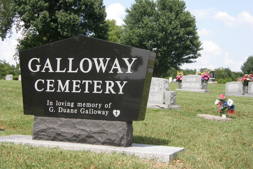
| Memorials | : | 1 |
| Location | : | Springfield, Greene County, USA |
| Coordinate | : | 37.1319000, -93.2322000 |
| Description | : | contact F. Hall 417-881-1754 Section 16 Township 28N Range 21W Directions: Glenstone to Hiway M/Republic Rd. east to Lone Pine then south to end of road. Cemetery is located on the side of a hill overlooking the cloverleaf at US 60 and US 65. The cemetery is bordered on the south by a dirt road. On the north and west sides by Rivermonte Memorial Gardens Cemetery. There are several old trees and evidence of many old unmarked graves that are said to be Civil War Graves. Other stories indicated there may be slave graves nearby. (This cemetery actually... Read More |
frequently asked questions (FAQ):
-
Where is Galloway Cemetery?
Galloway Cemetery is located at 4500 S Lone Pine Avenue Springfield, Greene County ,Missouri , 65804USA.
-
Galloway Cemetery cemetery's updated grave count on graveviews.com?
1 memorials
-
Where are the coordinates of the Galloway Cemetery?
Latitude: 37.1319000
Longitude: -93.2322000
Nearby Cemetories:
1. Rivermonte Memorial Gardens
Springfield, Greene County, USA
Coordinate: 37.1319008, -93.2322006
2. Lakeland Pet Cemetery
Springfield, Greene County, USA
Coordinate: 37.1312700, -93.2343500
3. Missouri Veterans Cemetery at Springfield
Springfield, Greene County, USA
Coordinate: 37.1194191, -93.2351303
4. All Saints Anglican Church Columbarium
Springfield, Greene County, USA
Coordinate: 37.1476399, -93.2417455
5. Doran Cemetery
Springfield, Greene County, USA
Coordinate: 37.1036470, -93.2364820
6. Kinser-Lee Cemetery
Greene County, USA
Coordinate: 37.1260986, -93.1941986
7. Gibson-Porter Cemetery
Greene County, USA
Coordinate: 37.0988998, -93.2114029
8. Dodson Cemetery
Mentor, Greene County, USA
Coordinate: 37.1128998, -93.1911011
9. Kings Way Garden Columbarium
Springfield, Greene County, USA
Coordinate: 37.1691500, -93.2474500
10. Simpson Cemetery
Springfield, Greene County, USA
Coordinate: 37.1646940, -93.2049180
11. Saint James Episcopal Church Columbarium
Springfield, Greene County, USA
Coordinate: 37.1704300, -93.2428700
12. Kirkwood Cemetery
Greene County, USA
Coordinate: 37.1744003, -93.2517014
13. Carmelite Monastery Cemetery
Springfield, Greene County, USA
Coordinate: 37.1396103, -93.2893677
14. Hazelwood Cemetery
Springfield, Greene County, USA
Coordinate: 37.1707993, -93.2647018
15. Gorman and Scharpf Mortuary Columbarium
Springfield, Greene County, USA
Coordinate: 37.1746900, -93.2593800
16. Springfield National Cemetery
Springfield, Greene County, USA
Coordinate: 37.1730995, -93.2636032
17. Kershner Cemetery
Greene County, USA
Coordinate: 37.1650009, -93.1875000
18. Temple Israel Cemetery
Springfield, Greene County, USA
Coordinate: 37.1730995, -93.2664032
19. Fielder Langston Cemetery
Springfield, Greene County, USA
Coordinate: 37.1873700, -93.2479700
20. Nancy Haden Grave
Springfield, Greene County, USA
Coordinate: 37.1868520, -93.2127710
21. Smith Burial Ground
Greene County, USA
Coordinate: 37.1150800, -93.1625710
22. Tillman Family Cemetery
Ozark, Christian County, USA
Coordinate: 37.0722000, -93.2460200
23. Yarbrough Cemetery
Greene County, USA
Coordinate: 37.1314011, -93.3106003
24. Redeemer Lutheran Church Columbarium
Springfield, Greene County, USA
Coordinate: 37.1625700, -93.3012600

