
| Memorials | : | 0 |
| Location | : | Wittenau, Reinickendorf, Germany |
| Coordinate | : | 52.5922430, 13.3254560 |
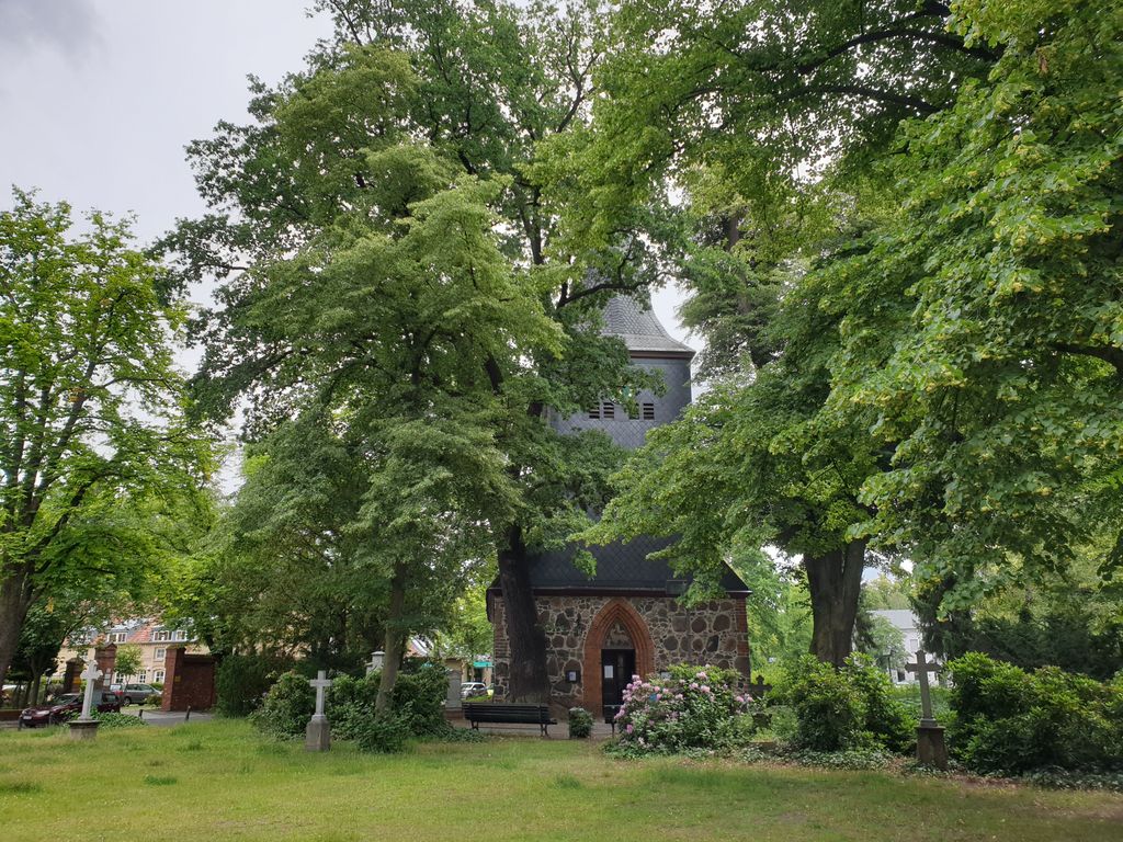
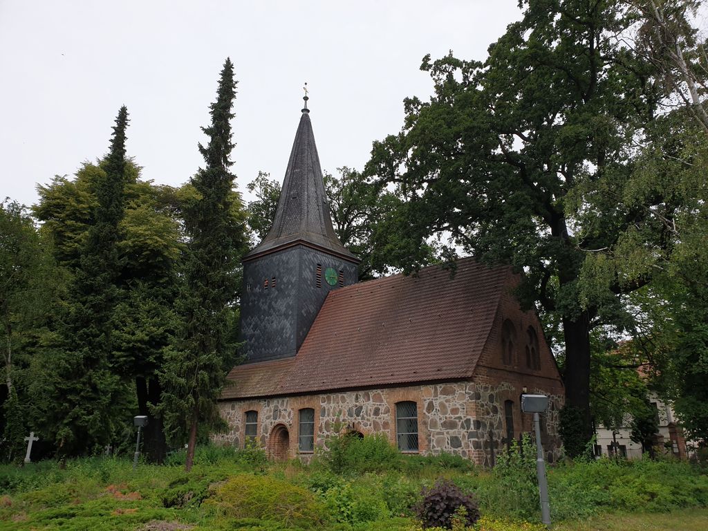
| Description | : | DEFUNCT There has been a cemetery at this location since the 15th century. The church building dates back to 1482. Wittenau used to be an independent village, but since 1920 is a part of the city of Berlin. This cemetery is now no longer in use. Over time many grave markers disappeared or were destroyed. The last known burial took place around 1900. |
frequently asked questions (FAQ):
-
Where is Dorfkirchhof Alt-Wittenau?
Dorfkirchhof Alt-Wittenau is located at Alt-Wittenau 64a Wittenau, Reinickendorf ,Berlin , 13437Germany.
-
Dorfkirchhof Alt-Wittenau cemetery's updated grave count on graveviews.com?
0 memorials
-
Where are the coordinates of the Dorfkirchhof Alt-Wittenau?
Latitude: 52.5922430
Longitude: 13.3254560
Nearby Cemetories:
1. Friedhof Wittenau
Wittenau, Reinickendorf, Germany
Coordinate: 52.5907960, 13.3222960
2. Martin-Luther-Friedhof
Tegel, Reinickendorf, Germany
Coordinate: 52.6009850, 13.2967830
3. Russisch-Orthodoxer Friedhof
Tegel, Reinickendorf, Germany
Coordinate: 52.5776600, 13.3007200
4. Friedhof Tegel Am Nordgraben
Tegel, Reinickendorf, Germany
Coordinate: 52.5935330, 13.2898950
5. Kriegsgräberstätte Reinickendorf
Reinickendorf, Reinickendorf, Germany
Coordinate: 52.5769726, 13.3512016
6. Friedhof Reinickendorf II
Reinickendorf, Reinickendorf, Germany
Coordinate: 52.5716553, 13.3404284
7. Sankt Sebastian-Friedhof
Reinickendorf, Reinickendorf, Germany
Coordinate: 52.5704346, 13.3364258
8. Friedhof Hermsdorf I
Hermsdorf, Reinickendorf, Germany
Coordinate: 52.6108017, 13.3031292
9. Friedhof Tegel Am Fliesstal
Tegel, Reinickendorf, Germany
Coordinate: 52.5967522, 13.2880278
10. Dorfkirchhof Alt-Reinickendorf
Reinickendorf, Reinickendorf, Germany
Coordinate: 52.5750910, 13.3519580
11. St. Hedwig-Friedhof III
Reinickendorf, Reinickendorf, Germany
Coordinate: 52.5686302, 13.3318720
12. Friedhof Pankow VII
Rosenthal, Pankow, Germany
Coordinate: 52.5941315, 13.3658123
13. Nazareth Kirchhof II
Reinickendorf, Reinickendorf, Germany
Coordinate: 52.5662155, 13.3354387
14. Friedhof Lübars
Lubars, Reinickendorf, Germany
Coordinate: 52.6153220, 13.3490750
15. Friedhof der Dankesgemeinde
Reinickendorf, Reinickendorf, Germany
Coordinate: 52.5652237, 13.3336687
16. Dorotheenstädtischer Friedhof III
Reinickendorf, Reinickendorf, Germany
Coordinate: 52.5628700, 13.3322535
17. Dorfkirchhof Alt-Tegel
Tegel, Reinickendorf, Germany
Coordinate: 52.5879686, 13.2768053
18. Humboldtschloss
Tegel, Reinickendorf, Germany
Coordinate: 52.5950000, 13.2763890
19. Sowjetisches Ehrenmal Schönholzer Heide
Pankow, Germany
Coordinate: 52.5811581, 13.3733418
20. Dorfkirchhof Rosenthal
Rosenthal, Pankow, Germany
Coordinate: 52.5995010, 13.3780000
21. Golgatha-Gnaden- und Johannes-Evangelist-Friedhof
Reinickendorf, Reinickendorf, Germany
Coordinate: 52.5625210, 13.3504060
22. Dorfkirchhof Alt-Lübars
Lubars, Reinickendorf, Germany
Coordinate: 52.6207230, 13.3573860
23. Neuer Friedhof Rosenthal
Rosenthal, Pankow, Germany
Coordinate: 52.6054580, 13.3782160
24. Domfriedhof II
Wedding, Mitte, Germany
Coordinate: 52.5580700, 13.3399020