
| Memorials | : | 196 |
| Location | : | Berkeley County, USA |
| Coordinate | : | 39.4182000, -77.9550500 |
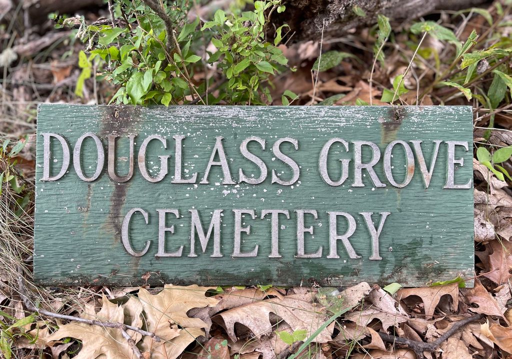
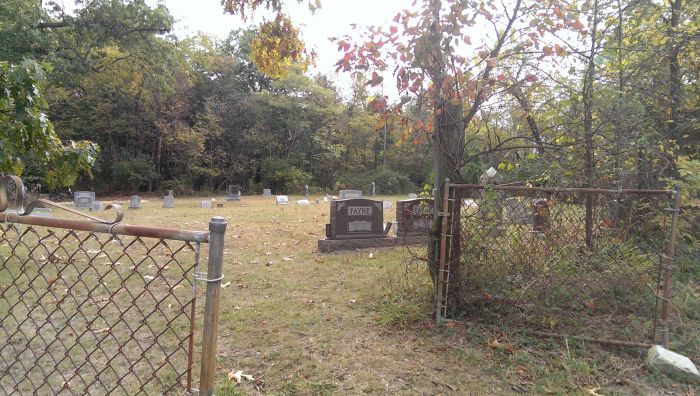
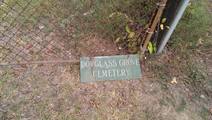
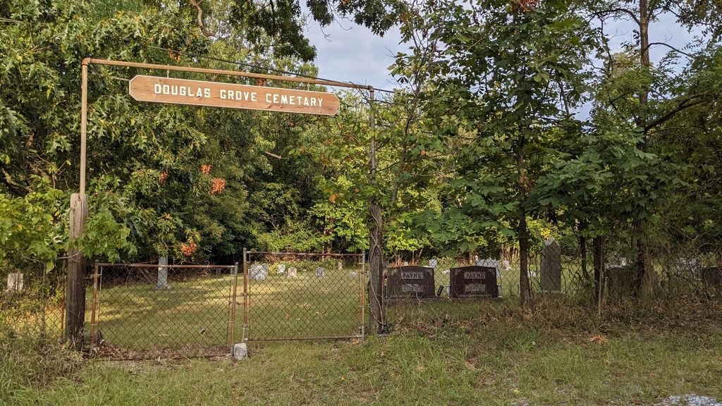
| Description | : | Located at the intersection of Douglas Grove Rd. (Rt. 9/16) & Dunnview Dr. (Rt. 9/15). Douglass Grove (Mt. Olive Methodist) Church was established in 1888 after receiving land from both George Shepherd (24 sq. poles) and Charles Robinson (54 sq. poles). The land from Charles Robinson was part of his ten acre tract he purchased in 1876 from John Burns. This was a black cemetery. Cemetery history courtesy of the Berkeley County Historical Society. |
frequently asked questions (FAQ):
-
Where is Douglass Grove Cemetery?
Douglass Grove Cemetery is located at Berkeley County ,West Virginia ,USA.
-
Douglass Grove Cemetery cemetery's updated grave count on graveviews.com?
196 memorials
-
Where are the coordinates of the Douglass Grove Cemetery?
Latitude: 39.4182000
Longitude: -77.9550500

Nearby Cemetories:
1. Shepherd Family Cemetery
Douglas Grove, Berkeley County, USA
Coordinate: 39.4180940, -77.9543920
2. Norborne Cemetery
Martinsburg, Berkeley County, USA
Coordinate: 39.4463997, -77.9682999
3. Pleasant View Memory Gardens
Martinsburg, Berkeley County, USA
Coordinate: 39.4121000, -77.9163000
4. Adam Stephen Monument
Martinsburg, Berkeley County, USA
Coordinate: 39.4490400, -77.9663400
5. VanMetre Family Burial Ground
Berkeley County, USA
Coordinate: 39.4454600, -77.9268400
6. Norbourne Parish Cemetery
Martinsburg, Berkeley County, USA
Coordinate: 39.4525414, -77.9671707
7. Green Hill Cemetery
Martinsburg, Berkeley County, USA
Coordinate: 39.4538994, -77.9558029
8. Saint Josephs Cemetery
Martinsburg, Berkeley County, USA
Coordinate: 39.4536018, -77.9666977
9. Whitenah Family Burial Ground
Berkeley County, USA
Coordinate: 39.4547200, -77.9562990
10. VanMetre Cemetery
Baker Heights, Berkeley County, USA
Coordinate: 39.3962631, -77.9160690
11. Mount Zion Baptist Church Cemetery
Martinsburg, Berkeley County, USA
Coordinate: 39.3889000, -77.9237700
12. Old Green Hill Colored Cemetery
Martinsburg, Berkeley County, USA
Coordinate: 39.4566383, -77.9638291
13. Trinity Episcopal Church Cemetery
Martinsburg, Berkeley County, USA
Coordinate: 39.4565750, -77.9653290
14. German Lutheran Reformed Cemetery
Martinsburg, Berkeley County, USA
Coordinate: 39.4563840, -77.9680570
15. Kearney Family Burial Site
Martinsburg, Berkeley County, USA
Coordinate: 39.4522930, -77.9825800
16. Beth Jacob Cemetery
Martinsburg, Berkeley County, USA
Coordinate: 39.4580800, -77.9403700
17. Rosedale Cemetery
Martinsburg, Berkeley County, USA
Coordinate: 39.4613991, -77.9403000
18. Beth Haven Baptist Church Cemetery
Berkeley County, USA
Coordinate: 39.4278800, -77.8983400
19. John Burns Cemetery
Baker Heights, Berkeley County, USA
Coordinate: 39.4137639, -77.8947583
20. Mount Hope Cemetery
Martinsburg, Berkeley County, USA
Coordinate: 39.4668999, -77.9533005
21. Smoketown Cemetery
Berkeley County, USA
Coordinate: 39.4575000, -77.9059000
22. Providence Quaker Cemetery
Martinsburg, Berkeley County, USA
Coordinate: 39.4653015, -78.0000992
23. Kearneysville Presbyterian Church Cemetery
Kearneysville, Jefferson County, USA
Coordinate: 39.3885155, -77.8876572
24. Olean Graveyard
Martinsburg, Berkeley County, USA
Coordinate: 39.4631004, -78.0065994