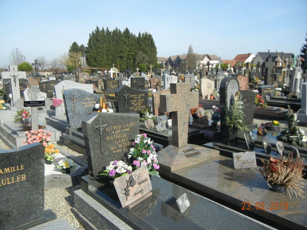
| Memorials | : | 0 |
| Location | : | Drusenheim, Departement du Bas-Rhin, France |
| Coordinate | : | 48.7663650, 7.9498927 |
| Description | : | A large flat almost square cemetery. |
frequently asked questions (FAQ):
-
Where is Drusenheim Cemetery?
Drusenheim Cemetery is located at Rue Du Cimetiere Drusenheim, Departement du Bas-Rhin ,Alsace , 67410France.
-
Drusenheim Cemetery cemetery's updated grave count on graveviews.com?
0 memorials
-
Where are the coordinates of the Drusenheim Cemetery?
Latitude: 48.7663650
Longitude: 7.9498927
Nearby Cemetories:
1. Dalhunden Cemetery
Dalhunden, Departement du Bas-Rhin, France
Coordinate: 48.7754963, 7.9868134
2. Friedhof Grauelsbaum
Grauelsbaum, Landkreis Rastatt, Germany
Coordinate: 48.7369000, 7.9886000
3. Friedhof Greffern
Greffern, Landkreis Rastatt, Germany
Coordinate: 48.7465000, 8.0039000
4. Friedhof Lichtenau
Lichtenau, Landkreis Rastatt, Germany
Coordinate: 48.7251959, 8.0068578
5. Friedhof Ulm
Ulm, Landkreis Rastatt, Germany
Coordinate: 48.7280600, 8.0162900
6. Église protestante
Bischwiller, Departement du Bas-Rhin, France
Coordinate: 48.7699490, 7.8612830
7. Friedhof Helmlingen
Helmlingen, Ortenaukreis, Germany
Coordinate: 48.7096388, 7.9729297
8. Friedhof Scherzheim
Scherzheim, Landkreis Rastatt, Germany
Coordinate: 48.7132800, 7.9981200
9. Friedhof Stollhofen
Stollhofen, Landkreis Rastatt, Germany
Coordinate: 48.7657966, 8.0459141
10. Bischwiller Jewish Cemetery
Bischwiller, Departement du Bas-Rhin, France
Coordinate: 48.7722000, 7.8490912
11. Friedhof Schwarzach
Schwarzach, Landkreis Rastatt, Germany
Coordinate: 48.7472719, 8.0507180
12. Friedhof Muckenschopf
Muckenschopf, Landkreis Rastatt, Germany
Coordinate: 48.6949674, 7.9919442
13. Friedhof Söllingen Rheinmünster
Söllingen, Landkreis Rastatt, Germany
Coordinate: 48.7793760, 8.0665080
14. Kaltenhouse Cemetery
Kaltenhouse, Departement du Bas-Rhin, France
Coordinate: 48.7883005, 7.8321041
15. Friedhof Moos
Moos, Landkreis Rastatt, Germany
Coordinate: 48.7218761, 8.0666697
16. Leutenheim Cemetery
Leutenheim, Departement du Bas-Rhin, France
Coordinate: 48.8422149, 8.0240358
17. Soldatengrab Söllingen
Söllingen, Landkreis Rastatt, Germany
Coordinate: 48.7689760, 8.0925950
18. Friedhof Freistett
Freistett, Ortenaukreis, Germany
Coordinate: 48.6676870, 7.9379876
19. Kurtzenhouse Cemetery
Kurtzenhouse, Departement du Bas-Rhin, France
Coordinate: 48.7410533, 7.8020753
20. Kauffenheim Cemetery
Kauffenheim, Departement du Bas-Rhin, France
Coordinate: 48.8533645, 8.0289781
21. Friedhof Oberbruch
Oberbruch, Landkreis Rastatt, Germany
Coordinate: 48.7223471, 8.0894357
22. Friedhof Memprechtshofen
Memprechtshofen, Ortenaukreis, Germany
Coordinate: 48.6742032, 8.0180611
23. Jüdischer Friedhof Freistett
Freistett, Ortenaukreis, Germany
Coordinate: 48.6609200, 7.9392300
24. Neuhaeusel Cemetery
Neuhaeusel, Departement du Bas-Rhin, France
Coordinate: 48.8250700, 8.0865400

