| Memorials | : | 1 |
| Location | : | Buford, Gwinnett County, USA |
| Coordinate | : | 34.0722800, -83.8982600 |
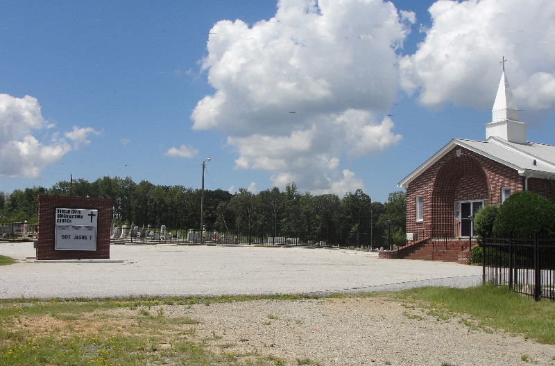
| Description | : | The cemetery includes all of the fenced in area to the left of the church building and the smaller fenced in area to the right of the church building. The remainder of the graves on the right belong to the adjacent Antioch Baptist Church cemetery. All of the graves are behind a black fence. |
frequently asked questions (FAQ):
-
Where is Duncan Creek Congregational Church Cemetery?
Duncan Creek Congregational Church Cemetery is located at 3868 Braselton Hwy Buford, Gwinnett County ,Georgia , 30519USA.
-
Duncan Creek Congregational Church Cemetery cemetery's updated grave count on graveviews.com?
1 memorials
-
Where are the coordinates of the Duncan Creek Congregational Church Cemetery?
Latitude: 34.0722800
Longitude: -83.8982600
Nearby Cemetories:
1. Antioch Baptist Church Cemetery
Buford, Gwinnett County, USA
Coordinate: 34.0723600, -83.8970500
2. Wood Family Private Cemetery
Buford, Gwinnett County, USA
Coordinate: 34.0806550, -83.8668190
3. Phillips Family Pet Cemetery
Buford, Gwinnett County, USA
Coordinate: 34.0695839, -83.9328003
4. Hog Mountain Church Cemetery New
Dacula, Gwinnett County, USA
Coordinate: 34.0534500, -83.9260440
5. Hog Mountain Church Cemetery Old
Dacula, Gwinnett County, USA
Coordinate: 34.0512800, -83.9263300
6. Sardis Methodist Church Cemetery
Buford, Gwinnett County, USA
Coordinate: 34.1003990, -83.8781204
7. Mount Moriah Baptist Church Cemetery
Gwinnett County, USA
Coordinate: 34.0706673, -83.8566971
8. Dobbs Family Cemetery
Gwinnett County, USA
Coordinate: 34.0860760, -83.8579130
9. Old Zion Hill Baptist Church Cemetery
Buford, Gwinnett County, USA
Coordinate: 34.0985941, -83.9338255
10. Seaborn Clack Cemetery
Gwinnett County, USA
Coordinate: 34.0500000, -83.8581500
11. Zion Hill Baptist Church Cemetery
Buford, Gwinnett County, USA
Coordinate: 34.0995500, -83.9364330
12. Union Grove Baptist Church Cemetery
Dacula, Gwinnett County, USA
Coordinate: 34.0380000, -83.8670000
13. Mauldin Family Cemetery #2
Flowery Branch, Hall County, USA
Coordinate: 34.0986300, -83.8565500
14. Tuggle Cemetery
Hall County, USA
Coordinate: 34.1085900, -83.8646900
15. Ivy Creek Baptist Church Cemetery
Buford, Gwinnett County, USA
Coordinate: 34.0698000, -83.9540000
16. Mauldin Family Cemetery
Flowery Branch, Hall County, USA
Coordinate: 34.1033900, -83.8565100
17. Waters Cemetery
Hall County, USA
Coordinate: 34.1184100, -83.9130600
18. Hamilton Mill Memorial Gardens
Buford, Gwinnett County, USA
Coordinate: 34.0937000, -83.9515000
19. Fraser Family Cemetery #2
Flowery Branch, Hall County, USA
Coordinate: 34.1232986, -83.8768997
20. Friendship Baptist Church Cemetery #01
Buford, Hall County, USA
Coordinate: 34.1257000, -83.9202000
21. Pirkle Family Cemetery #2
Flowery Branch, Hall County, USA
Coordinate: 34.1276820, -83.8811960
22. Pirkle Family Cemetery
Flowery Branch, Hall County, USA
Coordinate: 34.1280310, -83.8821600
23. Friendship Baptist Church Cemetery #02
Buford, Hall County, USA
Coordinate: 34.1272000, -83.9230000
24. Cherokee Bluffs Park Cemetery
Flowery Branch, Hall County, USA
Coordinate: 34.1347770, -83.9137160

