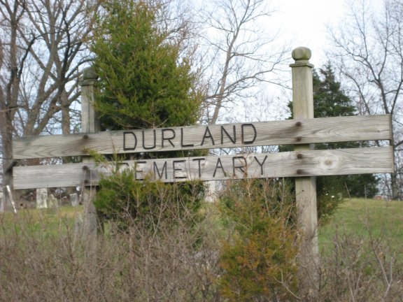
| Memorials | : | 0 |
| Location | : | Jackson County, USA |
| Coordinate | : | 38.9068985, -85.9894028 |
| Description | : | The cemetery is located in Brownstown Township on the east side of W. Tipton Street (US 50) about 800 feet north of its intersection with E County Road 175 N. Indiana Cemetery Locations, Volume 4, published by the Indiana Genealogical Society (April 2009), gives the primary cemetery name as Crane Hill Cemetery with alternate names of Douglas Cemetery and Durland Cemetery. The cemetery is listed in the Cemetery and Burial Grounds Registry of the Indiana Department of Natural Resources (DNR) and in the State Historical Architectural and Archaeological Research Database (SHAARD) with Cemetery Record Number CR-36-6 (Durland ... Read More |
frequently asked questions (FAQ):
-
Where is Durland Cemetery?
Durland Cemetery is located at W. Tipton Street Jackson County ,Indiana , 47274USA.
-
Durland Cemetery cemetery's updated grave count on graveviews.com?
0 memorials
-
Where are the coordinates of the Durland Cemetery?
Latitude: 38.9068985
Longitude: -85.9894028
Nearby Cemetories:
1. Robertson Cemetery
Brownstown, Jackson County, USA
Coordinate: 38.9049988, -86.0057983
2. Findley Cemetery
Brownstown, Jackson County, USA
Coordinate: 38.8985900, -86.0056920
3. Hamilton Cemetery
Shields, Jackson County, USA
Coordinate: 38.8972633, -86.0135195
4. Robertson Cemetery
Seymour, Jackson County, USA
Coordinate: 38.9432983, -86.0164032
5. Fairview Cemetery
Brownstown, Jackson County, USA
Coordinate: 38.8868484, -86.0405045
6. Saint Peters Lutheran Cemetery
Brownstown, Jackson County, USA
Coordinate: 38.8862686, -86.0404663
7. Kelly Cemetery
Cortland, Jackson County, USA
Coordinate: 38.9519470, -85.9903280
8. Brownstown Old City Cemetery
Brownstown, Jackson County, USA
Coordinate: 38.8786583, -86.0387802
9. Saint Johns Lutheran Church Cemetery
Seymour, Jackson County, USA
Coordinate: 38.8650169, -85.9523087
10. Beem Cemetery
Brownstown, Jackson County, USA
Coordinate: 38.8882810, -86.0521510
11. Brown Cemetery
Seymour, Jackson County, USA
Coordinate: 38.9601100, -85.9734030
12. Day Cemetery
Cortland, Jackson County, USA
Coordinate: 38.9617670, -85.9856850
13. Crane Cemetery
Seymour, Jackson County, USA
Coordinate: 38.9386080, -85.9310890
14. Woodmansee Cemetery
Brownstown, Jackson County, USA
Coordinate: 38.8734600, -86.0466400
15. Drier Cemetery
Wegan, Jackson County, USA
Coordinate: 38.8489930, -85.9918040
16. Robertson-Ewing Cemetery
Brownstown, Jackson County, USA
Coordinate: 38.8818110, -86.0625020
17. Cortland Cemetery
Cortland, Jackson County, USA
Coordinate: 38.9724998, -85.9730988
18. Isaacs Cemetery
Cortland, Jackson County, USA
Coordinate: 38.9719580, -86.0258780
19. Immanuel Lutheran Cemetery
Seymour, Jackson County, USA
Coordinate: 38.9530983, -85.9178009
20. Burrell Cemetery
Brownstown, Jackson County, USA
Coordinate: 38.8625090, -86.0656180
21. Chestnut Ridge Cemetery
Dudleytown, Jackson County, USA
Coordinate: 38.8843994, -85.8855972
22. Lubker Cemetery
Jackson County, USA
Coordinate: 38.8231010, -85.9839020
23. Saint Pauls Cemetery
Wegan, Jackson County, USA
Coordinate: 38.8279580, -86.0289570
24. Moore Cemetery
Jackson County, USA
Coordinate: 38.9058849, -85.8800927

