
| Memorials | : | 1 |
| Location | : | Brownstown, Jackson County, USA |
| Coordinate | : | 38.8818110, -86.0625020 |
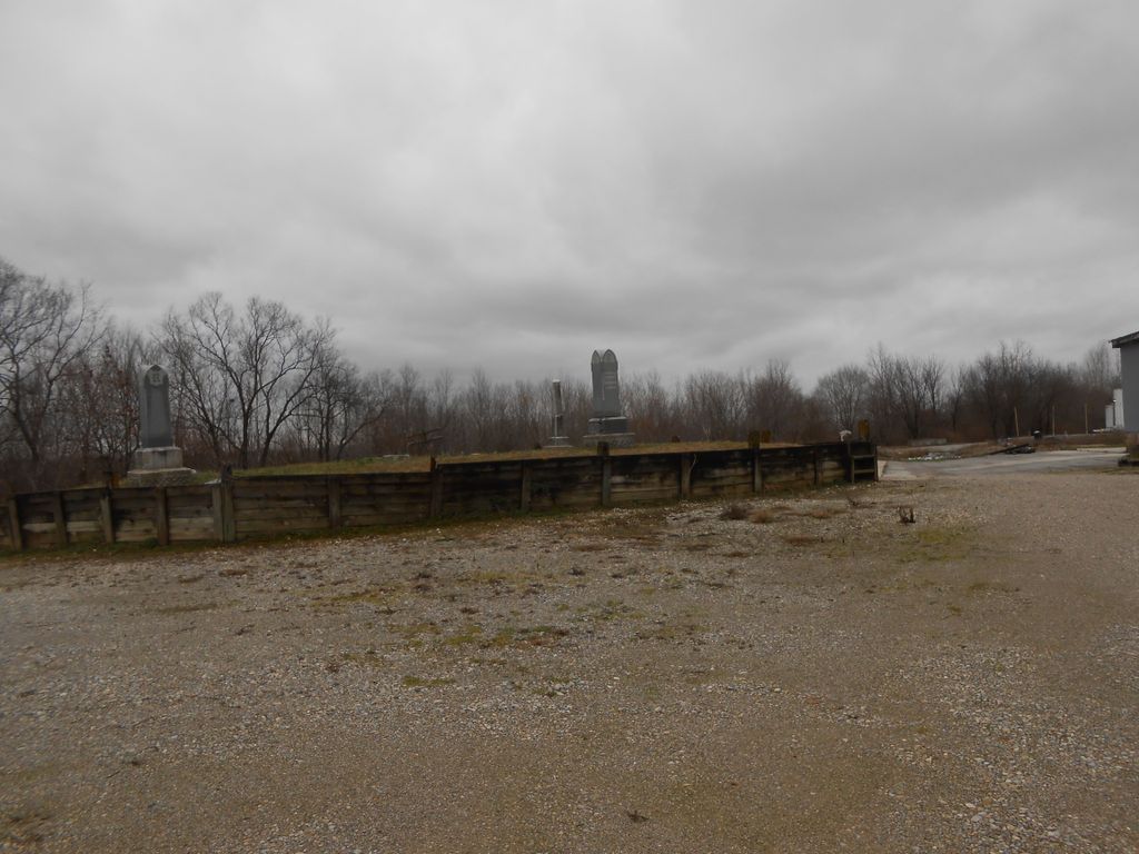
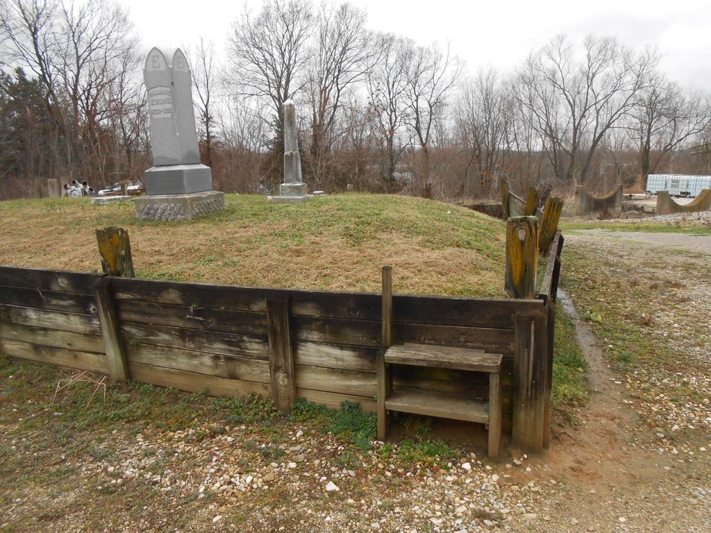
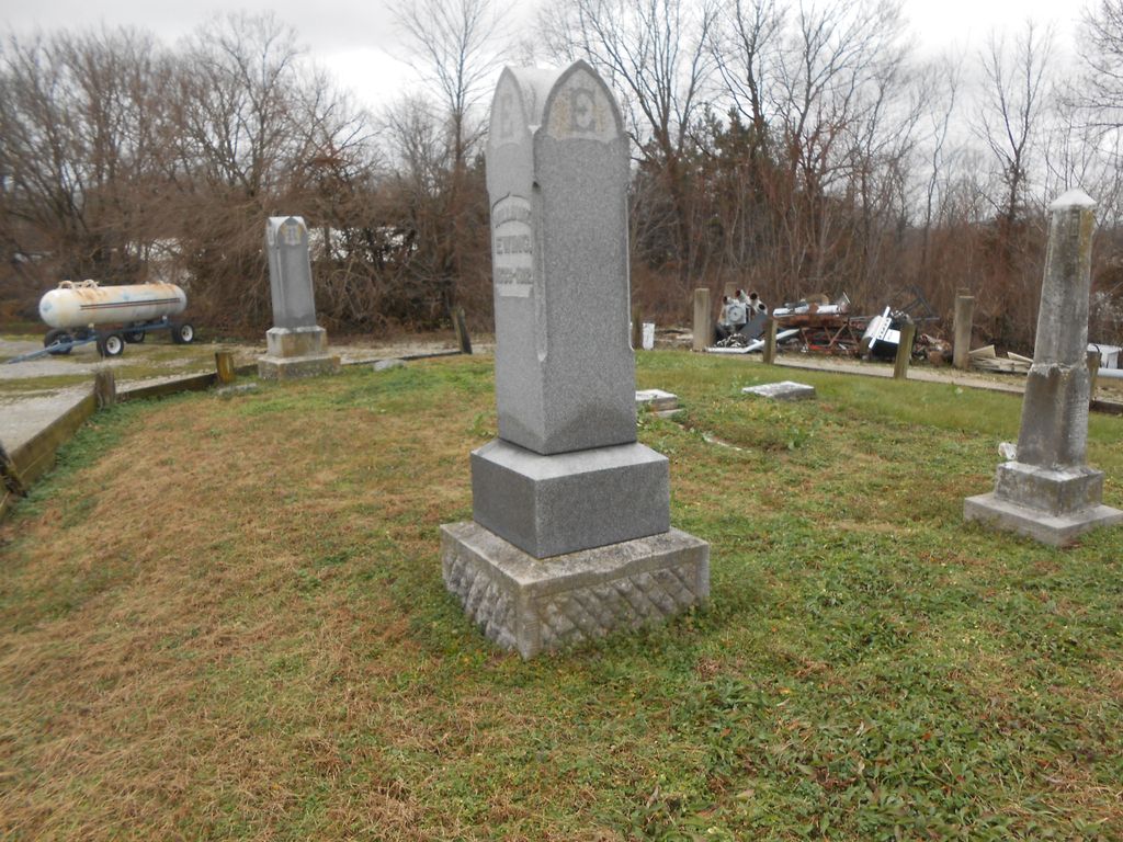
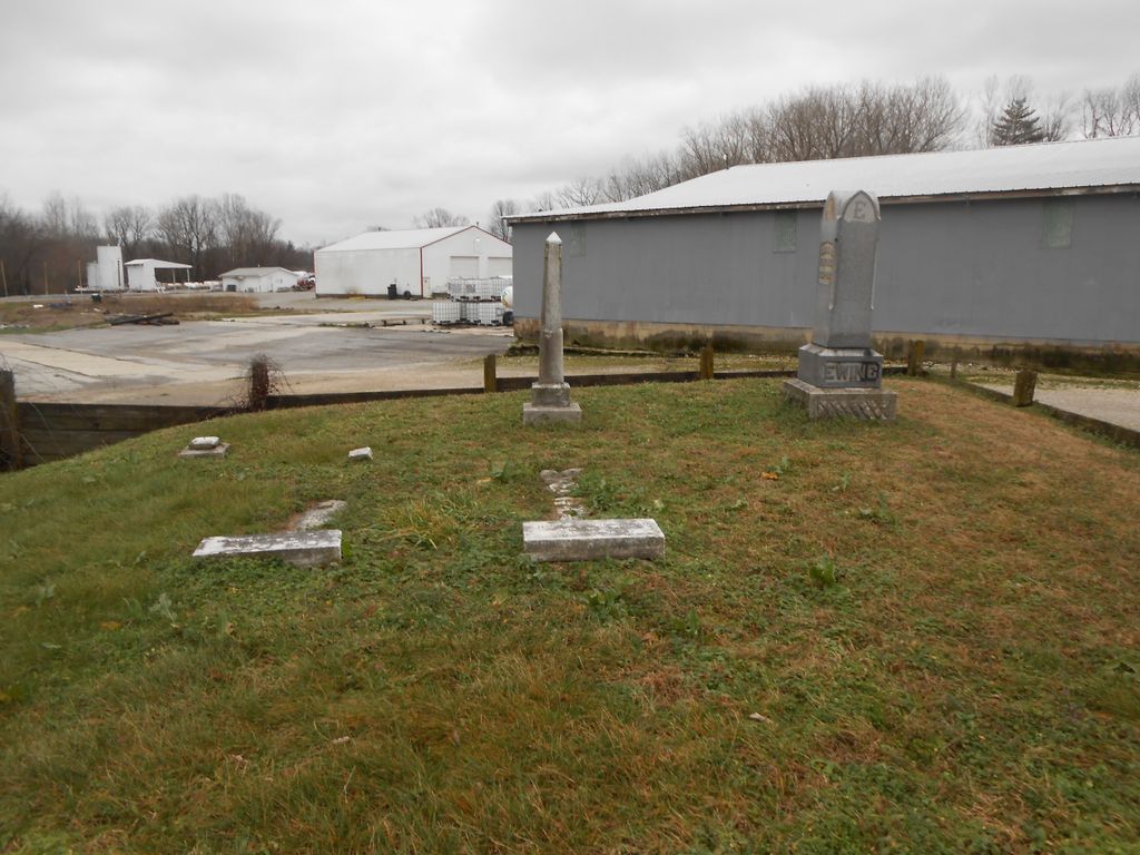
| Description | : | Very small cemetery - seven known headstones. According to the Brownstown Township Cemeteries Book, it is located at Section 10, T5N, R4E; over by the Robertson Mill. Indiana Cemetery Locations, Volume 4, published by the Indiana Genealogical Society (April 2009), gives the primary cemetery name as Robertson-Ewing Cemetery with an alternate name of Ewing Cemetery. The cemetery is listed in the Cemetery and Burial Grounds Registry of the Indiana Department of Natural Resources (DNR) and in the State Historical Architectural and Archaeological Research Database (SHAARD) with Cemetery Record Number CR-36-20 (Roberts-Ewing). |
frequently asked questions (FAQ):
-
Where is Robertson-Ewing Cemetery?
Robertson-Ewing Cemetery is located at Farm Bureau Road Brownstown, Jackson County ,Indiana , 47220USA.
-
Robertson-Ewing Cemetery cemetery's updated grave count on graveviews.com?
1 memorials
-
Where are the coordinates of the Robertson-Ewing Cemetery?
Latitude: 38.8818110
Longitude: -86.0625020
Nearby Cemetories:
1. Beem Cemetery
Brownstown, Jackson County, USA
Coordinate: 38.8882810, -86.0521510
2. Woodmansee Cemetery
Brownstown, Jackson County, USA
Coordinate: 38.8734600, -86.0466400
3. Saint Peters Lutheran Cemetery
Brownstown, Jackson County, USA
Coordinate: 38.8862686, -86.0404663
4. Fairview Cemetery
Brownstown, Jackson County, USA
Coordinate: 38.8868484, -86.0405045
5. Brownstown Old City Cemetery
Brownstown, Jackson County, USA
Coordinate: 38.8786583, -86.0387802
6. Burrell Cemetery
Brownstown, Jackson County, USA
Coordinate: 38.8625090, -86.0656180
7. Weathers Cemetery
Jackson County, USA
Coordinate: 38.8580650, -86.0791680
8. Miller Cemetery
Jackson County, USA
Coordinate: 38.8622017, -86.0894012
9. Crane Cemetery
Brownstown, Jackson County, USA
Coordinate: 38.8793280, -86.1131780
10. Peters Cemetery
Jackson County, USA
Coordinate: 38.8443985, -86.0792007
11. Hamilton Cemetery
Shields, Jackson County, USA
Coordinate: 38.8972633, -86.0135195
12. Findley Cemetery
Brownstown, Jackson County, USA
Coordinate: 38.8985900, -86.0056920
13. Vallonia Cemetery
Vallonia, Jackson County, USA
Coordinate: 38.8417750, -86.0960620
14. Robertson Cemetery
Brownstown, Jackson County, USA
Coordinate: 38.9049988, -86.0057983
15. Wayman Cemetery
Jackson County, USA
Coordinate: 38.9233017, -86.0986023
16. Smallwood Cemetery
Brownstown, Jackson County, USA
Coordinate: 38.8978004, -86.1256027
17. Smith Cemetery
Jackson County, USA
Coordinate: 38.8379400, -86.0995200
18. Saint Pauls Cemetery
Wegan, Jackson County, USA
Coordinate: 38.8279580, -86.0289570
19. Durland Cemetery
Jackson County, USA
Coordinate: 38.9068985, -85.9894028
20. Drier Cemetery
Wegan, Jackson County, USA
Coordinate: 38.8489930, -85.9918040
21. Lopp Cemetery
Brownstown, Jackson County, USA
Coordinate: 38.8237110, -86.0230890
22. Saint Pauls Lutheran Cemetery
Wegan, Jackson County, USA
Coordinate: 38.8237000, -86.0162000
23. Robertson Cemetery
Seymour, Jackson County, USA
Coordinate: 38.9432983, -86.0164032
24. Beem Heighten Hill Cemetery
Medora, Jackson County, USA
Coordinate: 38.8546982, -86.1511002