
| Memorials | : | 0 |
| Location | : | Richmond, Fort Bend County, USA |
| Coordinate | : | 29.3967830, -95.6253830 |
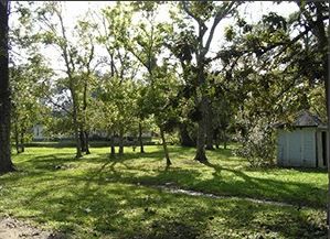
| Description | : | aka Duty Grave Fort Bend Cemetery # FB-C075 The cemetery status is inactive. The cemetery is not affiliated with any organizations and the ethnicity is primarily Anglo. The size of the cemetery is unknown. The number of known burials is 1 and the date of the earliest burial is 1980. Cemetery access is via private property. Permission from the land owner must be obtained prior to visiting cemetery. |
frequently asked questions (FAQ):
-
Where is Duty Cemetery?
Duty Cemetery is located at Sawmill Road Richmond, Fort Bend County ,Texas ,USA.
-
Duty Cemetery cemetery's updated grave count on graveviews.com?
0 memorials
-
Where are the coordinates of the Duty Cemetery?
Latitude: 29.3967830
Longitude: -95.6253830
Nearby Cemetories:
1. Brown-Beard Cemetery
Richmond, Fort Bend County, USA
Coordinate: 29.4032884, -95.6399500
2. Gubbels Family Cemetery
Thompsons, Fort Bend County, USA
Coordinate: 29.4721220, -95.6077430
3. Wheat Cemetery
Fairchilds, Fort Bend County, USA
Coordinate: 29.4158600, -95.7204900
4. Y U Jones Cemetery
Richmond, Fort Bend County, USA
Coordinate: 29.4833000, -95.6114330
5. Edwards Cemetery
Thompsons, Fort Bend County, USA
Coordinate: 29.4814000, -95.5854670
6. Mount Pilgrim Baptist Church Cemetery
Thompsons, Fort Bend County, USA
Coordinate: 29.4980000, -95.5909200
7. Henry Jones Family Cemetery
Crabb, Fort Bend County, USA
Coordinate: 29.4981900, -95.6819000
8. Woods Cemetery
Brazoria County, USA
Coordinate: 29.3855991, -95.4906006
9. Waters Burial Site
Sienna Plantation, Fort Bend County, USA
Coordinate: 29.4981417, -95.5523099
10. Guy Cemetery
Guy, Fort Bend County, USA
Coordinate: 29.3663998, -95.7600021
11. Sandy Point Cemetery
Brazoria County, USA
Coordinate: 29.3761005, -95.4852982
12. Quarles Family Cemetery
Otey, Brazoria County, USA
Coordinate: 29.2849800, -95.5535900
13. Concord Cemetery
Fort Bend County, USA
Coordinate: 29.4449997, -95.7621994
14. Mount Pleasant Baptist Church Cemetery
Thompsons, Fort Bend County, USA
Coordinate: 29.5268400, -95.6243400
15. Ramsey State Farm Prison Cemetery
Rosharon, Brazoria County, USA
Coordinate: 29.2863890, -95.5463890
16. Pilgrims, Knights and Daughters Cemetery
Rosharon, Brazoria County, USA
Coordinate: 29.3521996, -95.4819031
17. Cesinger Cemetery
Fairchilds, Fort Bend County, USA
Coordinate: 29.4106007, -95.7802963
18. Mount Tabor Cemetery
Arcola, Fort Bend County, USA
Coordinate: 29.4468900, -95.4761700
19. Mennonite Cemetery
Fairchilds, Fort Bend County, USA
Coordinate: 29.4437500, -95.7768600
20. Saints Cyril and Methodius Catholic Cemetery
Damon, Brazoria County, USA
Coordinate: 29.2884870, -95.7373450
21. Arcola Community Cemetery
Missouri City, Fort Bend County, USA
Coordinate: 29.4781170, -95.4863670
22. Mount Olive Baptist Church Cemetery
Sugar Land, Fort Bend County, USA
Coordinate: 29.5373900, -95.5727800
23. Phelps Cemetery
Damon, Brazoria County, USA
Coordinate: 29.2547900, -95.5769920
24. Duke Cemetery
Duke, Fort Bend County, USA
Coordinate: 29.4939400, -95.4939200