
| Memorials | : | 0 |
| Location | : | Xenia, Greene County, USA |
| Coordinate | : | 39.6879340, -83.9199990 |
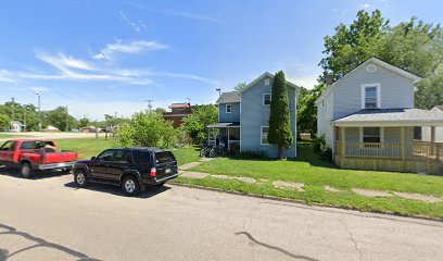
| Description | : | The cemetery was located on the south side of East Church Street between N. Fair Street and Evans Street. In 2002, the location was a school playground. The cemetery is located in Xenia Township, Greene County, Ohio, and is # 4324 (East Church Street Cemetery) in “Ohio Cemeteries 1803-2003”, compiled by the Ohio Genealogical Society. |
frequently asked questions (FAQ):
-
Where is East Church Street Cemetery (Defunct)?
East Church Street Cemetery (Defunct) is located at 535 East Church Street Xenia, Greene County ,Ohio , 45385USA.
-
East Church Street Cemetery (Defunct) cemetery's updated grave count on graveviews.com?
0 memorials
-
Where are the coordinates of the East Church Street Cemetery (Defunct)?
Latitude: 39.6879340
Longitude: -83.9199990
Nearby Cemetories:
1. Methodist Cemetery (Defunct)
Xenia, Greene County, USA
Coordinate: 39.6840640, -83.9184530
2. Gowdy Associate Reformed Cemetery
Xenia, Greene County, USA
Coordinate: 39.6835938, -83.9194183
3. Stand Pipe Cemetery
Xenia, Greene County, USA
Coordinate: 39.6873500, -83.9113330
4. Tornado Victims Memorial Plaque
Xenia, Greene County, USA
Coordinate: 39.6862490, -83.9293760
5. Forsman Cemetery
Xenia, Greene County, USA
Coordinate: 39.6955500, -83.9147300
6. Associate Church Cemetery (Defunct)
Xenia, Greene County, USA
Coordinate: 39.6858860, -83.9334690
7. Woodland Cemetery
Xenia, Greene County, USA
Coordinate: 39.6885986, -83.9400024
8. Ohio Veterans Childrens Home Cemetery
Xenia, Greene County, USA
Coordinate: 39.6710243, -83.9232330
9. Cherry Grove Cemetery
Xenia, Greene County, USA
Coordinate: 39.6810989, -83.9477997
10. Saint Brigid Cemetery
Xenia, Greene County, USA
Coordinate: 39.6828003, -83.9630966
11. Bonner Family Cemetery
Xenia, Greene County, USA
Coordinate: 39.6561500, -83.9393500
12. Davis Cemetery (Defunct)
Xenia, Greene County, USA
Coordinate: 39.6518830, -83.9216730
13. Allen-Hawkins Cemetery
Xenia, Greene County, USA
Coordinate: 39.7040825, -83.9632263
14. Heath Cemetery
Xenia, Greene County, USA
Coordinate: 39.6498489, -83.9073486
15. House Family Cemetery
Xenia, Greene County, USA
Coordinate: 39.7217789, -83.8937454
16. Loyd Cemetery
Xenia, Greene County, USA
Coordinate: 39.6480000, -83.9019000
17. Stevenson Cemetery
Wilberforce, Greene County, USA
Coordinate: 39.7311096, -83.8925171
18. Andrews Farm Cemetery
Xenia, Greene County, USA
Coordinate: 39.7158630, -83.9728760
19. Bell Cemetery
Xenia Township, Greene County, USA
Coordinate: 39.6453018, -83.8865967
20. Hook Cemetery
Xenia Township, Greene County, USA
Coordinate: 39.6428413, -83.8864059
21. Hedges Road Stone
Xenia, Greene County, USA
Coordinate: 39.6499460, -83.9706150
22. Maxey Cemetery
Xenia, Greene County, USA
Coordinate: 39.6333110, -83.9201500
23. McDonald Cemetery
Xenia, Greene County, USA
Coordinate: 39.6410190, -83.8825030
24. Friends Cemetery
Xenia Township, Greene County, USA
Coordinate: 39.7425385, -83.9332275