
| Memorials | : | 2 |
| Location | : | Mankato, Jewell County, USA |
| Coordinate | : | 39.7805700, -98.1940500 |
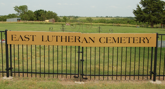
| Description | : | East Lutheran Cemetery is approximately 1/4 mile south of US Highway 36 on Meadow Lark Lane, in Section 23, Township 3 South, Range 8 West (Center Township), Jewell County, Kansas, just east of Mankato. |
frequently asked questions (FAQ):
-
Where is East Lutheran Cemetery?
East Lutheran Cemetery is located at Mankato, Jewell County ,Kansas ,USA.
-
East Lutheran Cemetery cemetery's updated grave count on graveviews.com?
2 memorials
-
Where are the coordinates of the East Lutheran Cemetery?
Latitude: 39.7805700
Longitude: -98.1940500
Nearby Cemetories:
1. Jewell County Farm Cemetery
Mankato, Jewell County, USA
Coordinate: 39.7646294, -98.1841812
2. Saint Theresa Catholic Cemetery
Mankato, Jewell County, USA
Coordinate: 39.7886009, -98.2238998
3. Mount Hope Cemetery
Mankato, Jewell County, USA
Coordinate: 39.7825012, -98.2300034
4. West Lutheran Cemetery
Mankato, Jewell County, USA
Coordinate: 39.7852150, -98.2694250
5. East Buffalo Cemetery
Jewell, Jewell County, USA
Coordinate: 39.7411800, -98.1344400
6. McGehee Cemetery
Jewell, Jewell County, USA
Coordinate: 39.7052994, -98.2502975
7. Steuben Cemetery
Webber, Jewell County, USA
Coordinate: 39.8717330, -98.1301370
8. Delta Cemetery
Jewell County, USA
Coordinate: 39.7961006, -98.0556030
9. Burr Oak Cemetery
Burr Oak, Jewell County, USA
Coordinate: 39.8652992, -98.2846985
10. Pleasant View Cemetery
Montrose, Jewell County, USA
Coordinate: 39.7556000, -98.0539017
11. German Baptist Brethren Cemetery II
Burr Oak, Jewell County, USA
Coordinate: 39.8720860, -98.2786470
12. Jewell City Cemetery
Jewell, Jewell County, USA
Coordinate: 39.6693993, -98.1671982
13. German Baptist Brethren Cemetery I
Burr Oak, Jewell County, USA
Coordinate: 39.8787900, -98.2955400
14. Wallace Cemetery
Jewell, Jewell County, USA
Coordinate: 39.6680984, -98.1046982
15. Pleasant View Cemetery
Jewell County, USA
Coordinate: 39.7666900, -98.3668040
16. Union Cemetery
Burr Oak, Jewell County, USA
Coordinate: 39.6408005, -98.2127991
17. Couch Cemetery
Jewell, Jewell County, USA
Coordinate: 39.6401100, -98.2134094
18. Switzers Gap Cemetery
Jewell County, USA
Coordinate: 39.8422012, -98.0255966
19. Montana Cemetery
Jewell County, USA
Coordinate: 39.9152985, -98.1082993
20. Cleveland Cemetery
Webber, Jewell County, USA
Coordinate: 39.9305992, -98.1939011
21. Baker Cemetery
Jewell County, USA
Coordinate: 39.8581009, -98.3617020
22. Zion Cemetery
Jewell County, USA
Coordinate: 39.7672005, -98.3914032
23. Ionia Cemetery
Ionia, Jewell County, USA
Coordinate: 39.6772003, -98.3574982
24. German Kellner Cemetery
Webber, Jewell County, USA
Coordinate: 39.9437828, -98.2119141