
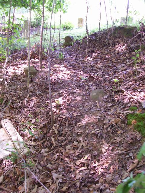
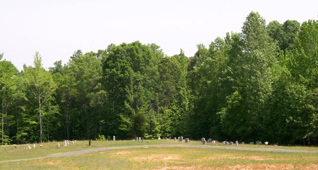
| Memorials | : | 54 |
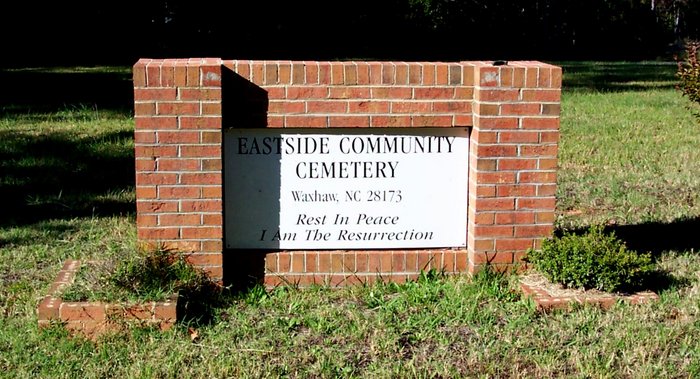
| Location | : | Waxhaw, Union County, USA |
| Coordinate | : | 34.9281883, -80.7384415 |
frequently asked questions (FAQ):
-
Where is Eastside Community Cemetery?
Eastside Community Cemetery is located at Waxhaw, Union County ,North Carolina ,USA.
-
Eastside Community Cemetery cemetery's updated grave count on graveviews.com?
54 memorials
-
Where are the coordinates of the Eastside Community Cemetery?
Latitude: 34.9281883
Longitude: -80.7384415
Nearby Cemetories:
1. Waxhaw City Cemetery
Waxhaw, Union County, USA
Coordinate: 34.9182816, -80.7384415
2. Providence Baptist Church Cemetery
Waxhaw, Union County, USA
Coordinate: 34.9441200, -80.7547200
3. Piney Grove Baptist Church West Cemetery
Waxhaw, Union County, USA
Coordinate: 34.9061356, -80.7312622
4. Price Chapel Baptist Church Cemetery
Waxhaw, Union County, USA
Coordinate: 34.9415283, -80.7617188
5. Waxhaw Baptist Church Cemetery
Waxhaw, Union County, USA
Coordinate: 34.9039001, -80.7251205
6. Ebenezer AME Zion Church Cemetery
Waxhaw, Union County, USA
Coordinate: 34.8974680, -80.7207480
7. Old Union Methodist Church Cemetery
Union County, USA
Coordinate: 34.9676094, -80.7292023
8. Thompson Chapel AME Zion Church Cemetery
Mineral Springs, Union County, USA
Coordinate: 34.9279351, -80.6880677
9. Rehobeth Presbyterian Church Cemetery
Union County, USA
Coordinate: 34.8881645, -80.7605209
10. Our Lady of Grace Catholic Church Cemetery
Indian Land, Lancaster County, USA
Coordinate: 34.9191510, -80.7933580
11. Pleasant Grove United Methodist Church Cemetery
Union County, USA
Coordinate: 34.9538803, -80.6846008
12. Bonds Grove United Methodist Church Cemetery
Waxhaw, Union County, USA
Coordinate: 34.9739609, -80.7715378
13. Walker Cemetery
Union County, USA
Coordinate: 34.9011002, -80.6821976
14. Heath Memorial United Methodist Church Cemetery
Union County, USA
Coordinate: 34.8889046, -80.7834396
15. Union United Methodist Church Cemetery
Union County, USA
Coordinate: 34.9818192, -80.7215424
16. Mineral Springs United Methodist Church Cemetery
Union County, USA
Coordinate: 34.9376678, -80.6666870
17. Center Grove Memorial Park
Indian Land, Lancaster County, USA
Coordinate: 34.9205500, -80.8122100
18. Osceola United Methodist Church Cemetery
Lancaster, Lancaster County, USA
Coordinate: 34.9056920, -80.8091770
19. Steele Hill AME Zion Church Cemetery
Lancaster, Lancaster County, USA
Coordinate: 34.8898697, -80.7984009
20. JAARS Center
Waxhaw, Union County, USA
Coordinate: 34.8645660, -80.7417470
21. Redding Springs AME Zion Church Cemetery
Union County, USA
Coordinate: 34.9911919, -80.7594910
22. McWhorter Family Cemetery
Jackson, Union County, USA
Coordinate: 34.8828011, -80.6800003
23. Old Elbethel AME Zion Church Cemetery
Indian Land, Lancaster County, USA
Coordinate: 34.9631250, -80.8125350
24. Liberty Hill Church Cemetery
Waxhaw, Union County, USA
Coordinate: 34.9895477, -80.6965332