
| Memorials | : | 2 |
| Location | : | Dale County, USA |
| Coordinate | : | 31.4862520, -85.7793040 |
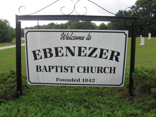
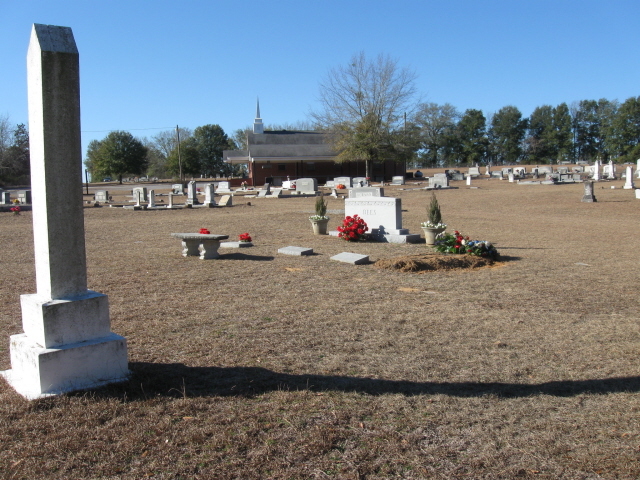
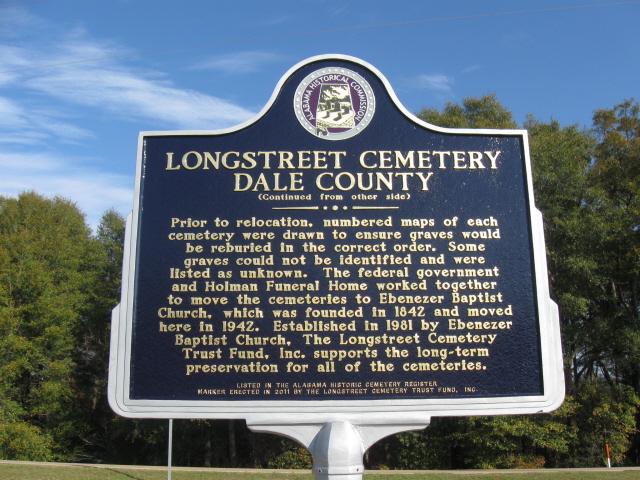
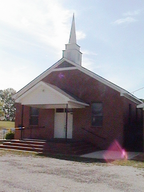
| Description | : | Ebenezer Cemetery is one of 6 cemeteries all located in an area also referred to as Longstreet Historical Cemetery. From Ozark, take US 231 North to CR 36. Turn left on CR 36. Longstreet Historical Cemetery is on the left right after CR 233 intersects CR 36 on the left. CR 233 runs along the south side of Longstreet Historical Cemetery and also intersects the cemetery. Longstreet Historical Cemetery contains six separate cemeteries that were moved to this location in August 1942 during the construction of Fort Rucker. CR 233 intersects Longstreet Historical Cemetery, separating Ebenezer and Zion cemeteries from... Read More |
frequently asked questions (FAQ):
-
Where is Ebenezer Cemetery?
Ebenezer Cemetery is located at Dale County ,Alabama ,USA.
-
Ebenezer Cemetery cemetery's updated grave count on graveviews.com?
2 memorials
-
Where are the coordinates of the Ebenezer Cemetery?
Latitude: 31.4862520
Longitude: -85.7793040


Nearby Cemetories:
1. Longstreet Historical Cemetery
Ozark, Dale County, USA
Coordinate: 31.4864210, -85.7793100
2. Haw Ridge Cemetery
Marley Mill, Dale County, USA
Coordinate: 31.4861030, -85.7802000
3. Mount Liberty Cemetery
Marley Mill, Dale County, USA
Coordinate: 31.4853700, -85.7798600
4. Old Salem Church Cemetery
Ozark, Dale County, USA
Coordinate: 31.4797001, -85.7418976
5. New Tabernacle Cemetery
Coffee County, USA
Coordinate: 31.5135994, -85.8060989
6. Old Tabernacle Cemetery
New Brockton, Coffee County, USA
Coordinate: 31.4953003, -85.8347015
7. Pea River Cemetery
Coffee County, USA
Coordinate: 31.4911003, -85.8403015
8. Prestwood Cemetery
New Hope, Coffee County, USA
Coordinate: 31.5363026, -85.8089752
9. Pleasant Ridge Methodist Cemetery
Ariton, Dale County, USA
Coordinate: 31.5352993, -85.7461014
10. Hopeful Primitive Baptist Cemetery
Ozark, Dale County, USA
Coordinate: 31.4871998, -85.7110977
11. Simmons Family Cemetery
Coffee County, USA
Coordinate: 31.5340460, -85.8273760
12. Pleasant Grove Baptist Church Cemetery
Ozark, Dale County, USA
Coordinate: 31.5078800, -85.7063190
13. Mount Olive Cemetery
Rocky Head, Dale County, USA
Coordinate: 31.5552998, -85.7727966
14. Mossy Grove Cemetery
Dillard, Dale County, USA
Coordinate: 31.5316200, -85.7164383
15. Byrd Cemetery
Dale County, USA
Coordinate: 31.4119780, -85.7208670
16. Woodlawn Memory Gardens
Ozark, Dale County, USA
Coordinate: 31.4648680, -85.6736570
17. Saint John Baptist Church Cemetery
New Hope, Coffee County, USA
Coordinate: 31.5528570, -85.8563520
18. Wesley Chapel Cemetery
Coffee County, USA
Coordinate: 31.4102993, -85.8463974
19. New Hope Cemetery
Coffee County, USA
Coordinate: 31.5536003, -85.8672028
20. New Hope Baptist Church Cemetery
Brundidge, Pike County, USA
Coordinate: 31.5539800, -85.8675100
21. Pleasant Hill Methodist Church Cemetery
Ozark, Dale County, USA
Coordinate: 31.4321995, -85.6742020
22. Claybank Cemetery
Ozark, Dale County, USA
Coordinate: 31.4472008, -85.6616974
23. Westside Cemetery
Ozark, Dale County, USA
Coordinate: 31.4611610, -85.6563150
24. Travelers Rest Cemetery
Ozark, Dale County, USA
Coordinate: 31.4603004, -85.6557999