
| Memorials | : | 0 |
| Location | : | Marley Mill, Dale County, USA |
| Coordinate | : | 31.4853700, -85.7798600 |
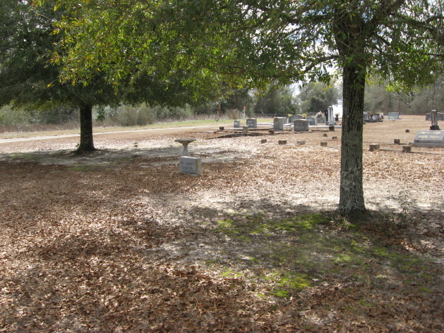
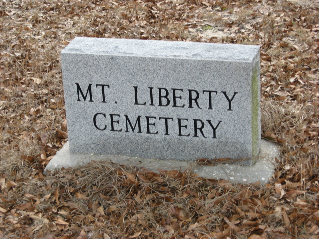
| Description | : | At Ebenezer Church. From Dale County Courthouse, take US 231 North to CR 36 ( 5.3 mi) . Turn left of CR 36 and go to Ebenezer Baptist Church (total distance 11.3 miles.) Organised in 1842 on what later became part of Camp Rucker, were relocated to the Longstreet site in 1942. These graves, laid out in the same order in which they were removed from the old graveyards, were placed in separte cemeteries at Longstreet. Mt. Liberty is south of the church; Hawridge is west of the church: and Zion, and Ebenezer are north of the church.... Read More |
frequently asked questions (FAQ):
-
Where is Mount Liberty Cemetery?
Mount Liberty Cemetery is located at Longstreet community at Ebenezer Church Marley Mill, Dale County ,Alabama ,USA.
-
Mount Liberty Cemetery cemetery's updated grave count on graveviews.com?
0 memorials
-
Where are the coordinates of the Mount Liberty Cemetery?
Latitude: 31.4853700
Longitude: -85.7798600
Nearby Cemetories:
1. Haw Ridge Cemetery
Marley Mill, Dale County, USA
Coordinate: 31.4861030, -85.7802000
2. Ebenezer Cemetery
Dale County, USA
Coordinate: 31.4862520, -85.7793040
3. Longstreet Historical Cemetery
Ozark, Dale County, USA
Coordinate: 31.4864210, -85.7793100
4. Old Salem Church Cemetery
Ozark, Dale County, USA
Coordinate: 31.4797001, -85.7418976
5. New Tabernacle Cemetery
Coffee County, USA
Coordinate: 31.5135994, -85.8060989
6. Old Tabernacle Cemetery
New Brockton, Coffee County, USA
Coordinate: 31.4953003, -85.8347015
7. Pea River Cemetery
Coffee County, USA
Coordinate: 31.4911003, -85.8403015
8. Prestwood Cemetery
New Hope, Coffee County, USA
Coordinate: 31.5363026, -85.8089752
9. Pleasant Ridge Methodist Cemetery
Ariton, Dale County, USA
Coordinate: 31.5352993, -85.7461014
10. Hopeful Primitive Baptist Cemetery
Ozark, Dale County, USA
Coordinate: 31.4871998, -85.7110977
11. Simmons Family Cemetery
Coffee County, USA
Coordinate: 31.5340460, -85.8273760
12. Pleasant Grove Baptist Church Cemetery
Ozark, Dale County, USA
Coordinate: 31.5078800, -85.7063190
13. Mount Olive Cemetery
Rocky Head, Dale County, USA
Coordinate: 31.5552998, -85.7727966
14. Mossy Grove Cemetery
Dillard, Dale County, USA
Coordinate: 31.5316200, -85.7164383
15. Byrd Cemetery
Dale County, USA
Coordinate: 31.4119780, -85.7208670
16. Woodlawn Memory Gardens
Ozark, Dale County, USA
Coordinate: 31.4648680, -85.6736570
17. Saint John Baptist Church Cemetery
New Hope, Coffee County, USA
Coordinate: 31.5528570, -85.8563520
18. Wesley Chapel Cemetery
Coffee County, USA
Coordinate: 31.4102993, -85.8463974
19. New Hope Cemetery
Coffee County, USA
Coordinate: 31.5536003, -85.8672028
20. New Hope Baptist Church Cemetery
Brundidge, Pike County, USA
Coordinate: 31.5539800, -85.8675100
21. Pleasant Hill Methodist Church Cemetery
Ozark, Dale County, USA
Coordinate: 31.4321995, -85.6742020
22. Claybank Cemetery
Ozark, Dale County, USA
Coordinate: 31.4472008, -85.6616974
23. Westside Cemetery
Ozark, Dale County, USA
Coordinate: 31.4611610, -85.6563150
24. Camp Ground Baptist Church Cemetery
Dale County, USA
Coordinate: 31.4186001, -85.6793976