
| Memorials | : | 0 |
| Location | : | St. Francis County, USA |
| Coordinate | : | 34.9306160, -90.8626120 |
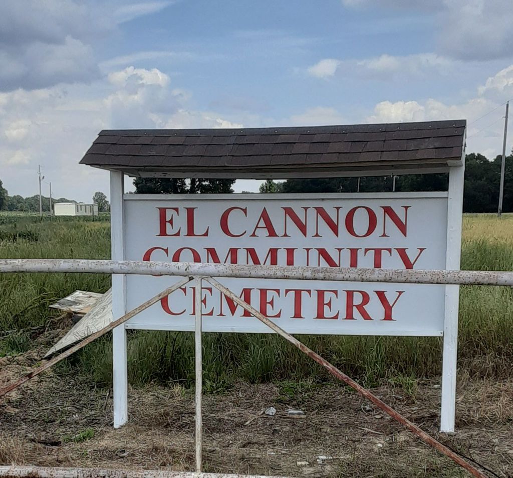
| Description | : | The El Cannon Community Cemetery is an African American cemetery located on SFC road 815 about 5.2 miles off Hwy 70 east in Palestine, Arkansas. This cemetery is associated with the El Cannon Baptist Church located at 2926 SFC 815. Once you pass the church you travel less than 1/2 miles and there you will find the sign (El Cannon Community Cemetery) turn left and travel 1/2 mile. |
frequently asked questions (FAQ):
-
Where is El Cannon Community Cemetery?
El Cannon Community Cemetery is located at St. Francis County ,Arkansas ,USA.
-
El Cannon Community Cemetery cemetery's updated grave count on graveviews.com?
0 memorials
-
Where are the coordinates of the El Cannon Community Cemetery?
Latitude: 34.9306160
Longitude: -90.8626120
Nearby Cemetories:
1. Elcana Cemetery
St. Francis County, USA
Coordinate: 34.9207993, -90.8525009
2. Yocona Cemetery
St. Francis County, USA
Coordinate: 34.9352989, -90.8244019
3. Mount Vernon Baptist Church Cemetery
St. Francis County, USA
Coordinate: 34.9267006, -90.8182983
4. Casteel Cemetery
St. Francis County, USA
Coordinate: 34.9800300, -90.8694400
5. Union Hill Cemetery
St. Francis County, USA
Coordinate: 34.9143982, -90.9242020
6. West Cemetery
Palestine, St. Francis County, USA
Coordinate: 34.9618700, -90.9196400
7. Hopewell Cemetery
Gill, Lee County, USA
Coordinate: 34.8764000, -90.8824997
8. Thomas Cemetery
St. Francis County, USA
Coordinate: 34.9872017, -90.8416977
9. Gill Cemetery
Holub Crossing, Lee County, USA
Coordinate: 34.8807983, -90.9068985
10. Mars Hill Cemetery
Gill, Lee County, USA
Coordinate: 34.8919220, -90.9274760
11. Bell Cemetery
Palestine, St. Francis County, USA
Coordinate: 35.0010986, -90.9068985
12. Forrest Park Cemetery
Forrest City, St. Francis County, USA
Coordinate: 34.9775009, -90.7830963
13. McDonald Cemetery
St. Francis County, USA
Coordinate: 34.9496994, -90.7643967
14. Mound City Cemetery
Lee County, USA
Coordinate: 34.8478012, -90.8439026
15. Henderson Cemetery
St. Francis County, USA
Coordinate: 34.9808006, -90.7722015
16. Forrest City Cemetery New
Forrest City, St. Francis County, USA
Coordinate: 34.9836080, -90.7745360
17. Forrest City Cemetery
Forrest City, St. Francis County, USA
Coordinate: 35.0046997, -90.7806015
18. Shady Grove Cemetery
Forrest City, St. Francis County, USA
Coordinate: 34.9340300, -90.7361500
19. Andrews-Haynie Cemetery
Lee County, USA
Coordinate: 34.8622017, -90.7649994
20. Robert Brown Sr Family Cemetery
Forrest City, St. Francis County, USA
Coordinate: 35.0215570, -90.7941820
21. Purifoy Cemetery
Forrest City, St. Francis County, USA
Coordinate: 35.0086890, -90.7719610
22. Mount Zion Cemetery
St. Francis County, USA
Coordinate: 34.9674988, -90.7319031
23. Mount Vernon Cemetery
Forrest City, St. Francis County, USA
Coordinate: 35.0250015, -90.7830963
24. Clay Hill Cemetery West
Lee County, USA
Coordinate: 34.8779010, -90.7320920