
| Memorials | : | 0 |
| Location | : | St. Francis County, USA |
| Coordinate | : | 34.9267006, -90.8182983 |
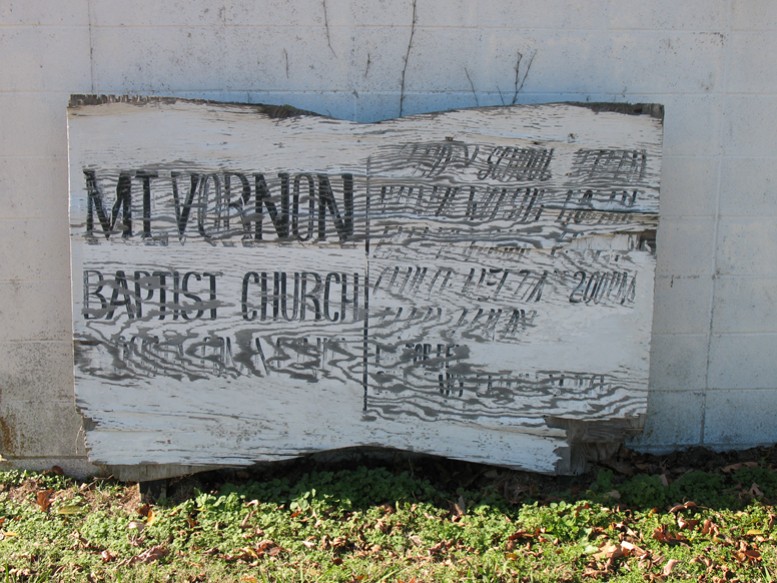
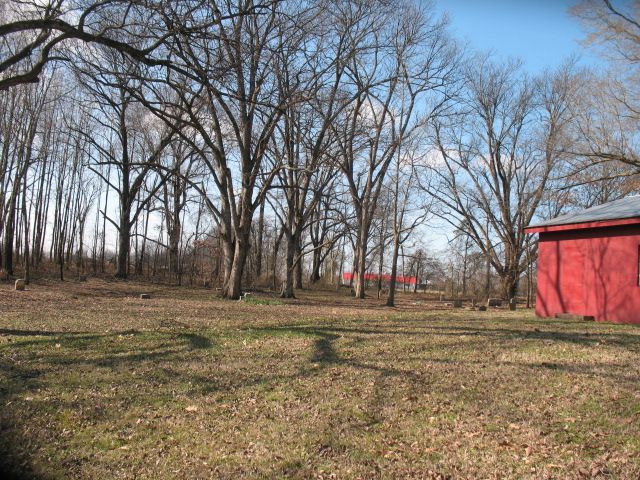
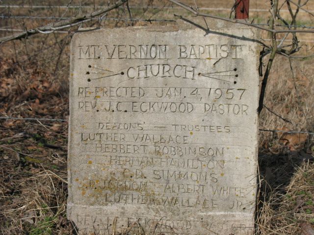
| Description | : | Mount Vernon Is an African American cemetery located on Yocona road (SFC 801), west of Forrest City, Arkansas. Mt Vernon is on the church grounds of the Mt. Vernon M B Church. The church has been abandoned and the owner of the land is using it for storage. |
frequently asked questions (FAQ):
-
Where is Mount Vernon Baptist Church Cemetery?
Mount Vernon Baptist Church Cemetery is located at St. Francis County ,Arkansas ,USA.
-
Mount Vernon Baptist Church Cemetery cemetery's updated grave count on graveviews.com?
0 memorials
-
Where are the coordinates of the Mount Vernon Baptist Church Cemetery?
Latitude: 34.9267006
Longitude: -90.8182983
Nearby Cemetories:
1. Yocona Cemetery
St. Francis County, USA
Coordinate: 34.9352989, -90.8244019
2. Elcana Cemetery
St. Francis County, USA
Coordinate: 34.9207993, -90.8525009
3. El Cannon Community Cemetery
St. Francis County, USA
Coordinate: 34.9306160, -90.8626120
4. McDonald Cemetery
St. Francis County, USA
Coordinate: 34.9496994, -90.7643967
5. Forrest Park Cemetery
Forrest City, St. Francis County, USA
Coordinate: 34.9775009, -90.7830963
6. Thomas Cemetery
St. Francis County, USA
Coordinate: 34.9872017, -90.8416977
7. Henderson Cemetery
St. Francis County, USA
Coordinate: 34.9808006, -90.7722015
8. Forrest City Cemetery New
Forrest City, St. Francis County, USA
Coordinate: 34.9836080, -90.7745360
9. Shady Grove Cemetery
Forrest City, St. Francis County, USA
Coordinate: 34.9340300, -90.7361500
10. Casteel Cemetery
St. Francis County, USA
Coordinate: 34.9800300, -90.8694400
11. Hopewell Cemetery
Gill, Lee County, USA
Coordinate: 34.8764000, -90.8824997
12. Andrews-Haynie Cemetery
Lee County, USA
Coordinate: 34.8622017, -90.7649994
13. Mound City Cemetery
Lee County, USA
Coordinate: 34.8478012, -90.8439026
14. Mount Zion Cemetery
St. Francis County, USA
Coordinate: 34.9674988, -90.7319031
15. Forrest City Cemetery
Forrest City, St. Francis County, USA
Coordinate: 35.0046997, -90.7806015
16. Clay Hill Cemetery West
Lee County, USA
Coordinate: 34.8779010, -90.7320920
17. Gill Cemetery
Holub Crossing, Lee County, USA
Coordinate: 34.8807983, -90.9068985
18. Union Hill Cemetery
St. Francis County, USA
Coordinate: 34.9143982, -90.9242020
19. Clay Hill Cemetery
Lee County, USA
Coordinate: 34.8772011, -90.7285995
20. Wylds Family Cemetery
St. Francis County, USA
Coordinate: 34.9472008, -90.7118988
21. West Cemetery
Palestine, St. Francis County, USA
Coordinate: 34.9618700, -90.9196400
22. Purifoy Cemetery
Forrest City, St. Francis County, USA
Coordinate: 35.0086890, -90.7719610
23. Mars Hill Cemetery
Gill, Lee County, USA
Coordinate: 34.8919220, -90.9274760
24. Robert Brown Sr Family Cemetery
Forrest City, St. Francis County, USA
Coordinate: 35.0215570, -90.7941820