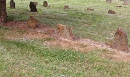
| Memorials | : | 0 |
| Location | : | Graball, Gibson County, USA |
| Description | : | From Highway 45 just south of Greenway Nursery turn East on to Graball Road heading towards Lavinia. You will pass a major road headed north at about 1 1/2 miles that leads to Area F. Area A is due south. Remain on the main road and do not take the loop that runs parallel to the south. Continue about 1/2 mile and completely passing the first lines of Igloos and look for a small road going north. It goes directly to the Elam Slave Burial Ground. If you follow this road further it will... Read More |
frequently asked questions (FAQ):
-
Where is Elam Slave Burial Ground?
Elam Slave Burial Ground is located at No GPS information available Add GPSGraball Lavinia Road Graball, Gibson County ,Tennessee , 38358USA.
-
Elam Slave Burial Ground cemetery's updated grave count on graveviews.com?
0 memorials
Nearby Cemetories:
1. Bethpage Baptist Church Cemetery
Gibson County, USA
Coordinate: 35.9706001, -89.0980988
2. Friendship Grove MB Church Cemetery
Brazil, Gibson County, USA
Coordinate: 35.8925018, -89.0606003
3. Old Beulah Cemetery
Brazil, Gibson County, USA
Coordinate: 36.1050010, -88.8742630
4. Zion Cemetery
Brazil, Gibson County, USA
Coordinate: 36.1061400, -88.8737340
5. Follis Chapel Cemetery
Gibson County, USA
Coordinate: 36.0402985, -88.7397003
6. Davis Family Cemetery
Frog Jump, Gibson County, USA
Coordinate: 36.0756030, -88.8239690
7. Jones Family Cemetery
Frog Jump, Gibson County, USA
Coordinate: 36.0511110, -88.8449340
8. Moore's Chapel Cemetery
Moores Chapel, Gibson County, USA
Coordinate: 36.0451750, -88.8527140
9. Union United Methodist Cemetery
Gibson County, USA
Coordinate: 36.0822690, -88.7552980
10. Veazey Cemetery
Gibson County, USA
Coordinate: 36.0936012, -88.8255997
11. Watson Cemetery
Gibson County, USA
Coordinate: 36.0161018, -88.7928009
12. Williams Chapel Cemetery
Gibson County, USA
Coordinate: 36.0677210, -88.7398220
13. Wilson Cemetery
Gibson County, USA
Coordinate: 35.9706001, -89.0980988
14. Bowers Chapel Cemetery
Gibson County, USA
Coordinate: 35.8925018, -89.0606003
15. Antioch Cumberland Presbyterian Cemetery
Bradford, Gibson County, USA
Coordinate: 36.1050010, -88.8742630
16. Antioch Methodist Cemetery
Bradford, Gibson County, USA
Coordinate: 36.1061400, -88.8737340
17. Belews Chapel Cemetery
Bradford, Gibson County, USA
Coordinate: 36.0402985, -88.7397003
18. Bradford Cemetery
Bradford, Gibson County, USA
Coordinate: 36.0756030, -88.8239690
19. Church of Jesus Christ Cemetery
Bradford, Gibson County, USA
Coordinate: 36.0511110, -88.8449340
20. Davis Grove Cemetery
Bradford, Gibson County, USA
Coordinate: 36.0451750, -88.8527140
21. Holt Family Cemetery
Bradford, Gibson County, USA
Coordinate: 36.0822690, -88.7552980
22. Locust Grove Church of Christ Cemetery
Bradford, Gibson County, USA
Coordinate: 36.0936012, -88.8255997
23. Mount Pisgah Baptist Church Cemetery
Bradford, Gibson County, USA
Coordinate: 36.0161018, -88.7928009
24. Mount Pleasant Cemetery
Bradford, Gibson County, USA
Coordinate: 36.0677210, -88.7398220

