
| Memorials | : | 28 |
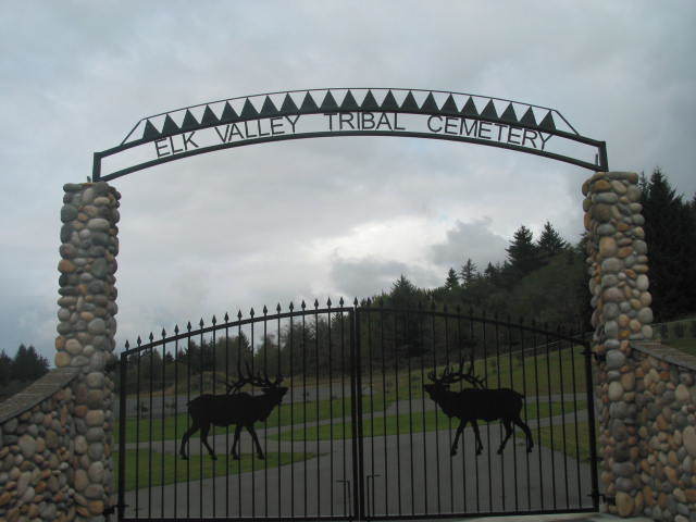
| Location | : | Crescent City, Del Norte County, USA |
| Coordinate | : | 41.7583340, -124.1468200 |
| Description | : | East of Casino, on way to Stout Grove. |
frequently asked questions (FAQ):
-
Where is Elk Valley Tribal Cemetery?
Elk Valley Tribal Cemetery is located at 3000 Howland Hill Road Crescent City, Del Norte County ,California ,USA.
-
Elk Valley Tribal Cemetery cemetery's updated grave count on graveviews.com?
14 memorials
-
Where are the coordinates of the Elk Valley Tribal Cemetery?
Latitude: 41.7583340
Longitude: -124.1468200
Nearby Cemetories:
1. Old County Cemetery
Crescent City, Del Norte County, USA
Coordinate: 41.7618010, -124.1992180
2. IOOF Cemetery
Crescent City, Del Norte County, USA
Coordinate: 41.7624290, -124.2002800
3. Veterans Memorial Cemetery
Crescent City, Del Norte County, USA
Coordinate: 41.7635380, -124.2008630
4. Saint Josephs Catholic Cemetery
Crescent City, Del Norte County, USA
Coordinate: 41.7641460, -124.2019310
5. Brother Jonathan Cemetery
Crescent City, Del Norte County, USA
Coordinate: 41.7508011, -124.2099991
6. Brother Jonathan Memorial
Crescent City, Del Norte County, USA
Coordinate: 41.7507030, -124.2112270
7. Camp Lincoln Cemetery
Del Norte County, USA
Coordinate: 41.8196560, -124.1351820
8. Forest Sky Clayberger Burial Site
Crescent City, Del Norte County, USA
Coordinate: 41.8583200, -124.2139690
9. Yontocket Indian Village Memorial Cemetery
Del Norte County, USA
Coordinate: 41.9071999, -124.1958008
10. Madame Gasquet Cemetery
Gasquet, Del Norte County, USA
Coordinate: 41.8497420, -123.9677980
11. Smith River Cemetery
Smith River, Del Norte County, USA
Coordinate: 41.9265640, -124.1557540
12. French Hill Cemetery
Gasquet, Del Norte County, USA
Coordinate: 41.8252200, -123.9244800
13. How-On-Quet Cemetery
Del Norte County, USA
Coordinate: 41.9553170, -124.2067690
14. Spott Family Cemetery
Requa, Del Norte County, USA
Coordinate: 41.5487900, -124.0719200
15. Gensaw Hill Cemetery
Requa, Del Norte County, USA
Coordinate: 41.5470560, -124.0672730
16. Williams Family Cemetery
Klamath, Del Norte County, USA
Coordinate: 41.5339230, -124.0783800
17. Costelloe Cemetery
Curry County, USA
Coordinate: 42.0148780, -124.1127480
18. Resighini Rancheria Tribal Cemetery
Del Norte County, USA
Coordinate: 41.5131730, -124.0226410
19. Hanzicker Grave
Brookings, Curry County, USA
Coordinate: 42.0264310, -124.0097460
20. Oceanview Cemetery
Harbor, Curry County, USA
Coordinate: 42.0424200, -124.2463400
21. Van Pelt Cemetery
Harbor, Curry County, USA
Coordinate: 42.0480995, -124.2489014
22. Saint Timothys Episcopal Church Memorial Garden
Brookings, Curry County, USA
Coordinate: 42.0570560, -124.2757830
23. Old Brookings Cemetery
Brookings, Curry County, USA
Coordinate: 42.0619130, -124.2775670
24. Ward Memorial Cemetery
Brookings, Curry County, USA
Coordinate: 42.0681000, -124.2818985