| Memorials | : | 0 |
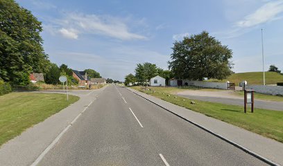
| Location | : | Nørresundby, Aalborg Kommune, Denmark |
| Coordinate | : | 54.9955100, 12.4012400 |
| Description | : | Cemetery is located at Elmelunde Church in Elmelunde, Denmark. Correct location is Elmelunde Kirkegaard, Elmelunde Sogn, Mønbo Herred, Præstø Amount, Denmark. We had to list a city to create the cemetery and will correct the city when FAG gets their database updated. |
frequently asked questions (FAQ):
-
Where is Elmelunde Church Cemetery?
Elmelunde Church Cemetery is located at Nørresundby, Aalborg Kommune ,Nordjylland ,Denmark.
-
Elmelunde Church Cemetery cemetery's updated grave count on graveviews.com?
0 memorials
-
Where are the coordinates of the Elmelunde Church Cemetery?
Latitude: 54.9955100
Longitude: 12.4012400
Nearby Cemetories:
1. Borre Cemetery
Borre, Vordingborg Kommune, Denmark
Coordinate: 54.9956200, 12.4473400
2. Stege Kirkegård
Stege, Vordingborg Kommune, Denmark
Coordinate: 54.9886630, 12.2894830
3. Bogø Graveyard
Bogo By, Vordingborg Kommune, Denmark
Coordinate: 54.9321090, 12.0482920
4. Præstø Kirkegård
Praesto, Vordingborg Kommune, Denmark
Coordinate: 55.1233328, 12.0482835
5. Beldringe Churchyard
Praesto, Vordingborg Kommune, Denmark
Coordinate: 55.1066900, 11.9968500
6. Hylleholt Cemetery
Fakse Ladeplads, Faxe Kommune, Denmark
Coordinate: 55.2168200, 12.1642300
7. Falkerslev Cemetery
Falkerslev, Guldborgsund Kommune, Denmark
Coordinate: 54.8361740, 11.9999790
8. Store Spjellerup Cemetery
Store Spjellerup, Faxe Kommune, Denmark
Coordinate: 55.2734340, 12.2254910
9. Moltke Burial Chapel in Karise Church
Karise, Faxe Kommune, Denmark
Coordinate: 55.2453413, 12.1140072
10. Faxe Church Cemetery
Faxe Kommune, Denmark
Coordinate: 55.2552000, 12.1202000
11. Sogns Graverkontor
Store Heddinge, Stevns Kommune, Denmark
Coordinate: 55.3150400, 12.3923900
12. Hammer Kirke
Naestved, Næstved Kommune, Denmark
Coordinate: 55.1454222, 11.8716044
13. Brarup Cemetery
Barup, Guldborgsund Kommune, Denmark
Coordinate: 54.8824460, 11.8072460
14. Magleby Kirke
Klippinge, Stevns Kommune, Denmark
Coordinate: 55.3635600, 12.3370800
15. Østre Kirkegård
Nykobing Falster, Guldborgsund Kommune, Denmark
Coordinate: 54.7589220, 11.8754610
16. Svino Churchyard
Svino, Vordingborg Kommune, Denmark
Coordinate: 55.1087440, 11.7535440
17. Freerslev kirkegård
Haslev, Faxe Kommune, Denmark
Coordinate: 55.3253860, 12.0159610
18. Herfølge Kirkegård
Herfolge, Køge Kommune, Denmark
Coordinate: 55.4173880, 12.1485338
19. Tårs Church Cemetery
Sakskøbing, Guldborgsund Kommune, Denmark
Coordinate: 54.8307992, 11.6394398
20. Sakskøbing Cemetery
Sakskøbing, Guldborgsund Kommune, Denmark
Coordinate: 54.7991677, 11.6295786
21. Skanör Church Cemetery
Skanor, Vellinge kommun, Sweden
Coordinate: 55.4196560, 12.8497240
22. Claras Kirkegaard
Koge, Køge Kommune, Denmark
Coordinate: 55.4650000, 12.1000000
23. Hunseby Kirke
Hunseby, Lolland Kommune, Denmark
Coordinate: 54.7983330, 11.5147220
24. Flädie Cemetery
Lomma kommun, Sweden
Coordinate: 55.4333000, 13.0413000

