
| Memorials | : | 0 |
| Location | : | Grantsville, Garrett County, USA |
| Coordinate | : | 39.6656860, -79.1549920 |
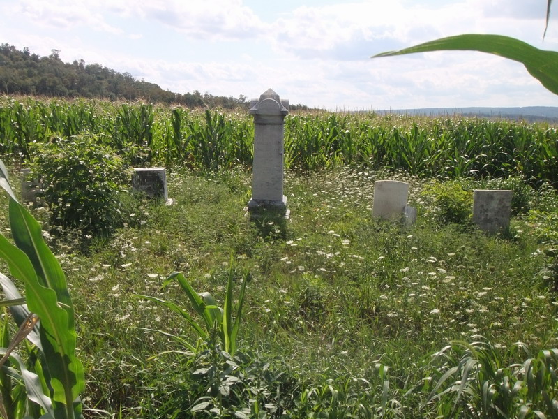
| Description | : | Cemetery located on the former Engle Farm, currently owned and operated by Wayne Mast and family on Hare Hollow Road. Private property. Please ask for permission before visiting cemetery. |
frequently asked questions (FAQ):
-
Where is Engle Cemetery?
Engle Cemetery is located at Grantsville, Garrett County ,Maryland ,USA.
-
Engle Cemetery cemetery's updated grave count on graveviews.com?
0 memorials
-
Where are the coordinates of the Engle Cemetery?
Latitude: 39.6656860
Longitude: -79.1549920
Nearby Cemetories:
1. Custer Cemetery
Garrett County, USA
Coordinate: 39.6720990, -79.1497030
2. Maple Grove Cemetery
Jennings, Garrett County, USA
Coordinate: 39.6737800, -79.1627000
3. Otto Cemetery
Jennings, Garrett County, USA
Coordinate: 39.6772970, -79.1577550
4. Wiland Farm Cemetery
Grantsville, Garrett County, USA
Coordinate: 39.6855900, -79.1663600
5. Eli Ridgeley Amish Cemetery
Garrett County, USA
Coordinate: 39.6662800, -79.1861300
6. Grantsville Cemetery
Grantsville, Garrett County, USA
Coordinate: 39.6949997, -79.1641998
7. Davies Family Cemetery
Grantsville, Garrett County, USA
Coordinate: 39.6770100, -79.1064200
8. Wilburn Cemetery
Jennings, Garrett County, USA
Coordinate: 39.6397200, -79.1937000
9. Maple Glen Cemetery
Grantsville, Garrett County, USA
Coordinate: 39.7061005, -79.1511002
10. Negro Mountain Cemetery
Garrett County, USA
Coordinate: 39.6697006, -79.2118988
11. Laughlin Church Cemetery
Grantsville, Garrett County, USA
Coordinate: 39.6702400, -79.2125900
12. Mount Beulah Methodist Church Cemetery
Garrett County, USA
Coordinate: 39.6376200, -79.1058100
13. Trinity Cemetery
Grantsville, Garrett County, USA
Coordinate: 39.6380997, -79.1050034
14. New Germany Methodist Cemetery
Grantsville, Garrett County, USA
Coordinate: 39.6382600, -79.1044400
15. Jesse Tomlinson Cemetery
Grantsville, Garrett County, USA
Coordinate: 39.6995620, -79.0961020
16. Amos J. Yoder Old Burial Ground
Elk Lick Township, Somerset County, USA
Coordinate: 39.7256000, -79.1539000
17. Oak Grove Mennonite Cemetery
Garrett County, USA
Coordinate: 39.7096550, -79.2110820
18. Beachy Grave Yard
Elk Lick Township, Somerset County, USA
Coordinate: 39.7283000, -79.1274000
19. Saint Ann's Cemetery
Avilton, Garrett County, USA
Coordinate: 39.6611190, -79.0660840
20. Dung Hill Cemetery
Garrett County, USA
Coordinate: 39.6302986, -79.2316971
21. Merrbach Cemetery
Garrett County, USA
Coordinate: 39.6893997, -79.0674973
22. Niverton Amish Cemetery
Niverton, Somerset County, USA
Coordinate: 39.7368340, -79.1257480
23. Hershberger Graveyard
Elk Lick Township, Somerset County, USA
Coordinate: 39.7380680, -79.1311060
24. Weitzell Cemetery
New Germany, Garrett County, USA
Coordinate: 39.5945690, -79.1222050