
| Memorials | : | 0 |
| Location | : | Columbia, Richland County, USA |
| Coordinate | : | 34.0569680, -80.9173300 |
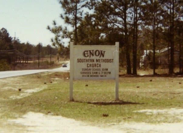
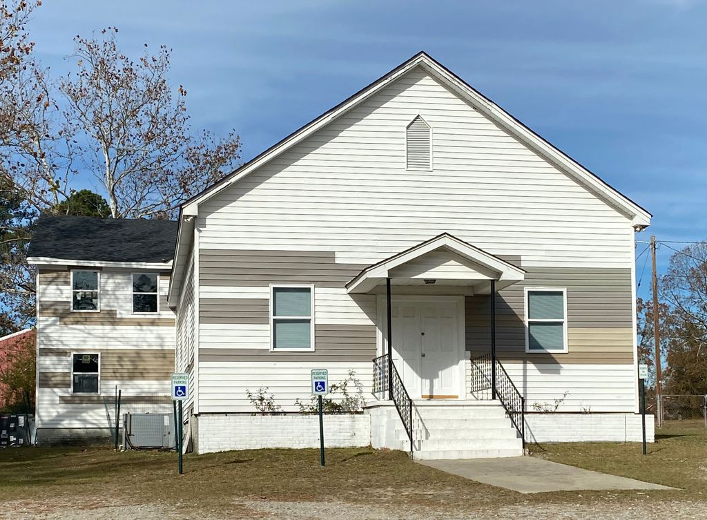
| Description | : | Enon Southern Methodist Church and cemetery were originally located on what is now Fort Jackson. Fort Jackson, originally named Camp Jackson after President Andrew Jackson, a South Carolina native, was established in 1917. In 1940 the base became permanent and was renamed Fort Jackson. After the federal government took over the farms, homes, stores and churches in that area to permanently establish the army base, Enon church moved to Percival Road. The families of the deceased in these cemeteries at the fort were contacted and given the option of... Read More |
frequently asked questions (FAQ):
-
Where is Enon Southern Methodist Church Cemetery?
Enon Southern Methodist Church Cemetery is located at 2215 Percival Road Columbia, Richland County ,South Carolina , 29223USA.
-
Enon Southern Methodist Church Cemetery cemetery's updated grave count on graveviews.com?
0 memorials
-
Where are the coordinates of the Enon Southern Methodist Church Cemetery?
Latitude: 34.0569680
Longitude: -80.9173300
Nearby Cemetories:
1. Old Macedonia Cemetery
Columbia, Richland County, USA
Coordinate: 34.0664260, -80.9073220
2. Alpine Baptist Church Cemetery
Columbia, Richland County, USA
Coordinate: 34.0650500, -80.9053840
3. Corley Chapel Cemetery
Columbia, Richland County, USA
Coordinate: 34.0749454, -80.9081729
4. Beulah Church Cemetery
Boyden Arbor, Richland County, USA
Coordinate: 34.0421982, -80.9332962
5. Midway Methodist Church Cemetery
Columbia, Richland County, USA
Coordinate: 34.0756080, -80.8983890
6. Macedonia Cemetery
Richland County, USA
Coordinate: 34.0483017, -80.8846970
7. Jackson Creek Baptist Church Cemetery
Dentsville, Richland County, USA
Coordinate: 34.0807710, -80.9405490
8. James Hammond Cemetery
Richland County, USA
Coordinate: 34.0263450, -80.9085110
9. Macedonia Baptist Church Cemetery
Columbia, Richland County, USA
Coordinate: 34.0322000, -80.9415000
10. Enon Cemetery
Columbia, Richland County, USA
Coordinate: 34.0661011, -80.8788986
11. Beth Shalom Arcadia Lakes Cemetery
Columbia, Richland County, USA
Coordinate: 34.0487840, -80.9583910
12. Rehoboth United Methodist Church
Richland County, USA
Coordinate: 34.0618640, -80.9611580
13. Forest Lake Presbyterian Church Memorial Garden
Columbia, Richland County, USA
Coordinate: 34.0457610, -80.9604940
14. LeGrand Road Cemetery
Columbia, Richland County, USA
Coordinate: 34.0895000, -80.9479300
15. Saint Davids Episcopal Church Cemetery
Columbia, Richland County, USA
Coordinate: 34.0961790, -80.8929210
16. Northeast Presbyterian Church Cemetery
Columbia, Richland County, USA
Coordinate: 34.0961690, -80.8919480
17. Ford Family Graves
Columbia, Richland County, USA
Coordinate: 34.0919930, -80.8771630
18. Saint John Neumann Catholic Church Cemetery
Columbia, Richland County, USA
Coordinate: 34.1033800, -80.8967150
19. Rials Family Cemetery
Forest Acres, Richland County, USA
Coordinate: 34.0401070, -80.9737340
20. Landrum-Stork Cemetery
Columbia, Richland County, USA
Coordinate: 34.0384820, -80.9745280
21. Cook Cemetery
Columbia, Richland County, USA
Coordinate: 34.0497220, -80.9809250
22. Saint Wesberry High Hill Cemetery
Horrell Hill, Richland County, USA
Coordinate: 34.0150400, -80.8758480
23. Bethel United Methodist Church Cemetery
Columbia, Richland County, USA
Coordinate: 34.0252080, -80.9710780
24. Spring Valley Pentecostal Holiness Church Cemetery
Pontiac, Richland County, USA
Coordinate: 34.1100630, -80.8961530