
| Memorials | : | 0 |
| Location | : | Ermreuth, Landkreis Forchheim, Germany |
| Phone | : | 09134- 70541 |
| Website | : | www.synagoge-museum-ermreuth.de |
| Coordinate | : | 49.6406320, 11.1918430 |
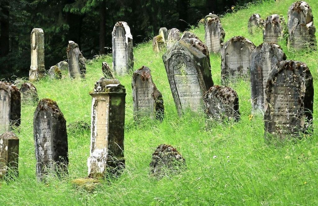
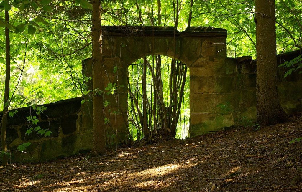
| Description | : | The historic Ermreuth Jewish cemetery is located in a picturesque landscape on Berg gegen Pommer about 1 mile northwest of the village of Ermreuth, halfway between Ermreuth and Pommer. The triangular shaped 28416.72 foot² cemetery site is surrounded by orchards and forests on the slope of the Heinbühl. Information on the cemetery can be obtained at the town museum and cultural center located in the renovated 1713 synagogue building. |
frequently asked questions (FAQ):
-
Where is Ermreuth Judenfriedhof?
Ermreuth Judenfriedhof is located at Wagnergasse 8 Ermreuth, Landkreis Forchheim ,Bavaria (Bayern) , 91077Germany.
-
Ermreuth Judenfriedhof cemetery's updated grave count on graveviews.com?
0 memorials
-
Where are the coordinates of the Ermreuth Judenfriedhof?
Latitude: 49.6406320
Longitude: 11.1918430
Nearby Cemetories:
1. Gräfenberg
Grafenberg, Landkreis Forchheim, Germany
Coordinate: 49.6440436, 11.2505282
2. St. Boniface
Weissenohe, Landkreis Forchheim, Germany
Coordinate: 49.6294440, 11.2533330
3. Bach in Eckental
Forth, Landkreis Erlangen-Hochstädt, Germany
Coordinate: 49.5896017, 11.2027805
4. Friedhof Forth
Forth, Landkreis Erlangen-Hochstädt, Germany
Coordinate: 49.5937920, 11.2308580
5. Friedhof Mittelehrenbach
Mittelehrenbach, Landkreis Forchheim, Germany
Coordinate: 49.6938970, 11.1719740
6. Friedhof Eckenhaid
Eckenhaid, Landkreis Erlangen-Hochstädt, Germany
Coordinate: 49.5762031, 11.2194221
7. Friedhof Eschenau
Eschenau, Landkreis Erlangen-Hochstädt, Germany
Coordinate: 49.5735022, 11.2071038
8. Friedhof St. Nikolaus Pinzberg
Pinzberg, Landkreis Forchheim, Germany
Coordinate: 49.6900209, 11.1018736
9. Hiltpoltstein
Hiltpoltstein, Landkreis Forchheim, Germany
Coordinate: 49.6576224, 11.3191882
10. Friedhof Kersbach
Kersbach, Landkreis Forchheim, Germany
Coordinate: 49.6790766, 11.0690829
11. Forchheim - Friedhof Reuth
Forchheim, Landkreis Forchheim, Germany
Coordinate: 49.7224260, 11.1143880
12. Friedhof Baiersdorf
Baiersdorf, Landkreis Erlangen-Hochstädt, Germany
Coordinate: 49.6585358, 11.0339612
13. Pretzfeld Jüdischer Friedhof
Pretzfeld, Landkreis Forchheim, Germany
Coordinate: 49.7470650, 11.1844830
14. Forchheim - Neuer Friedhof
Forchheim, Landkreis Forchheim, Germany
Coordinate: 49.7233800, 11.0657400
15. Forchheim - Alter Friedhof
Forchheim, Landkreis Forchheim, Germany
Coordinate: 49.7238830, 11.0621380
16. Altstädter Friedhof
Erlangen, Stadtkreis Erlangen, Germany
Coordinate: 49.6022060, 10.9993150
17. Neustädter Friedhof
Erlangen, Stadtkreis Erlangen, Germany
Coordinate: 49.5939050, 10.9999530
18. Ehrenfriedhof
Erlangen, Stadtkreis Erlangen, Germany
Coordinate: 49.5930945, 10.9988815
19. Zentralfriedhof Erlangen
Erlangen, Stadtkreis Erlangen, Germany
Coordinate: 49.5888990, 10.9969920
20. Friedhof
Lauf an der Pegnitz, Nürnberger Land, Germany
Coordinate: 49.5135466, 11.2812387
21. Erlangen Bruck Friedhof
Erlangen, Stadtkreis Erlangen, Germany
Coordinate: 49.5715490, 10.9891740
22. Friedhof Betzenstein
Betzenstein, Landkreis Bayreuth, Germany
Coordinate: 49.6850619, 11.4198669
23. Friedhof Nürnberg-Kraftshof
Kraftshof, Stadtkreis Nürnberg, Germany
Coordinate: 49.5111396, 11.0540553
24. Pfarrkirche St. Martin Friedhof Eggolsheim
Eggolsheim, Landkreis Forchheim, Germany
Coordinate: 49.7722188, 11.0580208