
| Memorials | : | 343 |
| Location | : | Esbon, Jewell County, USA |
| Coordinate | : | 39.8143997, -98.4199982 |
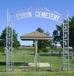
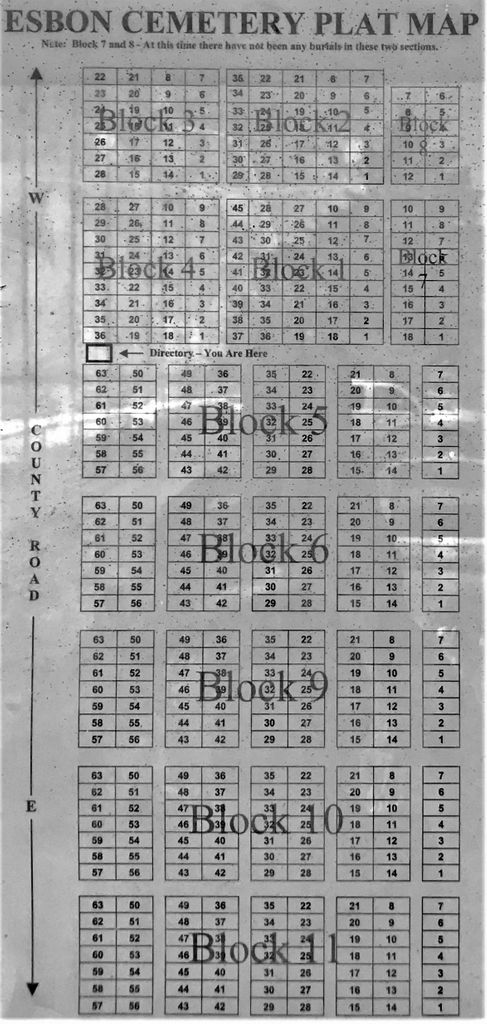
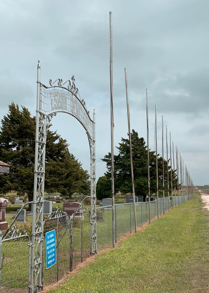
| Description | : | Esbon Cemetery is located approximately 2 1/2 miles due east of Esbon. Coming from Mankato, KS on US Highway 36 go 18 miles west to the Esbon turn off on Kansas Highway 112 by turning right (north). Go 2 miles to where highway makes a 90 degree turn. Turn right (east) on to dirt road and drive 1/2 mile to the cemetery on the north side of road. Note the roofed structure in picture. This contains a bulletin board with a alphabetized list of interments with death date, block number, lot number and space number for each grave. A cemetery... Read More |
frequently asked questions (FAQ):
-
Where is Esbon Cemetery?
Esbon Cemetery is located at Esbon, Jewell County ,Kansas ,USA.
-
Esbon Cemetery cemetery's updated grave count on graveviews.com?
343 memorials
-
Where are the coordinates of the Esbon Cemetery?
Latitude: 39.8143997
Longitude: -98.4199982
Nearby Cemetories:
1. Saint Elizabeth Cemetery
Esbon, Jewell County, USA
Coordinate: 39.7844009, -98.4347000
2. Prairie Home Cemetery
Esbon, Jewell County, USA
Coordinate: 39.8278008, -98.4661026
3. Zion Cemetery
Jewell County, USA
Coordinate: 39.7672005, -98.3914032
4. Baker Cemetery
Jewell County, USA
Coordinate: 39.8581009, -98.3617020
5. Pleasant View Cemetery
Jewell County, USA
Coordinate: 39.7666900, -98.3668040
6. Providence Cemetery
Jewell County, USA
Coordinate: 39.8866997, -98.4008026
7. Salem Cemetery
Esbon, Jewell County, USA
Coordinate: 39.8755989, -98.5006027
8. Oak Creek Cemetery
Jewell County, USA
Coordinate: 39.9014015, -98.3918991
9. Baxter Cemetery
Ionia, Jewell County, USA
Coordinate: 39.7158420, -98.4158680
10. Sweet Home Cemetery
Lebanon, Smith County, USA
Coordinate: 39.7854830, -98.5465380
11. Amity Cemetery
Jewell County, USA
Coordinate: 39.9153170, -98.4673780
12. Pleasant Plains Cemetery
Lebanon, Smith County, USA
Coordinate: 39.8793400, -98.5419400
13. German Baptist Brethren Cemetery I
Burr Oak, Jewell County, USA
Coordinate: 39.8787900, -98.2955400
14. Burr Oak Cemetery
Burr Oak, Jewell County, USA
Coordinate: 39.8652992, -98.2846985
15. Odessa Cemetery
Jewell County, USA
Coordinate: 39.7124100, -98.4953613
16. West Lutheran Cemetery
Mankato, Jewell County, USA
Coordinate: 39.7852150, -98.2694250
17. German Baptist Brethren Cemetery II
Burr Oak, Jewell County, USA
Coordinate: 39.8720860, -98.2786470
18. Walnut Creek Friends Cemetery
Northbranch, Jewell County, USA
Coordinate: 39.9298800, -98.3436400
19. Old Highland Township Cemetery
Jewell County, USA
Coordinate: 39.9430600, -98.4458900
20. Price Cemetery
Oak Township, Smith County, USA
Coordinate: 39.7986860, -98.5993060
21. Conservative Friends Cemetery
Jewell County, USA
Coordinate: 39.9448800, -98.3527500
22. Ionia Cemetery
Ionia, Jewell County, USA
Coordinate: 39.6772003, -98.3574982
23. Mount Hope Cemetery
Mankato, Jewell County, USA
Coordinate: 39.7825012, -98.2300034
24. Highland Cemetery
Jewell County, USA
Coordinate: 39.9660988, -98.4300003