| Memorials | : | 0 |
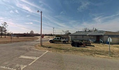
| Location | : | Harrah, Oklahoma County, USA |
| Coordinate | : | 35.4750000, -97.1681000 |
frequently asked questions (FAQ):
-
Where is Evangelical Lutheran Cemetery?
Evangelical Lutheran Cemetery is located at 501 N. Harrison Road Harrah, Oklahoma County ,Oklahoma , 73045USA.
-
Evangelical Lutheran Cemetery cemetery's updated grave count on graveviews.com?
0 memorials
-
Where are the coordinates of the Evangelical Lutheran Cemetery?
Latitude: 35.4750000
Longitude: -97.1681000
Nearby Cemetories:
1. Memory Lane Cemetery
Harrah, Oklahoma County, USA
Coordinate: 35.4791603, -97.1691589
2. Saint Teresas Catholic Cemetery
Harrah, Oklahoma County, USA
Coordinate: 35.4851400, -97.1607200
3. Jager Cemetery
Harrah, Oklahoma County, USA
Coordinate: 35.4714000, -97.1948860
4. Mills Cemetery
Lincoln County, USA
Coordinate: 35.5071983, -97.1374969
5. Kansas Cemetery
Choctaw, Oklahoma County, USA
Coordinate: 35.4500170, -97.2148530
6. McLoud Riverside Cemetery
McLoud, Pottawatomie County, USA
Coordinate: 35.4431000, -97.1243973
7. Logan Family Cemetery
McLoud, Pottawatomie County, USA
Coordinate: 35.4493000, -97.1062000
8. Goodman Family Cemetery
Newalla, Oklahoma County, USA
Coordinate: 35.4140300, -97.1726100
9. Saint Mary Cemetery
Harrah, Oklahoma County, USA
Coordinate: 35.5393982, -97.1761017
10. Tom Ferrell Community Cemetery
Lincoln County, USA
Coordinate: 35.5293999, -97.1228027
11. Kickapoo Cemetery
McLoud, Pottawatomie County, USA
Coordinate: 35.4638000, -97.0866000
12. Summit Ridge Cemetery
Harrah, Oklahoma County, USA
Coordinate: 35.5363998, -97.2022018
13. Kickapoo Friends Church Cemetery
Lincoln County, USA
Coordinate: 35.4639015, -97.0858994
14. Saint Johns Lutheran Cemetery
McLoud, Pottawatomie County, USA
Coordinate: 35.4272995, -97.1073990
15. Stevens Family Cemetery
Shawnee, Pottawatomie County, USA
Coordinate: 35.4240000, -97.0999000
16. Elmwood Cemetery
Choctaw, Oklahoma County, USA
Coordinate: 35.4874050, -97.2649730
17. Wahpekeche Tribal Cemetery
McLoud, Pottawatomie County, USA
Coordinate: 35.4780000, -97.0676000
18. Walker Family Cemetery
McLoud, Pottawatomie County, USA
Coordinate: 35.4681000, -97.0660000
19. Southview Cemetery
Choctaw, Oklahoma County, USA
Coordinate: 35.4748978, -97.2743868
20. Minneha Cemetery
McLoud, Pottawatomie County, USA
Coordinate: 35.3965500, -97.1067100
21. Frye Family Cemetery
McLoud, Pottawatomie County, USA
Coordinate: 35.4774500, -97.0535700
22. Jent Cemetery
McLoud, Pottawatomie County, USA
Coordinate: 35.4566994, -97.0528030
23. Pilgrims Rest Cemetery
Stella, Cleveland County, USA
Coordinate: 35.3714500, -97.1593100
24. Valley Cemetery
Choctaw, Oklahoma County, USA
Coordinate: 35.4058800, -97.2731900

